Mammoth Winter Storm To Turn Deadly As It Evolves To Become Bomb Cyclone
This article is more than 2 years old
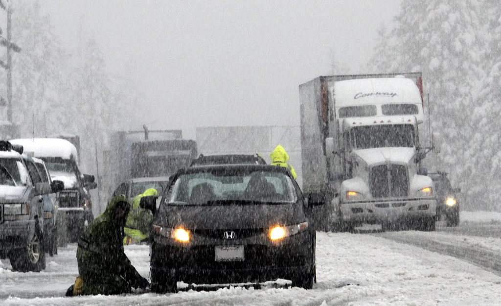
A behemoth of a winter storm is on the brink of pummeling the midwest. It is expected to severely impact at least 17 states as well as heavily impede holiday travel in the coming days. Needless to say, this storm is a doozy, and if it turns into a bomb cyclone, potential impacts could get even worse.
The winter storm began in the west and has been moving eastward for a couple of days. However, it was made worse and continues to be fueled by a burst of bitterly cold arctic air that made its way down from Canada, and that cold air is what could give it the ammunition to turn into a bomb cyclone weather event.
A bomb cyclone is a term used to classify large-scale storms that rapidly intensify. Technically speaking a bomb cyclone is a storm whose “pressure drops 24 millibars in 24 hours.” Temperatures have already plunged to frigid levels along the country’s Northern tier in states like Minnesota all the way to the south in Texas. The weather service in Minneapolis, Minnesota has already categorized this storm as a “high-end, life-threatening event.”
The winter storm’s greatest impacts are expected to be felt Thursday and Friday. Blizzard warnings are currently in effect for parts of North Dakota, South Dakota, Minnesota, Iowa, Michigan, and Indiana. These areas could receive up to a foot, or more of snow, and surrounding areas and states are expected to get snow accumulation of at least six inches.
Parts of the Northeast are expected to be impacted heavily as well. This is especially true for areas surrounding the Great Lakes, due to this winter storm’s propensity to produce significant lake-effect snow. Buffalo’s weather service is already classifying this storm as a “once-in-a-lifetime snow event.” The Catskills and Adirondacks will also likely see significant snow accumulation from this winter storm.
Slightly further to the east, the Mid-Atlantic states are predicted to get mostly rain. However, flooding is predicted to be severe along the coastal and low-lying areas. The heaviest rain is expected to fall overnight Thursday into Friday.
Regardless of what states experience rain or snow events, this winter storm will leave bitterly cold arctic air in its wake. According to the Washington Post, approximately 50 million people are currently under wind chill warnings. For instance, in Texas cities like Houston and Dallas will experience temperatures as low as -7 degrees Fahrenheit. And the Dakotas will see deathly cold chills as low as -45 degrees in some spots.
Weather personnel are urging residents to take precautions. Some of these include rearranging holiday travel plans, winterizing vehicles, ensuring pets are brought inside, and checking in on family members with the greatest sensitivity to the cold weather.
Overall, this winter storm is shaping up to be one for the record books before it has even officially left its mark. From significant snowfall totals to freezing temperatures, this holiday will be marked by one of the coldest and snowiest in recorded history. Bundle up, hunker down, and break out the hot cocoa because mother nature is coming in hot this holiday season.


