Lost civilizations revealed through satellite imagery
Imagine soaring high above the earth, where entire civilizations whisper their secrets to the sky. In recent years, satellite imagery has become a powerful tool in archaeology, revealing hidden worlds without turning a single stone.
This bird’s-eye view offers a unique perspective, allowing archaeologists to rediscover lost cities and ancient marvels. From dense jungles to arid deserts, satellites are unlocking doors to the past, proving that sometimes the best way to uncover history is from above.
The Dawn of Satellite Imagery in Archaeology
The use of satellite imagery in archaeology began in earnest in the late 20th century. It was a game-changer, enabling researchers to explore vast areas quickly and efficiently.
Early pioneers like CORONA, a U.S. reconnaissance satellite, provided images that revealed hidden roads and structures. These early efforts paved the way for more sophisticated technologies, such as LIDAR and multispectral imaging, which continue to push the boundaries of what we can discover from space.
How Satellites See the Unseen: A Quick Science Lesson

Satellites use a combination of optical and radar sensors to capture images of the Earth’s surface. Optical sensors work like digital cameras, capturing visible light, while radar sensors use radio waves to detect objects and landscapes, even through clouds and vegetation.
These technologies allow satellites to reveal hidden structures and patterns that aren’t visible to the naked eye, offering archaeologists a glimpse into worlds long forgotten.
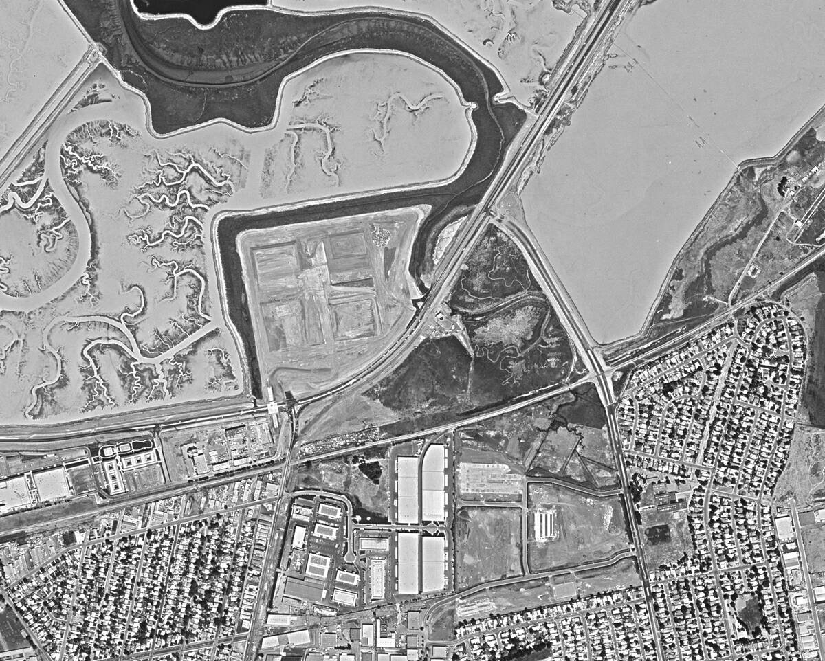
Ancient Cities Rediscovered: The Power of Modern Technology
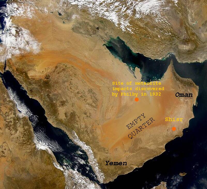
Modern satellite technology has rediscovered countless ancient cities once lost to time. For example, the ancient city of Ubar, known as the ‘Atlantis of the Sands,’ was located in Oman using satellite images.
This finding was a testament to the power of technology in archaeology, as ground surveys had failed to uncover its location. Satellites have also helped identify extensive networks of ancient roads and trade routes, adding depth to our understanding of past civilizations.
The Enigmatic Nazca Lines: Aerial Mysteries of the Past
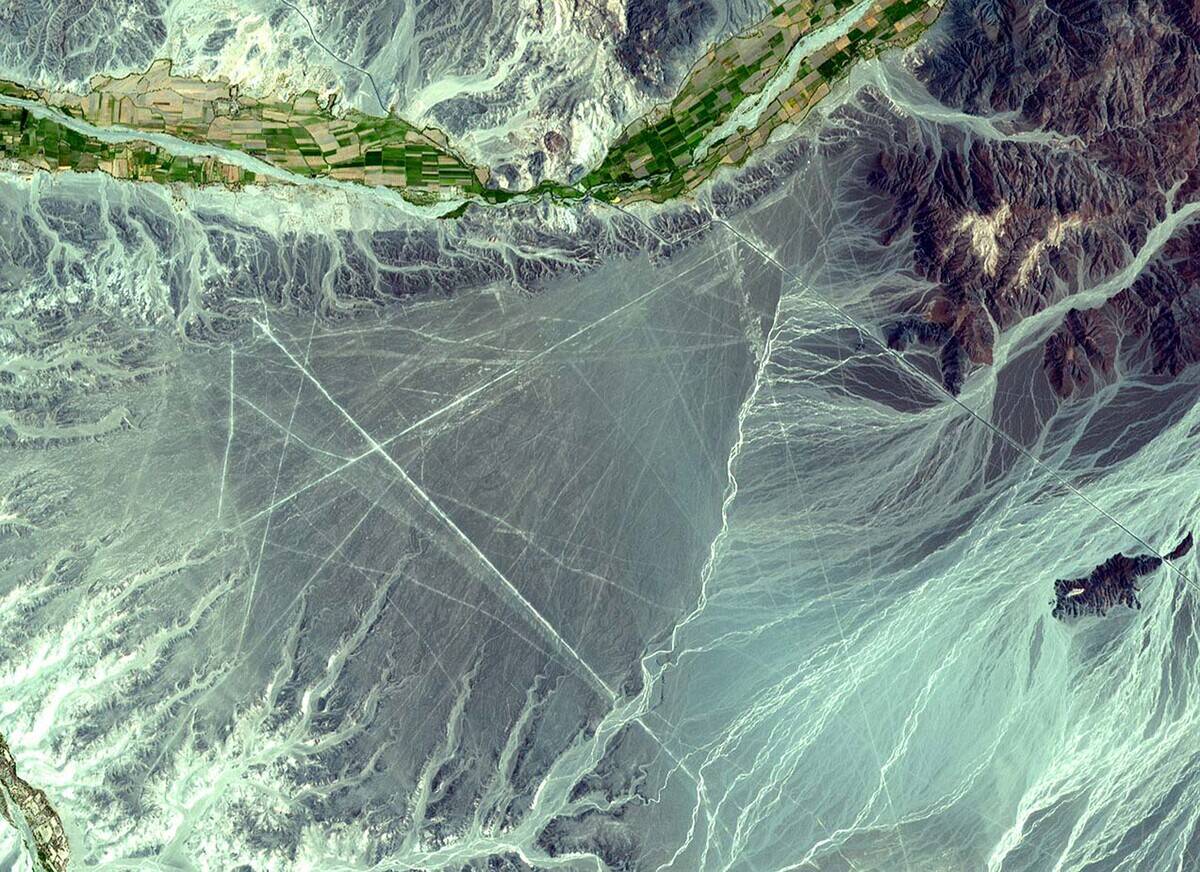
The Nazca Lines in Peru are one of the most famous examples of ancient mysteries best appreciated from above. Created over 2,000 years ago, these massive geoglyphs depict various figures, including animals and geometric shapes.
Their purpose remains debated, but satellite imagery has helped archaeologists map their full extent and understand the landscape that surrounds them. The lines’ visibility from space underscores the advantage of aerial views in studying ancient sites.
Angkor Wat: Uncovering Hidden Temples Beneath the Jungle
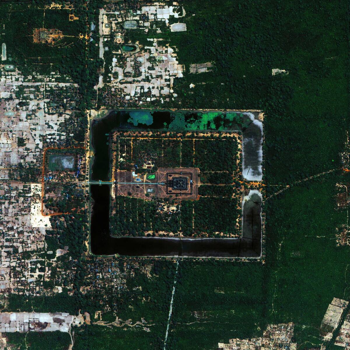
Angkor Wat, the iconic temple complex in Cambodia, has long fascinated historians and archaeologists. However, it’s the surrounding jungle that holds many secrets. Using LIDAR technology, researchers have uncovered hidden temples and intricate water systems beneath the dense foliage.
These discoveries have reshaped our understanding of the Khmer Empire’s reach and sophistication, showcasing the essential role of airborne technology in uncovering lost histories and architectural marvels.
The Amazon’s Lost Civilizations: Cities in the Forest
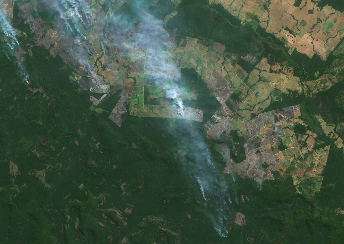
The Amazon rainforest, often dubbed the ‘lungs of the Earth,’ is also home to ancient civilizations hidden beneath its canopy. Satellite imagery has unveiled vast networks of interconnected settlements, challenging the notion of an untouched wilderness.
These discoveries suggest that the Amazon was once as bustling as the ancient cities of the Maya and the Khmer. This insight has prompted a reevaluation of human impact on the rainforest, revealing a more complex history than previously imagined.
The Egyptian Pyramids: New Discoveries from the Sky
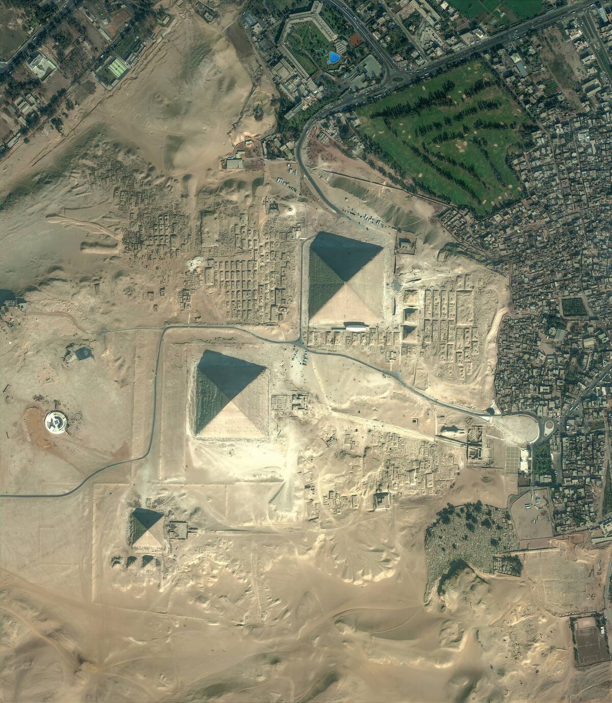
While the grandeur of the Egyptian pyramids is well-known, satellite technology continues to uncover new facets of these ancient wonders. Recent satellite surveys have identified previously unknown pyramids and structures buried beneath the sands.
These findings offer fresh insights into the construction techniques and societal organization of ancient Egypt. The ability to peer beneath the surface from space has reignited interest in one of the most studied civilizations in history, proving there’s always more to discover.
Maya Megalopolis: Revealing the Extent of Ancient Cities
The vastness of the ancient Maya civilization has been further illuminated by satellite imagery. Through LIDAR, archaeologists have identified a sprawling network of cities, roads, and agricultural terraces hidden beneath the dense jungles of Central America.
These findings have dramatically increased estimates of the Maya population, revealing a level of complexity and scale that rivals other great civilizations. The bird’s-eye view provided by satellites continues to transform our understanding of the ancient Maya world.
Satellite Revelations in the Middle East: From Mesopotamia to Modern Insights
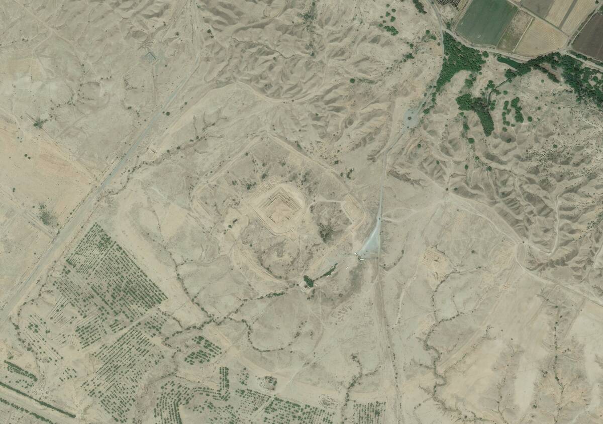
The Middle East, home to some of the world’s oldest civilizations, has been a focal point for archaeological discoveries via satellite. In Iraq and Syria, satellites have mapped ancient Mesopotamian cities, revealing their layout and extent.
This technology has also been crucial for monitoring and protecting heritage sites in conflict zones. By providing real-time data, satellites help archaeologists and governments preserve these invaluable cultural treasures for future generations.
The Sahara’s Secret: Ancient River Systems and Civilizations
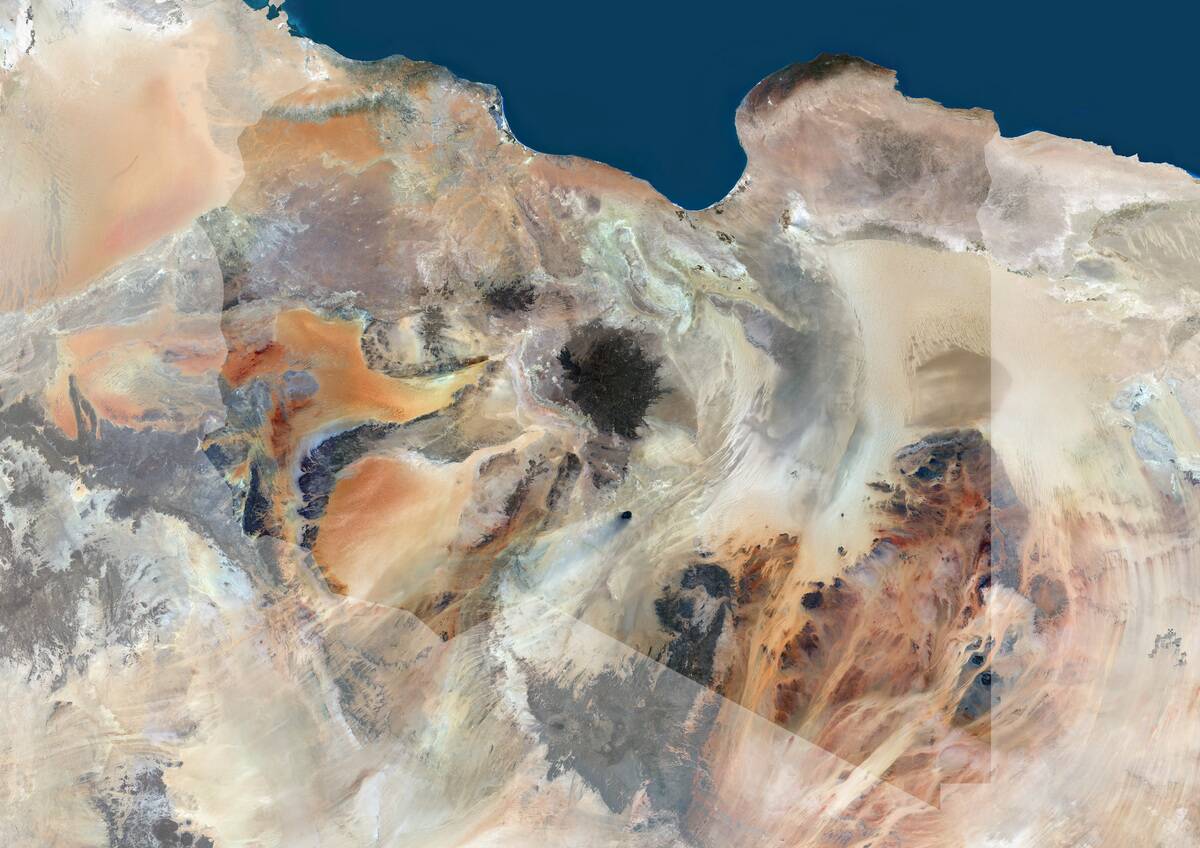
Beneath the vast dunes of the Sahara Desert lie the remnants of ancient river systems, revealed by satellite imagery. These rivers once supported thriving civilizations, now lost to time.
Discoveries of ancient settlements along these waterways have provided insights into how past climates influenced human habitation. The ability to trace these hidden rivers has opened new avenues for understanding the Sahara’s past, demonstrating the critical role of satellite technology in uncovering history’s hidden layers.
Stone Circles from Space: Unraveling the Mysteries of Stonehenge
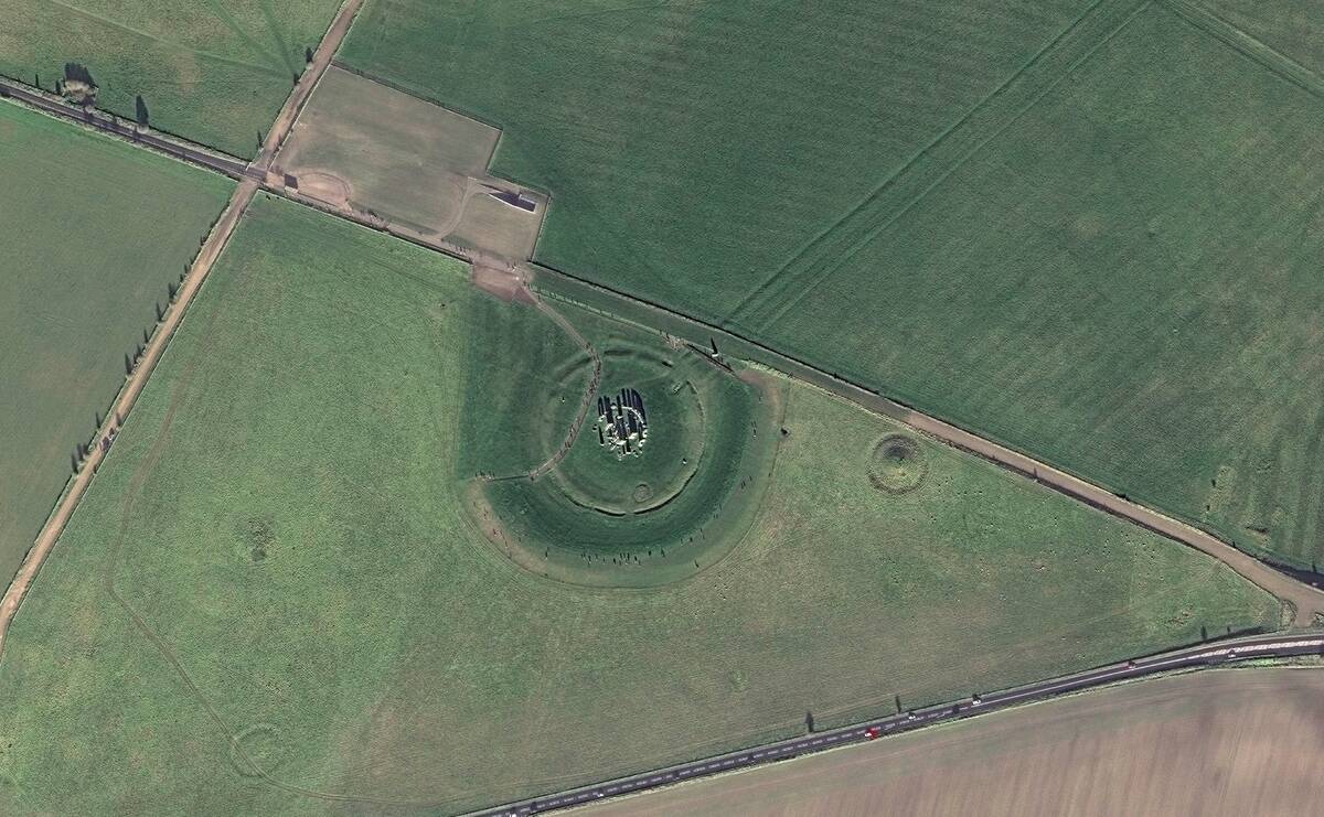
Stonehenge has long captivated the imagination, but satellite imagery has revealed even more about this ancient site. Through aerial surveys, researchers have identified additional stone structures and earthworks in the surrounding landscape, offering clues about the site’s construction and purpose.
These discoveries have sparked new theories about the cultural and astronomical significance of Stonehenge, highlighting the synergy between modern technology and ancient mysteries.


