23 ways people found their way before GPS
Short answer: practice, paper, and people. For most of the 20th century, travelers stitched together routes with atlases, gas‑station maps, and a mental rolodex of landmarks. The U.S. Interstate Highway System alone sprawls over 48,000 miles, and yet families crossed it every summer armed with nothing more than a glovebox full of folded maps and a highlighter.
If you could read a legend, keep an eye on mile markers, and ask a stranger without blushing, you could reliably reach anywhere with a road and a name.
We also leaned on older arts: compasses, celestial cues, and the wisdom of those who drove the road yesterday. Truckers swapped updates over CB radio; sailors watched lighthouses and stars; hikers trusted topographic lines and a baseplate compass. By the late 1990s, MapQuest and printer paper joined the mix, but the core recipe stayed the same: plan a route, pay attention, and course‑correct with whatever clues the world offered.
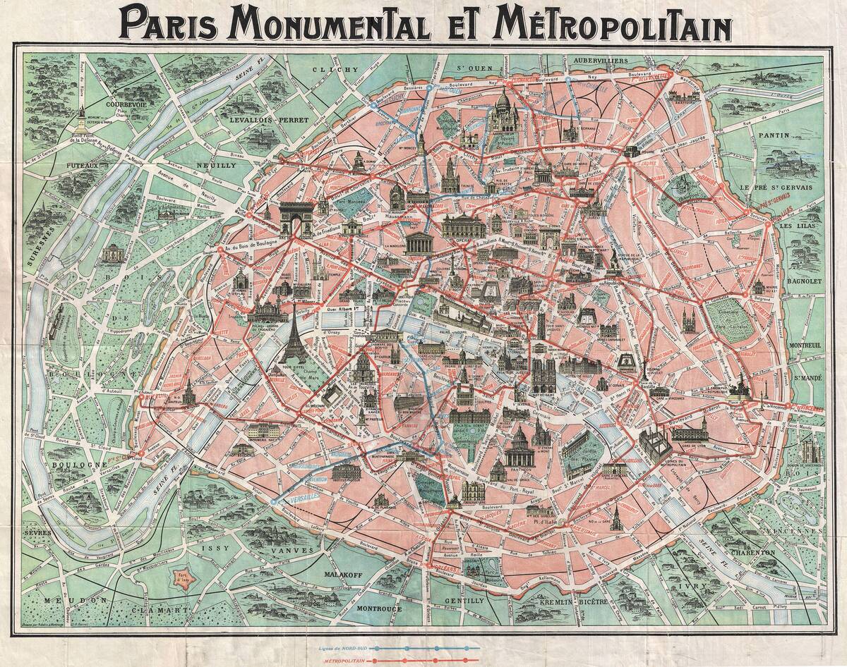
Paper maps: glovebox staples and coffee-stained atlases
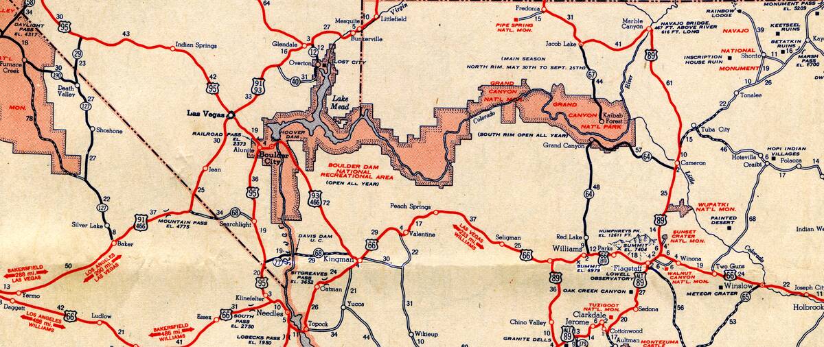
The Rand McNally Road Atlas, first published in 1924, became a summer standard, updated annually with new interstates, exits, and city inserts. DeLorme’s Atlas & Gazetteer series, launched in the 1970s, drilled down to backroads, boat launches, and trailheads by state. Gas stations once handed out branded maps for free—Shell, Gulf, and Texaco stocked racks into the 1960s—until printing costs and the oil crises nudged that perk toward history.
Maps packed real data: scales in miles and kilometers, contour hints, scenic byway symbols, and a legend that decoded everything from unpaved roads to rest areas. You could pencil your route right on the page, then flip to the city inset for tight turns downtown. The inevitable coffee stain wasn’t a flaw—it was proof of use, a brown ring around the diner where you figured out which fork in the road actually forked.
The mysterious art of folding a road map without crying
Highway maps tended to fold to a tidy rectangle—roughly 9 by 4 inches—then exploded into a lap‑sized poster at first unfold. Most used accordion folds with a final cross fold, so the trick was to reverse the last move and refold along the existing creases. Fail to align the panels, and you’d invent a new topography of crumples, turning Iowa into origami. Seasoned navigators pre‑creased along fresh lines to make repeated refolds painless.
There’s even some science here. The Miura‑ori pattern, devised by Japanese astrophysicist Koryo Miura in 1970, lets large sheets collapse and expand smoothly—NASA used versions of it for solar arrays. A few modern mapmakers flirted with similar schemes, but for most of us the method was simpler: fold loosely, keep the legend visible, and surrender pride when needed. A rubber band or map case beat wrestling a paper sail in a crosswind.
AAA TripTiks and the joy of a highlighted route
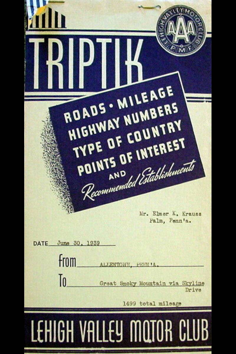
AAA introduced TripTiks in 1937, custom spiral‑bound booklets with your route hand‑marked in yellow. Each flip page covered a manageable strip of road—often 20–30 miles—with notes on construction, detours, and scenic alternatives. Members could request them at a branch or by mail, and the booklets arrived with lodging suggestions and TourBook listings tucked alongside, a one‑stop kit for a long drive.
By the 2000s AAA added the TripTik Travel Planner online, but the charm of the paper version endured: no batteries, no glare, and easy sharing between driver and co‑pilot. TripTiks dovetailed with real‑world cues—turn at exit numbers, watch for mile markers, and check the next panel in a minute or two. If the plan changed mid‑trip, a pencil line or a quick call at a pay phone updated the day’s playbook.
Asking for directions: gas stations, neighbors, and friendly strangers
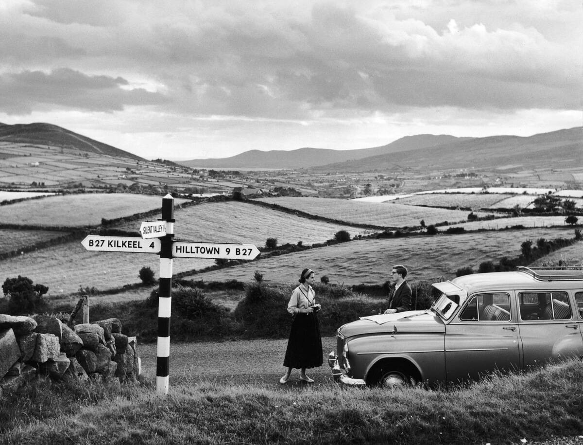
For decades, gas stations doubled as wayfinding hubs. Attendants pumped fuel, washed windshields, and pointed travelers toward Route 6 with a rag still in hand. Oil companies printed millions of free road maps through the mid‑20th century, and a counter clerk could draw a big X where you should turn. Small‑town bars, diners, and hardware stores served the same function: news, roads, and the day’s detours.
Etiquette counted. You offered the destination, not just “How do I get out of here?” and confirmed key steps aloud—left at the light, right at the school, slight jog after the bridge. Locals gave warnings a map could not: a washed‑out shoulder, a rolling stop sign notorious for tickets, or a back way that dodged the harvest convoy. The social network ran on eye contact and thank‑yous.
Landmarks over lefts and rights: “turn at the big red barn”
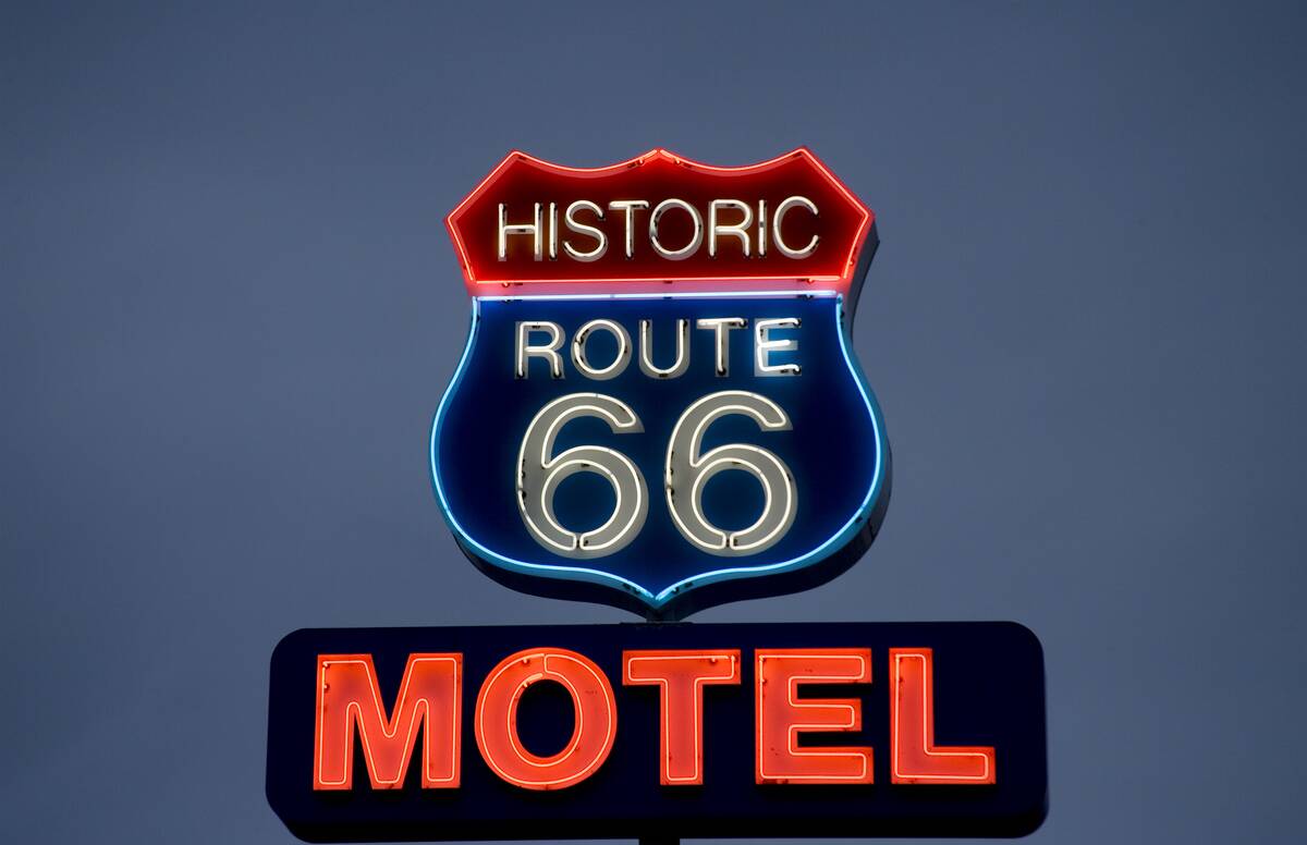
Landmark directions intentionally anchor instructions to things we actually notice. A bright water tower, a courthouse dome, or one of those 20‑foot “Muffler Men” statues along old highways can trump a barely visible street sign. On Route 66, neon motel signs and Wigwam Village teepees became navigational shorthand, readable before headlights found the next marker.
The advantage is speed: the brain locks onto a barn faster than a tiny road placard.
The risk is impermanence—paint jobs and demolitions happen. Good landmark directions hedge: “Turn right by the red barn—if it’s gone, it’s the first right after the creek.” Used alongside mile counts or exit numbers, though, landmarks make lefts and rights human‑scale, keeping your eyes outside the car instead of buried in the atlas.
Cardinal directions and compasses: N, S, E, W like a pro
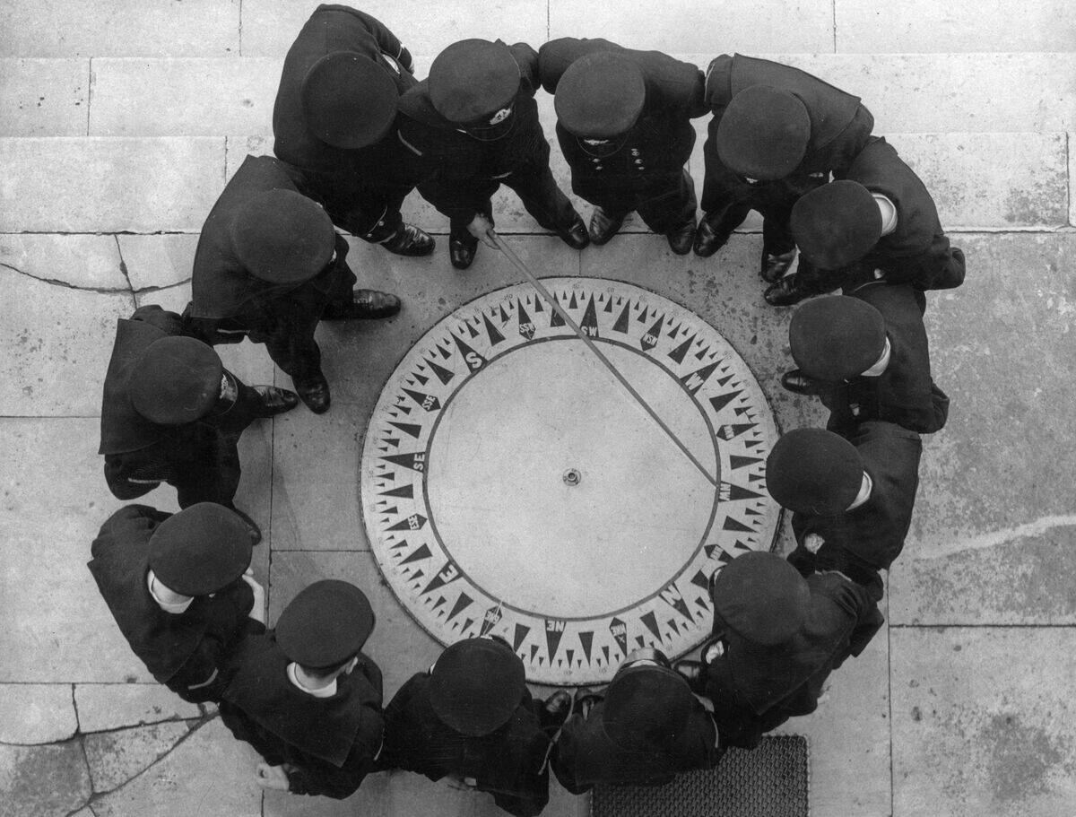
Before blue dots, many drivers learned the lay of the land by the compass. In the Northern Hemisphere, the sun sits due south at local solar noon; shadows at midday point roughly north. Cities often embed direction in their grids: Phoenix and Denver run near cardinal; Chicago addresses climb away from State and Madison; Manhattan’s grid is rotated about 29 degrees, yielding the summer spectacle nicknamed Manhattanhenge when the sunset aligns with the streets.
Dashboard compasses and simple button compasses did steady work when clouds hid the sun or signage got sparse. A quick orient—“this road trends northeast”—made paper maps easier to read because the vehicle and page agreed. With a baseplate compass, you could even align the map to reality, adjusting for magnetic declination noted in the legend so that north on paper matched north on earth.
Mileage charts, odometers, and the trusty trip meter

Most road atlases included mileage charts listing distances between major cities—Chicago to Omaha 470‑ish, Albuquerque to Flagstaff 325‑ish—so you could budget fuel and daylight. On the micro scale, drivers paired printed turn‑by‑turns with the car’s trip odometer: reset to zero at the last intersection, then watch for a turn “in 6.2 miles.” Road logs like The MILEPOST on the Alaska Highway have done this since 1949, flagging services and landmarks by precise mile.
Odometers turned a fuzzy instruction into a countdown. If a lane split appeared at 5.7 instead of 6.2, you knew you were very close—slow down and scan. The method still works when signs vanish or roads snake: distance plus direction beats hope. Old‑school drivers also learned the limits—wheel sizes and tire wear introduce small errors—so they used mileage as a guide, not a verdict.
Road signs, mile markers, and exit numbers as breadcrumbs
The Interstate system encodes clues in plain sight. In the U.S., even‑numbered interstates generally run east–west, odd numbers north–south. Three‑digit interstates starting with an even number usually loop or bypass a city; those starting with an odd number tend to be spurs. Most states number exits by milepost, so Exit 187 comes roughly 187 miles from the state line—watch the mile markers tick upward to confirm you’re headed the right way.
Mile markers reset at borders and help in emergencies—“stopped at mile 42 eastbound” pinpoints you for roadside assistance. Service logos, brown recreation signs, and blue food/lodging panels preview what’s ahead. Even the shape and color of signs carry meaning standardized by the Manual on Uniform Traffic Control Devices: octagons for stop, diamonds for warnings, green for guidance. Reading the roadside is a learnable language.
City guides: Thomas Guides, A–Zs, and street index grids
Before turn‑by‑turn apps, urban drivers swore by street atlases. The Thomas Guide—produced by Thomas Brothers Maps—was ubiquitous in Southern California, with page‑and‑grid references like 672‑C3 printed in a thick index. Dispatchers, delivery drivers, and real‑estate agents dog‑eared those books, memorizing cut‑throughs long before Waze claimed them. Editions existed for many metros, and updates tracked new subdivisions and renamed streets.
Across the Atlantic, Geographers’ A–Z put London’s labyrinth in your lap starting in 1936, using an alphanumeric grid to hop from page to page. Cross‑referencing was the game: find the street in the index, flip to the page, then drill down to the grid square. It was fast with practice and delightfully analog—pens for closures, sticky tabs for favorites, and a practiced flip that landed on Shoreditch without thumbing 200 pages.
Public transit with pocket maps, timetables, and tokens
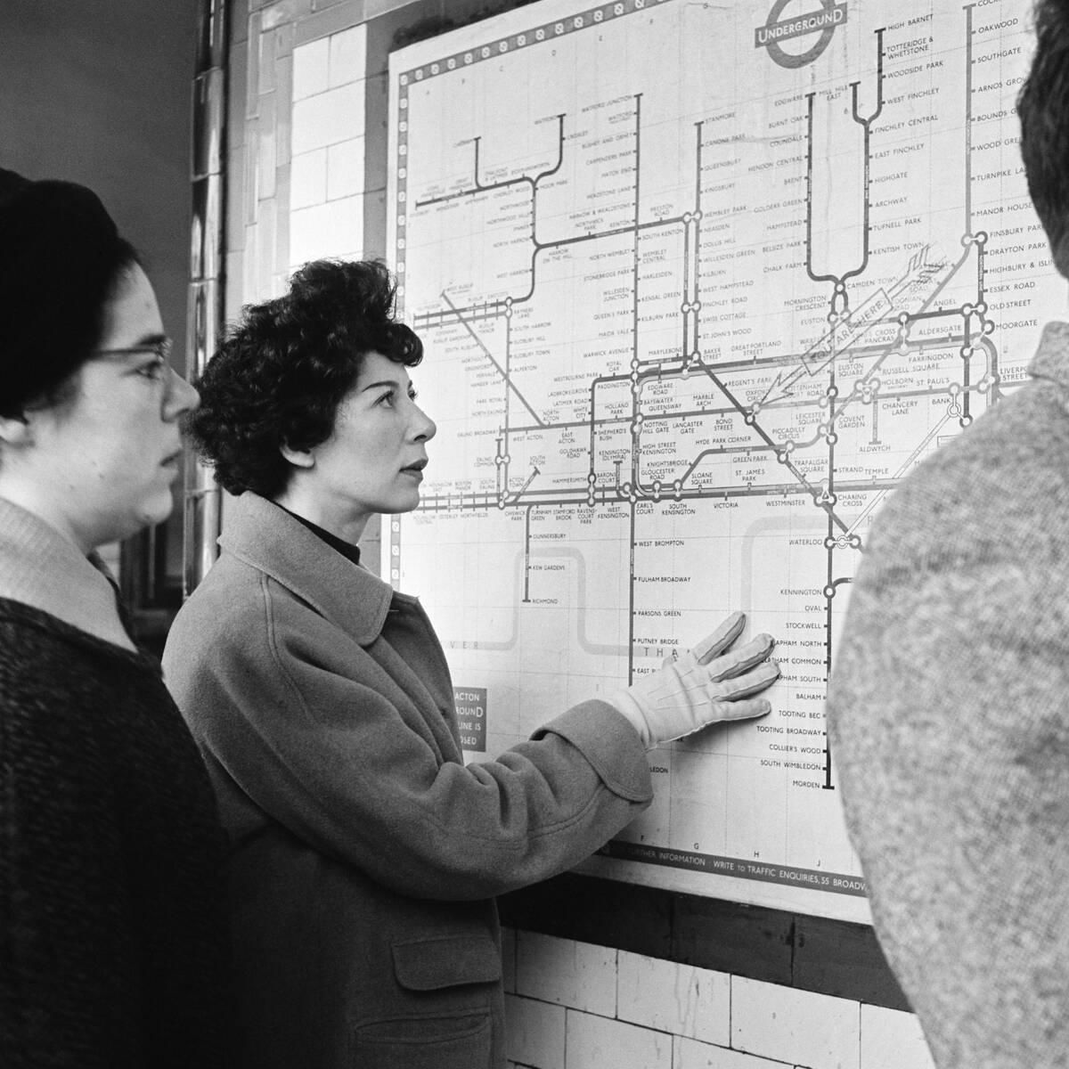
Transit riders navigated with a different toolkit. Londoners favored the schematic Tube map first drawn by Harry Beck in 1933, which traded geographic accuracy for clarity. New Yorkers stuffed fold‑out subway maps and line‑specific timetables into jacket pockets; the MTA used tokens from 1953 until 2003 before switching to MetroCards and now OMNY. Bus riders watched transfer slips and headway charts like hawks to judge the next ride.
Timetables taught rhythms: weekday rush patterns, weekend gaps, last‑train cutoffs. Stations posted spider maps for local routes, and kiosks handed out free paper guides by the stack. If you missed a connection, you recalculated by the clock, not an app: walk two avenues, switch lines, or grab the crosstown bus whose schedule you half‑remembered. Exact change and a pocket of tokens were your offline battery backup.
The navigator’s seat: road-trip co-pilots and family roles
In the pre‑GPS minivan, the front‑right seat doubled as mission control. The co‑pilot organized maps, called lane changes, and rationed snacks. Bench seats common into the 1980s made room to spread an atlas without creasing Wyoming. Children learned the basics early: count mile markers, spot the next exit, and warn if Dad was about to blast past the rest area the map clearly showed three miles back.
Teams developed systems—highlighter routes, sticky tabs for motels, and a clipboard for reservations. The driver listened for “next left in half a mile” and watched the odometer. Disputes were settled by printed evidence: if the Thomas Guide said the street dead‑ended, it probably did. Night duty meant a flashlight angled just so to avoid dazzling the driver, and everyone learned to call out signs loudly over crosswinds and classic rock.
Truckers, CB radio, and real-time intel before live traffic
Citizens Band radio surged in the 1970s, giving drivers a low‑cost way to swap road intel. In the U.S., CB operates around 27 MHz with 40 channels; Channel 19 became the de facto highway hailing channel. With a legal 4‑watt AM rig, truckers might reach a few miles—enough to warn about a jackknifed rig, a speed trap (“Smokey at the 142”), or black ice on the next grade.
A lexicon grew: bear, pickle park, hammer down. Beyond slang, CB offered redundancy when pay phones were scarce and storms knocked out lines. It also stitched together ad‑hoc communities—westbounders shepherding each other through whiteouts or around detours radioed from the front of the pack. The medium demanded attention and courtesy: clear your mic, give mile markers, and switch to a quieter channel to carry on.
Pay phones, paper address books, and meeting “under the clock”
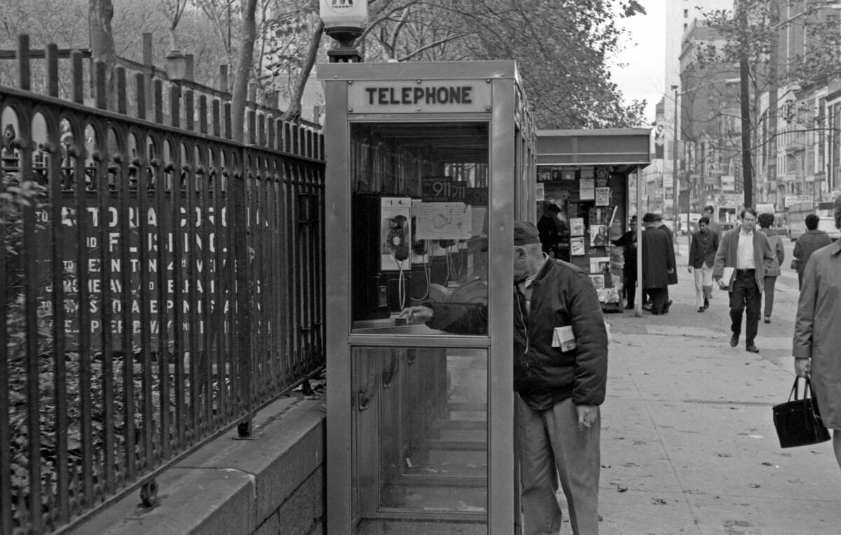
When plans shifted, a quarter and a pay phone saved the day. The U.S. had millions of pay phones in the 1990s; their numbers plunged with mobile adoption, and New York City removed its last curbside pay phones in 2022. Travelers kept paper address books or a Rolodex (introduced in 1956) with home, work, and emergency numbers, plus hotel switchboards. Calls were concise: confirm the landmark, the time, and who waits where.
Meet‑ups centered on unmistakable beacons. “Under the clock” at Grand Central Terminal—beneath the four‑faced opal glass clock above the Main Concourse information booth—has been a reliable rendezvous since 1913. In Chicago, friends met “under the clock” at Marshall Field’s on State Street. Before text messages, people padded arrival times and stuck to the plan, trusting that a famous public object would not move and could not be missed.
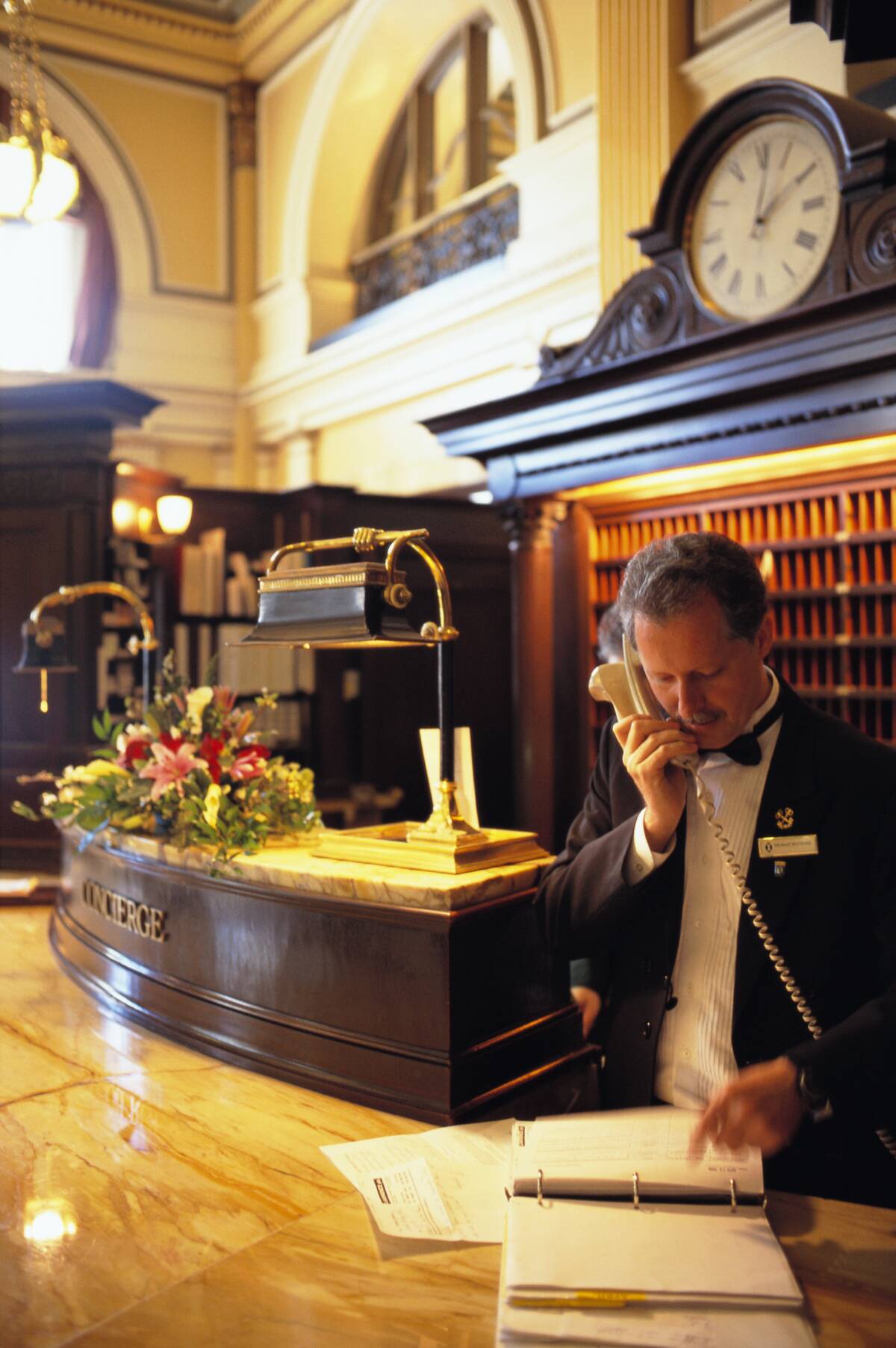
Visitor centers, hotel concierges, and free fold-out city maps
Highway rest areas and state visitor centers stocked free brochures, fold‑out maps, and construction notices keyed to the season. National Park visitor centers still hand out excellent paper maps with mileages, trailheads, and elevation profiles you can read in rain. Staff knew current closures and wildlife delays—hard intel you won’t glean from a static atlas.
A five‑minute chat could save an hour on the road.
In cities, hotel concierges wielded gold keys (Les Clefs d’Or, founded 1929) and gold‑standard advice. They circled bakeries on photocopied neighborhood maps, booked tours, and warned when a taxi line would beat the subway. Tourist boards printed area maps with attractions and transit overlays, perfect for pocket planning. The paper stack at the front desk was often better tailored than any national guide, and it updated with a fresh photocopy.
Guidebooks and travel agents: planning with paper and a pen
Guidebooks framed trips before the first mile. Frommer’s “Europe on $5 a Day” debuted in 1957, seeding budget adventures, while Lonely Planet’s first book in 1973 covered “Across Asia on the Cheap.” Paper itineraries lived in manila folders with confirmation numbers for ferries and motels. Margins held practical tweaks: market days, museum closures, and that café the desk clerk swore by.
Travel agents stitched this into tickets. American Airlines and IBM launched SABRE in 1960, one of the first computer reservation systems, and agents used similar platforms to compare fares and print multi‑part paper tickets with carbon copies. They knew IATA codes by heart—CDG vs. ORY, LHR vs. LGW—and phoned hotels for late arrivals. A highlighted index card with flight times and record locators fit in a breast pocket and worked at 30,000 feet without Wi‑Fi.
MapQuest printouts and Yahoo! Maps in the early internet age
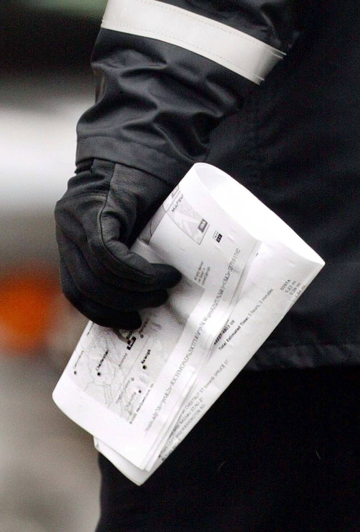
By the late 1990s, MapQuest let you type two addresses and print turn‑by‑turn directions with estimated distances and times. People tucked those pages next to the shifter, turning every driver into a one‑person rally navigator. Directions chained landmarks (“bear right”) to street names and exit numbers, with a final “If you reach X, you’ve gone too far” echoing the napkin era—just cleaner and in 12‑point Arial.
Yahoo! Maps and similar services joined in the early 2000s, layering traffic snapshots and alternate routes. But the workflow stayed analog: refresh before leaving, print two copies, and make notes by hand when construction wrecked Step 7. If a turn vanished behind orange barrels, you pulled into a lot, dialed the destination, and penned a detour in the margin. The printer was your first navigation accessory.
Celestial navigation: sextants, stars, and the trusty chronometer
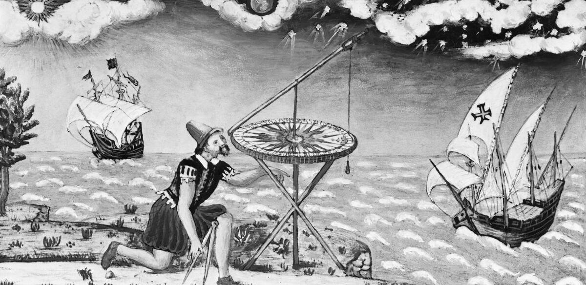
Celestial navigation measures the angle between a celestial body and the horizon with a sextant, then uses time and tables to plot a line of position. John Harrison’s marine chronometer H4, proven in the 1760s, solved longitude by keeping accurate time at sea; each hour’s error equals 15 degrees of longitude. The British Nautical Almanac, first published in 1767, provided the celestial data needed to turn angles and time into a fix.
The North Star, Polaris, sits close to the celestial north pole, so its altitude roughly equals your latitude in the Northern Hemisphere—a comforting check. Sun sights at local noon give latitude; morning and afternoon sights cross to yield a near point. It’s methodical, portable, and independent of radio or satellite. Many ocean sailors still carry a sextant and practice a noon sight for the joy of it and the backup it provides.
Pilots aloft: sectional charts, VOR beacons, and the E6B
VFR pilots read sectional charts at 1:500,000 scale, where magenta and blue rings mark controlled airspace and tiny ticks note tower heights. Before GPS, the airway network and ground‑based VORs—VHF Omnidirectional Range beacons broadcasting radials—provided reliable guidance. Dial a VOR to 090°, center the needle, and fly the line; cross‑radials from a second station gave a position fix accurate enough to spot the right lake below.
The E6B flight computer, invented in the 1930s by Lt. Philip Dalton, handled wind triangles, fuel burns, and time–distance problems with a circular slide rule and a wind‑correction grid. Pilots tracked checkpoints by the clock—“pond at 14 minutes, highway at 22”—and compared ground speed to plan. Sectionals also pack frequencies, landmarks, and obstruction data, so even without a radio a careful pilot could stay found under clear skies.
Topographic maps and a baseplate compass for trails
USGS 7.5‑minute quadrangle maps at 1:24,000 scale have been the hiker’s standard for decades, showing contours, streams, and man‑made features with fine detail. The legend lists contour intervals and magnetic declination so you can correct bearings. A clear baseplate compass—popularized by companies like Silva in Sweden—lets you align map and ground: set the bearing on the bezel, align orienting lines with north on the map, and follow the needle.
Handrails and backstops make it stick. Hike along a creek (handrail), aiming off slightly to hit a trail junction from a predictable side, with a ridge (backstop) ensuring you don’t overshoot. If fog rolls in, convert your planned route into distances and bearings, pacing between waypoints. Paper never loses signal, and a pencil note by the lake outlasts phone batteries in cold.
Orienteering: navigation turned into a weekend sport

Born in Scandinavia in the late 19th century, orienteering turns map‑and‑compass work into a race. The first public competition is often credited to 1897 in Sweden; the International Orienteering Federation formed in 1961. Courses string together control points marked by orange‑and‑white flags, each with a unique punch or electronic chip box to prove you were there. Maps are ultra‑detailed, with vegetation and rock features mapped at scales like 1:10,000.
Competitors choose routes on the fly: straight over the spur, or contour around marshy ground for speed? Modern events use SportIdent or EMIT timing for split analysis, but the skills are timeless—thumbing the map, keeping a precise compass bearing, and reading subtle terrain. Color‑coded courses (white to black) welcome beginners and experts, making it one of the friendliest ways to learn not to be lost.
Indigenous wayfinding: stars, swells, songlines, and stick charts
Pacific navigators read the ocean itself. In the Marshall Islands, stick charts (mattang, meddo, rebbelib) abstracted island positions and swell patterns so apprentices could learn how waves refract around land. Polynesian wayfinders used a sidereal compass—rising and setting points of known stars—to steer at night, with cloud color, bird flight, and swell angles confirming direction by day and dawn.
These traditions are living. In 1976, master navigator Mau Piailug guided the voyaging canoe Hōkūleʻa from Hawaiʻi to Tahiti without instruments, helping spark a renaissance in Polynesian navigation. Australian Aboriginal songlines encode routes in stories tied to landscape features, a mnemonic geography walked and sung across vast distances. These systems pair deep observation with communal memory, proving that navigation can be as much culture as it is calculation.
The Green Book, Michelin strip maps, and other historic guides
From 1936 to 1966, Victor Hugo Green’s Negro Motorist Green Book listed hotels, restaurants, and services that welcomed Black travelers in the United States. It turned dangerous uncertainty into planned safety, updating yearly as routes and businesses changed. Copies lived in gloveboxes alongside maps, reminding us that wayfinding isn’t just geometry—it’s access, dignity, and logistics shaped by social reality.
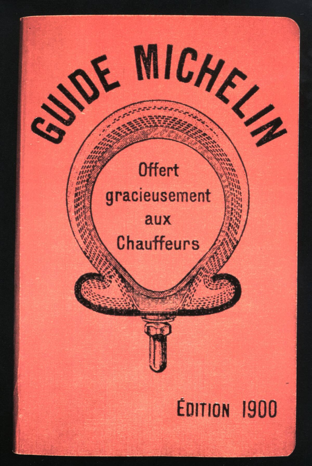
Across the Atlantic, Michelin encouraged motoring early: the Michelin Guide began in 1900, and the company published road maps and strip maps that unfolded a route linearly. Strip maps—also produced by clubs like the UK’s AA and by AAA in the U.S.—excelled for following one corridor without flipping across a big atlas. Star ratings came later for restaurants (one in 1926, expanded in 1931), but the maps themselves were the first invite to explore.
Myths vs reality: moss on trees and other “tips” we tested

Moss doesn’t read compasses. It grows where it’s damp, which can be the north side of a tree in some forests but just as often the shaded side by a stream or rock. Better bets: in the Northern Hemisphere, the sun arcs through the southern sky, and the North Star sits close to true north at night. On an analog watch, the halfway angle between the hour hand and the sun points south—helpful, but approximate.
Other folk cues need context. Ants don’t reliably build on one side of mounds; snowdrifts depend on wind, not cardinal points. Landmarks move, and smoke plumes wander. The fix is redundancy: combine multiple indicators—sun, slope aspect, map, and time—and keep an error budget in mind. Myths make great icebreakers; reality makes great arrivals. When in doubt, stop, observe, and verify with something printed or measured.


