Aerial photos that show history in a new light
History is usually photographed from ground level, because most of us exist on ground level. But taking a top-down, aerial view gives us a unique angle of proceedings – while individual people aren’t usually identifiable, the wide scope of the image is full of intrigue.
These photos all show history, in one form or another – but instead of an up-close-and-personal-view, they take a top-down approach.
The first aerial photograph ever taken, Boston, 1860
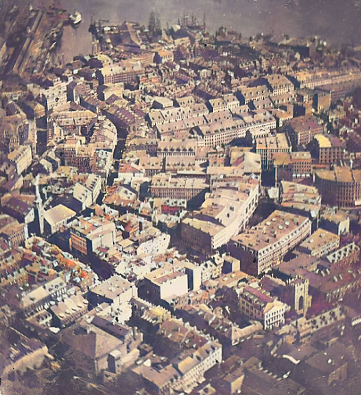
Captured in 1860 by photographer James Wallace Black from a hot-air balloon, this image is considered one of the first successful aerial photographs in history. Taken from roughly 1,200 feet above Boston, the photograph—titled “Boston, as the Eagle and the Wild Goose See It”—offered a completely new perspective of the city that had previously only been seen from the ground.
The image marked a major milestone in both photography and aviation, demonstrating the potential of capturing landscapes from the sky. Although the original photograph was later lost, surviving prints preserved the historic view of Boston and helped inspire the future development of aerial mapping, surveillance, and photography.
Ellis Island at its peak
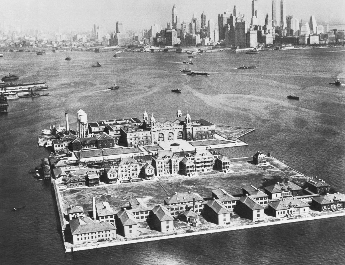
In 1933, Ellis Island stood as the busiest immigration inspection station in the United States, processing millions of newcomers seeking a new life in America. The aerial view highlights the island’s location in New York Harbor, with the rapidly growing Manhattan skyline rising in the distance. The scene reflects the contrast between the orderly immigration facilities on the island and the towering city that represented opportunity for generations of arrivals.
At its peak, Ellis Island handled thousands of immigrants each day, with medical examinations and legal inspections determining who could enter the country. Although processing numbers had declined by the 1930s due to stricter immigration laws and the Great Depression, the island remained a powerful symbol of American immigration history. Today, it is preserved as a historic landmark and museum honoring the experiences of millions of immigrants.
Rose Bowl during the 1994 World Cup
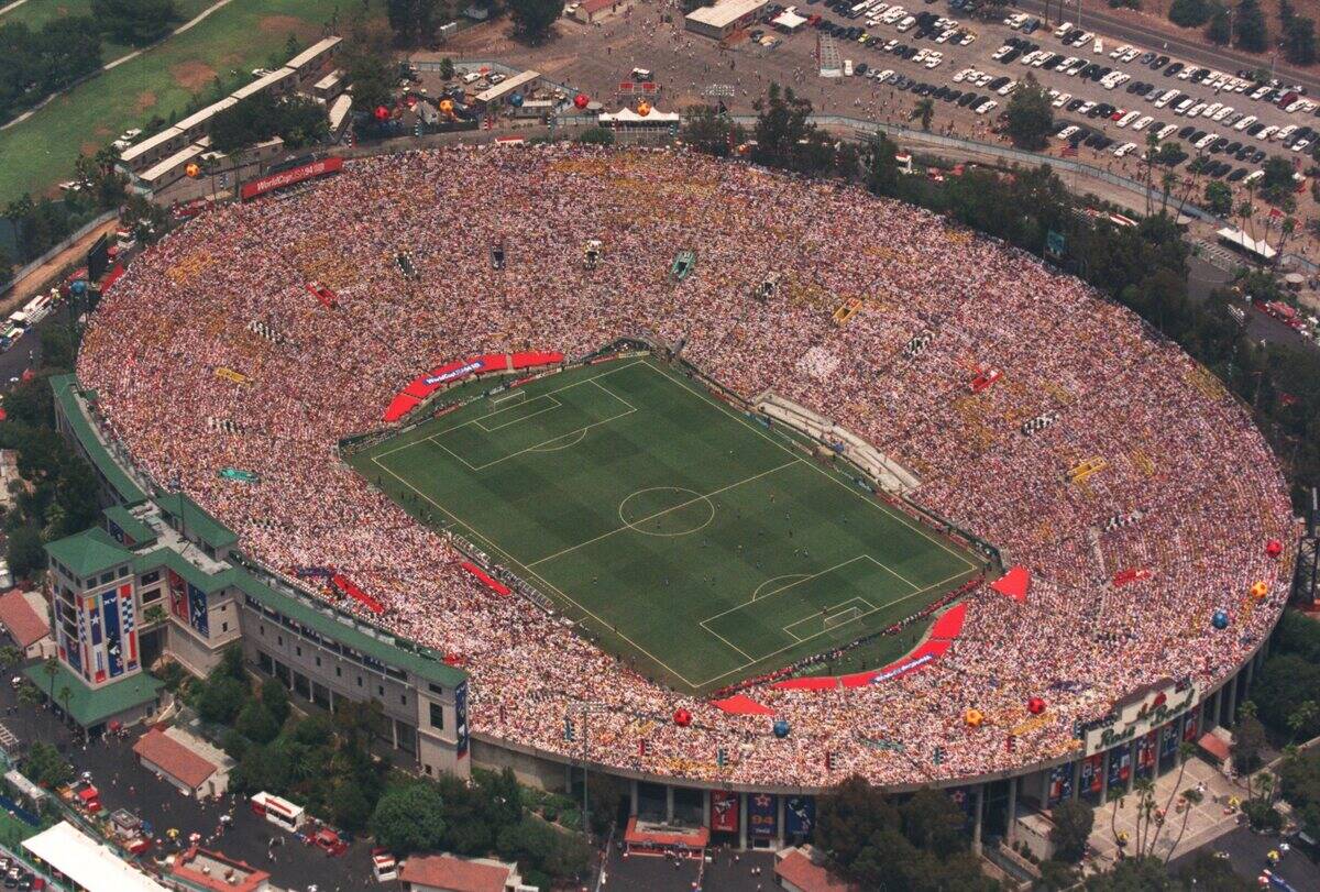
The Rose Bowl in Pasadena, California, hosted one of the most memorable moments in soccer history when the United States staged the 1994 FIFA World Cup Final. The aerial view shows the iconic stadium packed with more than 90,000 spectators as Brazil faced Italy on July 17, 1994. Surrounded by the San Gabriel Mountains and the cityscape of Pasadena, the venue provided a dramatic backdrop for the tournament’s championship match.
The final ended in a tense 0–0 draw after extra time, with Brazil defeating Italy 3–2 in a penalty shootout to win its fourth World Cup title. The tournament helped popularize soccer in the United States and paved the way for the creation of Major League Soccer two years later. The Rose Bowl remains one of the most historic sports venues in America.
Disneyland shortly after opening in 1955
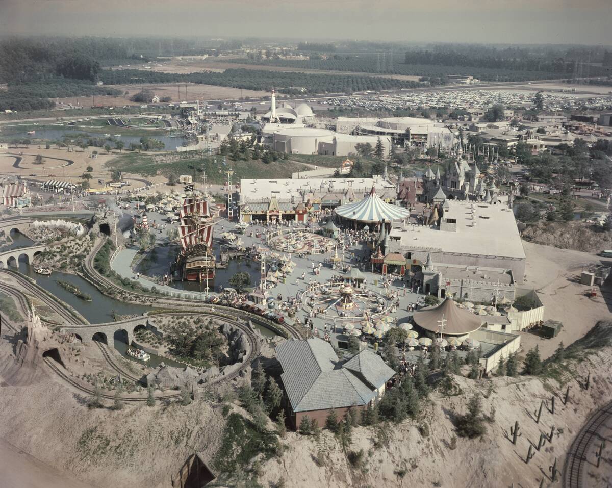
The aerial view of Disneyland in 1955 reveals a dramatically smaller park compared with the sprawling resort it would become decades later. Located in Anaheim, California, Disneyland officially opened on July 17, 1955, introducing visitors to Walt Disney’s vision of a theme park built around immersive storytelling and family entertainment. The original layout featured five themed areas: Main Street, U.S.A., Adventureland, Frontierland, Fantasyland, and Tomorrowland.
When it opened, Disneyland covered roughly 160 acres and included many attractions that became classics, such as the Jungle Cruise, Peter Pan’s Flight, and the Mad Tea Party. The park’s success transformed Anaheim into a major tourist destination and changed the entertainment industry forever. This early aerial perspective captures the beginning of a cultural landmark that would eventually welcome hundreds of millions of visitors from around the world.
The Roman Colosseum from above in 1930
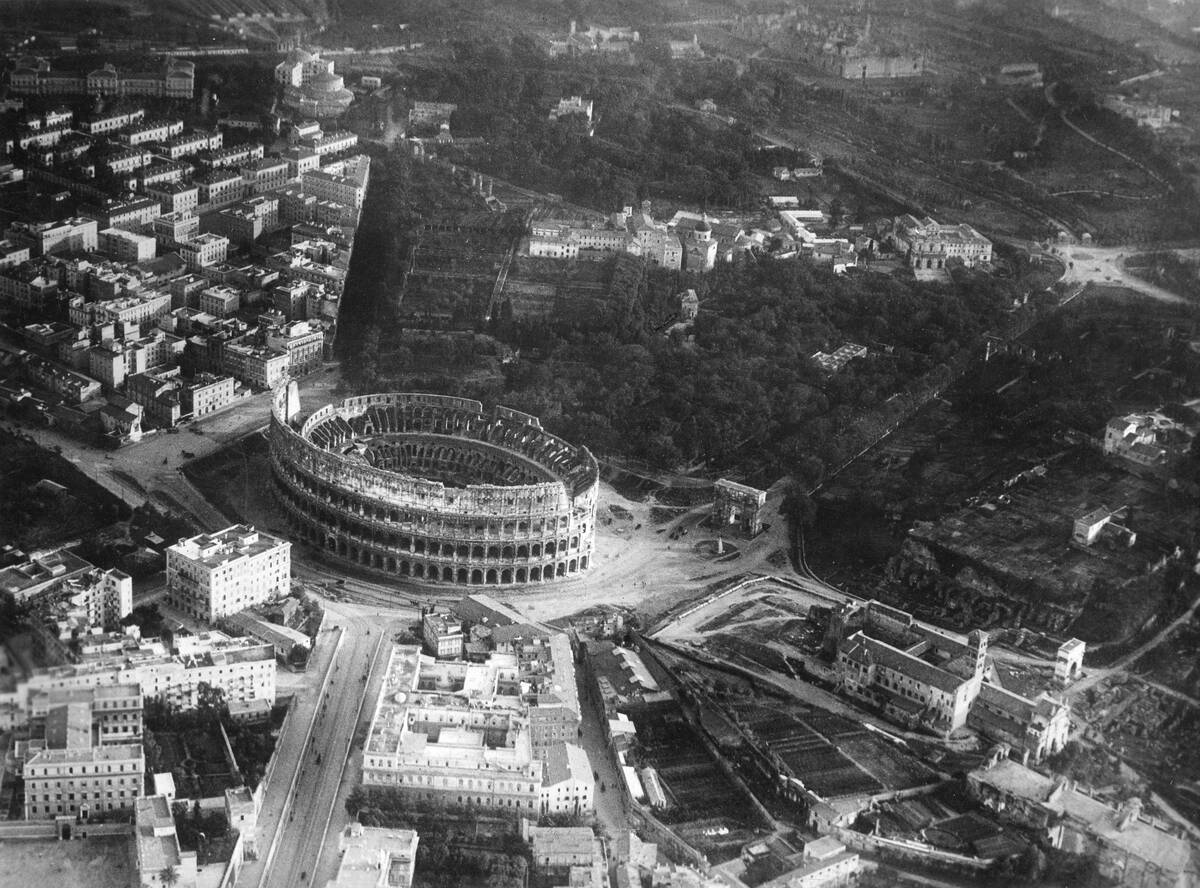
This aerial view of the Roman Colosseum from 1930 highlights the ancient amphitheater as it stood nearly two millennia after its construction. Surrounded by the historic streets of Rome, the massive oval structure shows the effects of centuries of weathering, earthquakes, and stone removal, while still retaining its unmistakable shape and grandeur.
Built under the Roman emperors Vespasian and Titus and completed in AD 80, the Colosseum once hosted gladiatorial contests, public spectacles, and large-scale events for tens of thousands of spectators. By the 20th century, it had become one of Italy’s most important archaeological landmarks. Today, it remains a powerful symbol of the engineering achievements of ancient Rome.
The Hindenburg flying above Manhattan before its 1937 disaster
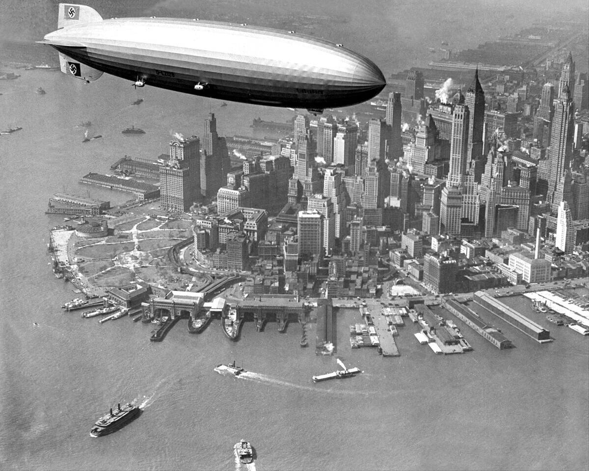
This dramatic aerial image shows the German airship Hindenburg passing above the Manhattan skyline just days before its infamous crash. At the time, the massive zeppelin represented the height of luxury air travel, carrying passengers across the Atlantic in spacious cabins while floating gracefully above some of the world’s most recognizable landmarks.
The Hindenburg was the largest aircraft ever built and had completed numerous successful flights before disaster struck on May 6, 1937, at Lakehurst, New Jersey. The airship caught fire while attempting to land, killing 36 people and bringing an abrupt end to the era of commercial passenger zeppelins. This photograph captures the brief moment before the tragedy that changed aviation history.
The Eiffel Tower and Paris during the tail end of the 19th century
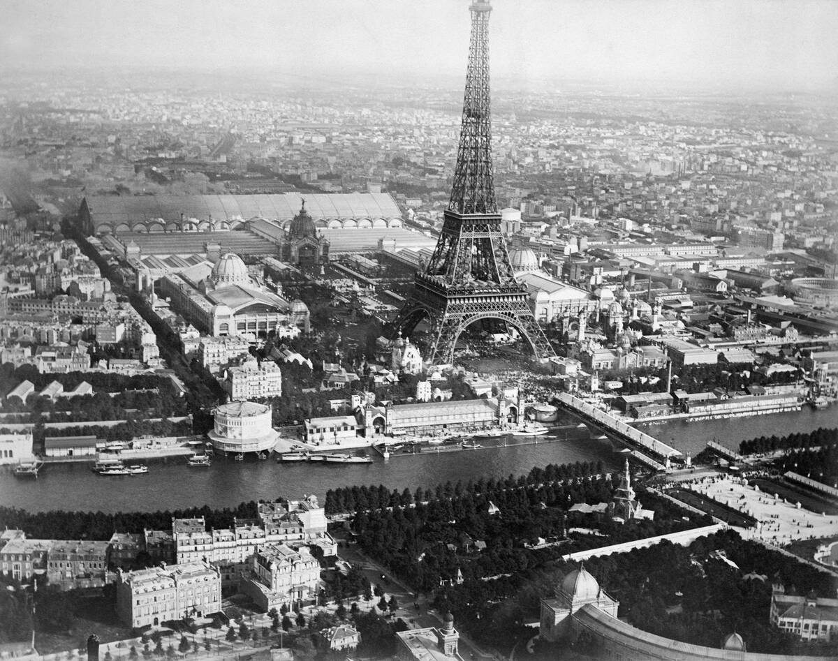
Completed in 1889 for the Exposition Universelle in Paris, the Eiffel Tower was unlike anything the city had seen before. This aerial perspective highlights the dramatic contrast between Gustave Eiffel’s iron structure and the much lower buildings that surrounded it at the close of the 19th century. Standing 1,083 feet tall at the time of completion, it was the tallest man-made structure in the world and dominated the Paris skyline.
Initially criticized by some artists and intellectuals who considered it an eyesore, the tower quickly became a symbol of modern engineering and French innovation. Built as a temporary exhibition centerpiece, it was nearly dismantled after 20 years but survived due to its usefulness as a radio transmission tower. Today, the Eiffel Tower remains one of the world’s most recognizable landmarks and a defining feature of Paris.
Lower Manhattan in 1928
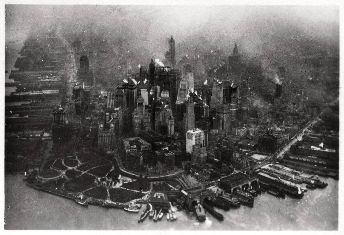
The aerial view of Lower Manhattan in 1928 captures New York City at the height of the Roaring Twenties, just before the Wall Street Crash transformed the economy. The neighborhood was already one of the world’s most important financial centers, with dense streets, bustling waterfronts, and an emerging skyline of skyscrapers. Among the most prominent structures was the newly completed Woolworth Building, which had briefly held the title of the world’s tallest building after opening in 1913.
The image shows a city undergoing rapid modernization, with older low-rise buildings standing alongside ambitious towers that reflected New York’s economic power and growth. Just one year after this photograph was taken, the stock market collapse of 1929 would usher in the Great Depression, dramatically changing the city’s fortunes. Nevertheless, Lower Manhattan remained the heart of global finance and commerce.
Pearl Harbor before the attack
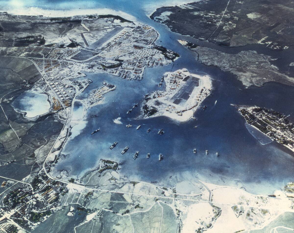
This aerial photograph captures Pearl Harbor in Hawaii before the devastating Japanese attack of December 7, 1941. At the time, the harbor was the central base of the U.S. Pacific Fleet and one of America’s most important military installations. The image shows a peaceful naval facility filled with battleships, docks, airfields, and support buildings, giving little indication of the conflict that was about to unfold.
The harbor’s strategic location made it a key target for Japan, which launched a surprise air assault that destroyed or damaged numerous American ships and aircraft. The attack killed more than 2,400 Americans and brought the United States into World War II. Today, Pearl Harbor remains one of the most historically significant military sites in the world.
An American supply plane flying over the Great Pyramid during World War II
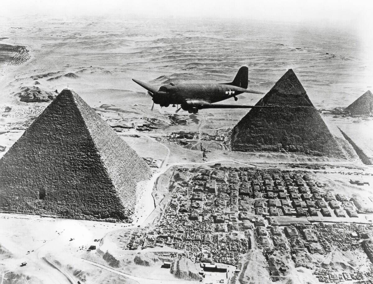
This striking image shows an American military aircraft flying above the Great Pyramid of Giza during World War II, combining one of the ancient world’s greatest monuments with the technology of modern warfare. Egypt was a crucial Allied position during the conflict, serving as a strategic base for operations in North Africa and the Mediterranean.
The Great Pyramid, built around 4,500 years ago as the tomb of Pharaoh Khufu, stood as a symbol of human achievement long before the arrival of aircraft. During the war, Allied forces operated throughout Egypt, using the country’s location to support campaigns against Axis forces in the region. The image captures a remarkable meeting of ancient history and 20th-century conflict.
The Allied land at Normandy, 1944
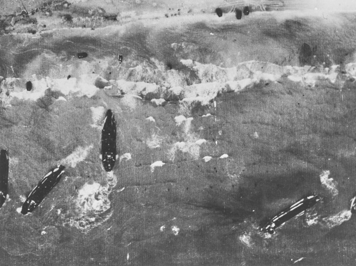
An aerial view of the Normandy coastline on D-Day captures the opening moments of the largest amphibious invasion in military history. Thousands of Allied troops, supported by landing craft, warships, and aircraft, stormed five beaches along the coast of northern France in a massive effort to liberate Western Europe from Nazi occupation. The scale of the operation is striking from above, with the shoreline crowded by waves of advancing forces.
More than 156,000 American, British, and Canadian troops took part in the invasion, despite fierce German resistance. D-Day marked a crucial turning point in World War II, establishing a foothold in occupied France that ultimately led to the liberation of Paris and the defeat of Nazi Germany less than a year later.
One of the first images of Earth taken from space, 1946
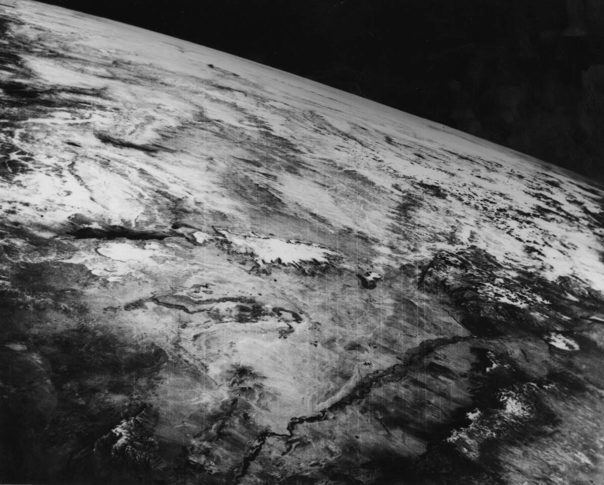
Captured on October 24, 1946, this groundbreaking photograph is considered one of the first images of Earth taken from space. It was recorded by a camera mounted aboard a modified German V-2 rocket launched from White Sands Missile Range in New Mexico. The black-and-white image revealed the planet’s curved horizon from an altitude of about 65 miles (105 kilometers).
The mission marked the beginning of space photography and paved the way for future satellite and crewed space exploration. Although primitive by today’s standards, the image offered humanity its first glimpse of Earth from beyond the atmosphere, forever changing our perspective of the planet.
The Brooklyn Bridge under construction
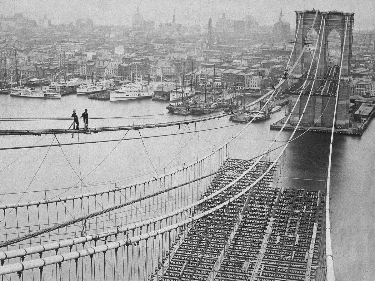
This rare aerial perspective captures the Brooklyn Bridge while it was still under construction in the 1870s, as workers assembled what would become one of the world’s most iconic suspension bridges. Stretching across the East River, the massive stone towers and network of steel cables gradually took shape, linking Manhattan and Brooklyn for the first time.
Construction lasted from 1870 to 1883 and required groundbreaking engineering techniques, though it came at a heavy human cost, with dozens of workers losing their lives. Upon its completion, the Brooklyn Bridge was the longest suspension bridge in the world and quickly became a symbol of New York City’s ambition and innovation.
Augusta National Golf Club in 1933
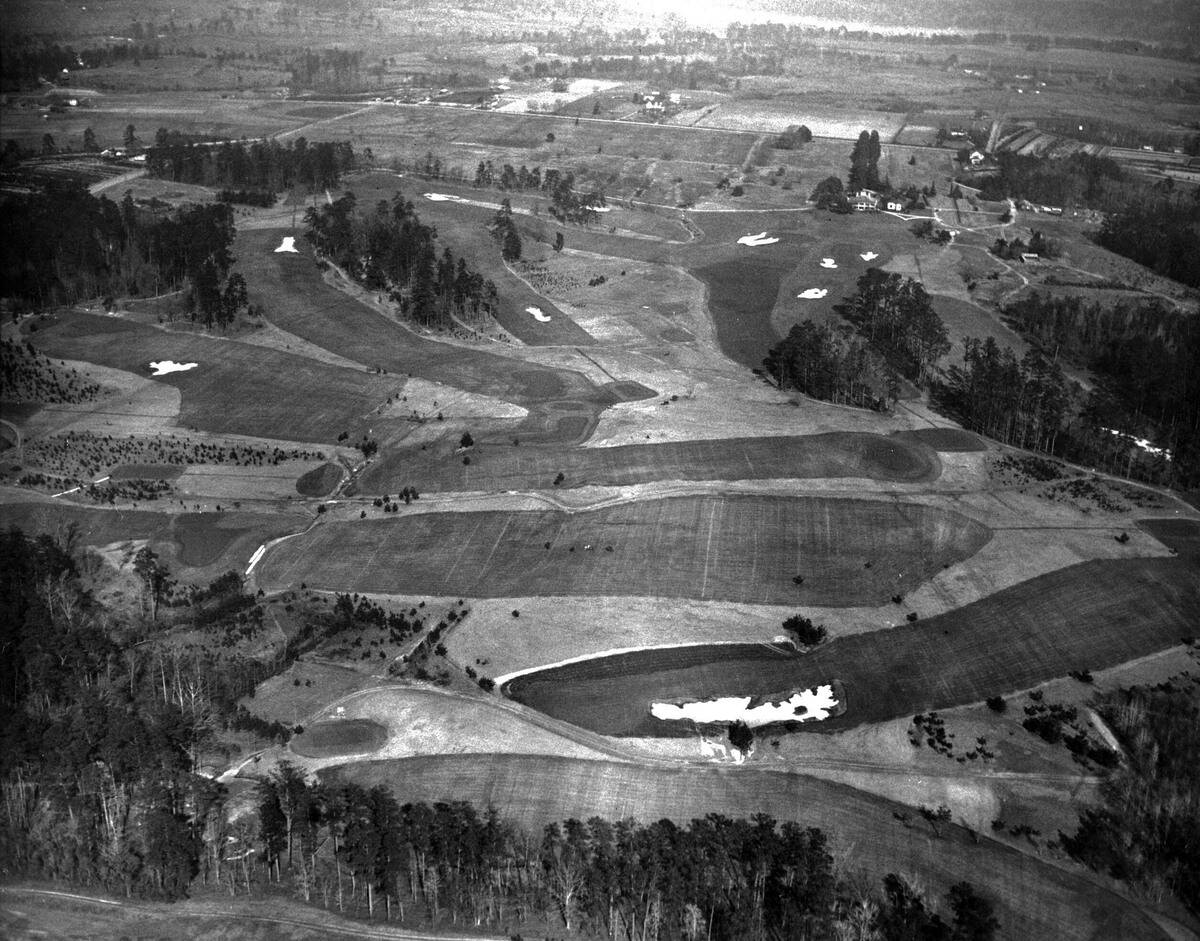
This shows Augusta National Golf Club shortly after the course was created in the early 1930s. Located in Augusta, Georgia, the property had previously been a plant nursery known as Fruitland, and founders Bobby Jones and Clifford Roberts transformed the land into one of the world’s most famous golf courses. The image captures the early layout before it became a global sporting landmark.
Augusta National officially opened in 1932, and the first Masters Tournament was held there in 1934. Over the decades, the course became synonymous with golf tradition, featuring iconic holes such as Amen Corner and hosting some of the sport’s greatest moments. Its carefully maintained grounds remain among the most recognizable landscapes in athletics.
Deadwood’s main street during the Black Hills Gold Rush, 1876
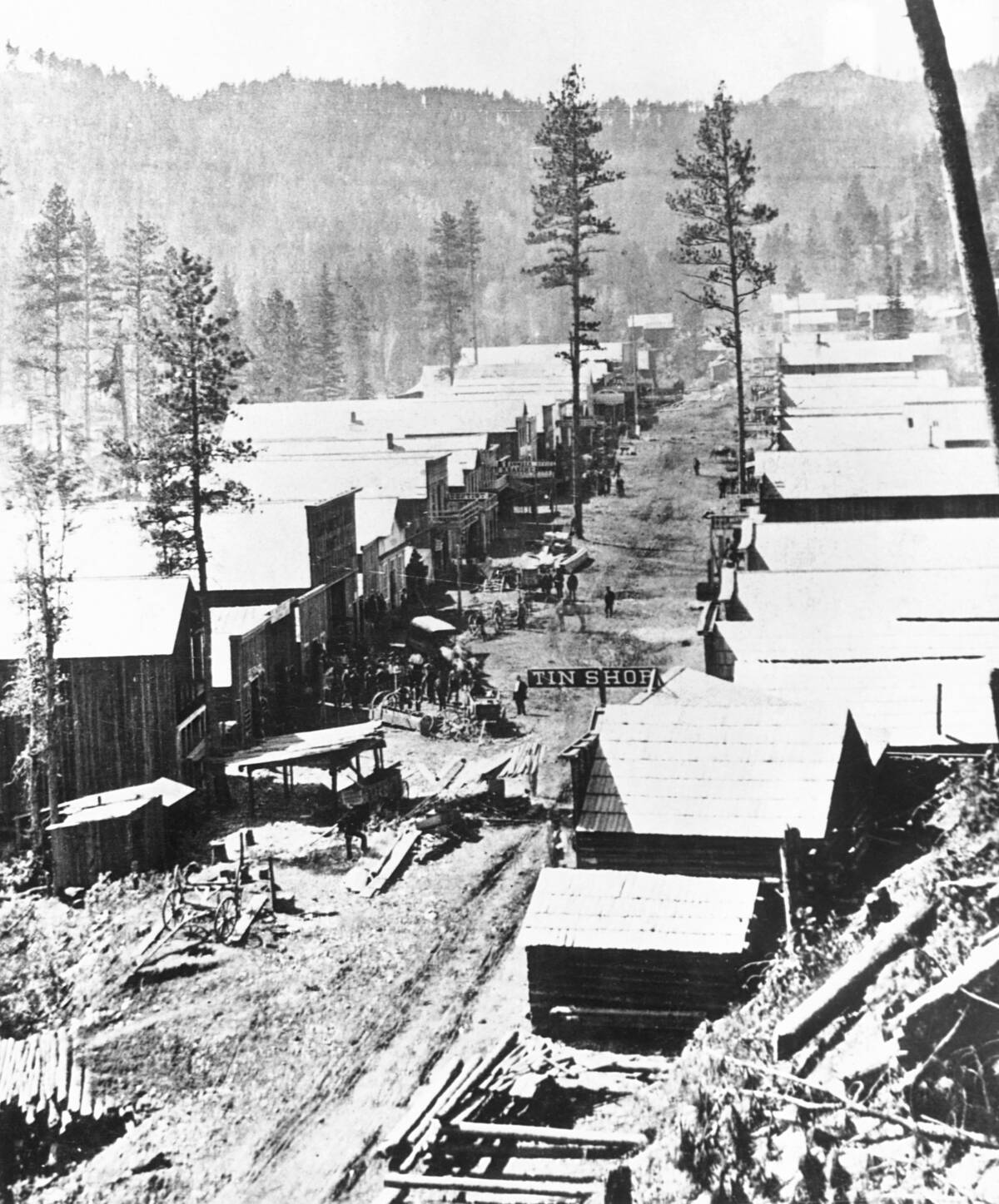
This aerial view looks down on the booming frontier town of Deadwood in the Dakota Territory during the height of the Black Hills Gold Rush. Founded in 1876 after gold was discovered nearby, the settlement grew almost overnight as prospectors, merchants, and gamblers poured into the region seeking fortune. Wooden buildings lined the town’s muddy main street, reflecting its rapid and often chaotic development.
Deadwood became famous for its larger-than-life residents, including Wild Bill Hickok and Calamity Jane, as well as its reputation for lawlessness. Although the gold rush eventually faded, the town survived and is now a National Historic Landmark that preserves an important chapter of the American Old West.
The aftermath of the Great Chicago Fire, 1871
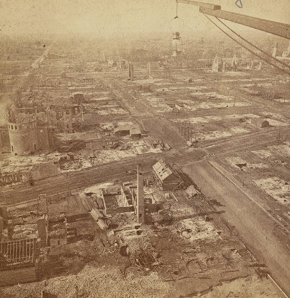
This aerial view reveals the devastation left behind by the Great Chicago Fire, which burned from October 8 to 10, 1871. The blaze destroyed more than 17,000 buildings, claimed hundreds of lives, and left roughly 100,000 residents homeless. Entire neighborhoods were reduced to ashes, with only scattered structures left standing amid the charred landscape.
Despite the scale of the disaster, Chicago rebuilt with remarkable speed. The fire prompted stricter building codes and a shift toward fire-resistant materials such as brick and stone, helping shape the modern city. Within a few decades, Chicago had emerged as a global center of architecture, business, and innovation.
Chernobyl today from above
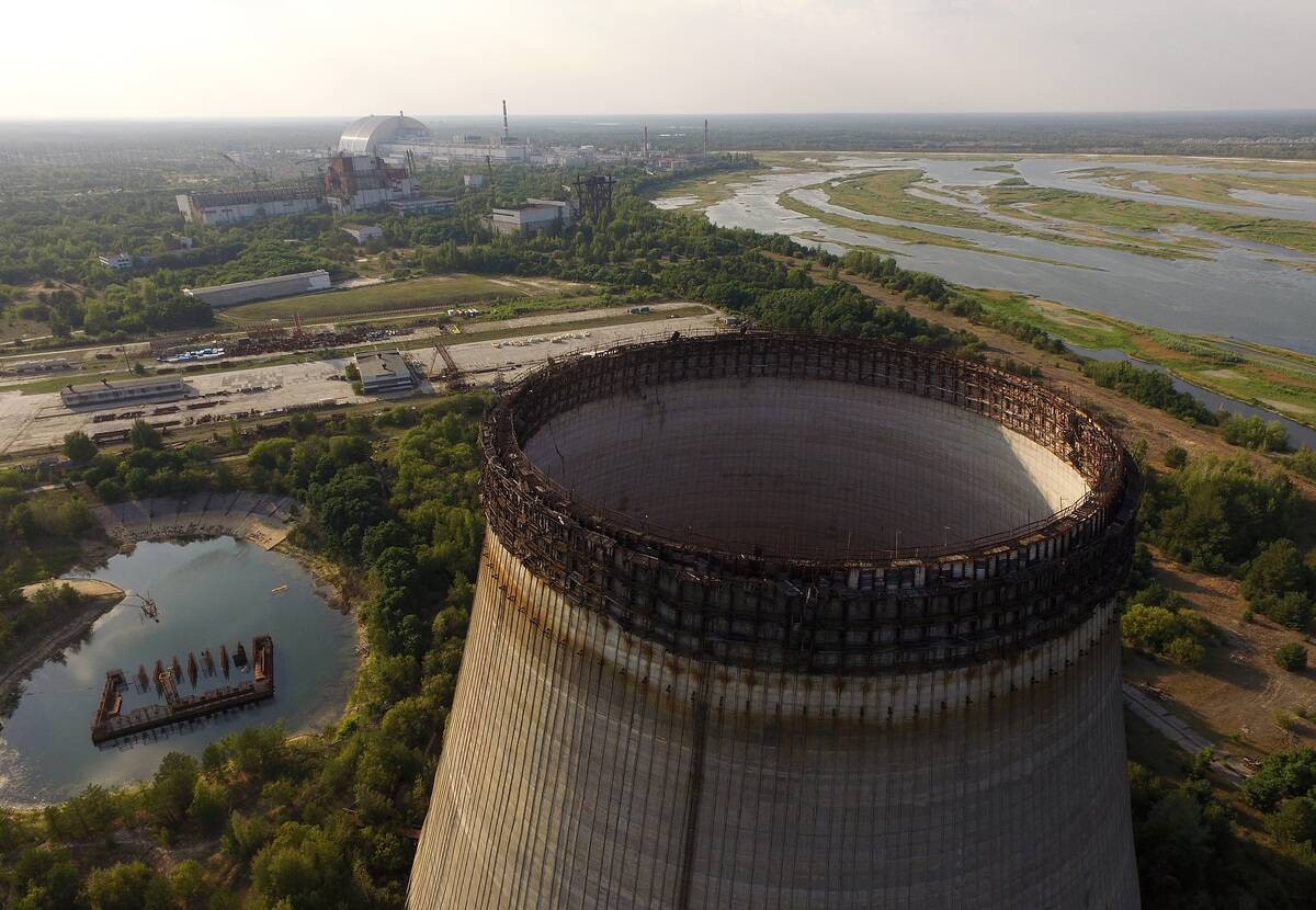
This aerial view shows the Chernobyl Nuclear Power Plant decades after the 1986 disaster, with the site’s massive cooling towers standing over the abandoned complex. The unfinished cooling tower visible in the image was part of a planned expansion that was never completed after the Reactor No. 4 explosion forced the shutdown of the project.
Today, the area surrounding Chernobyl remains within the Exclusion Zone, a restricted region created after radioactive contamination spread across the landscape. Nature has gradually reclaimed many abandoned areas, with forests and wildlife returning to places once occupied by workers and residents. The view offers a striking contrast between industrial ambition, environmental recovery, and the lasting legacy of the world’s most infamous nuclear accident.
Baghdad from above in 1930
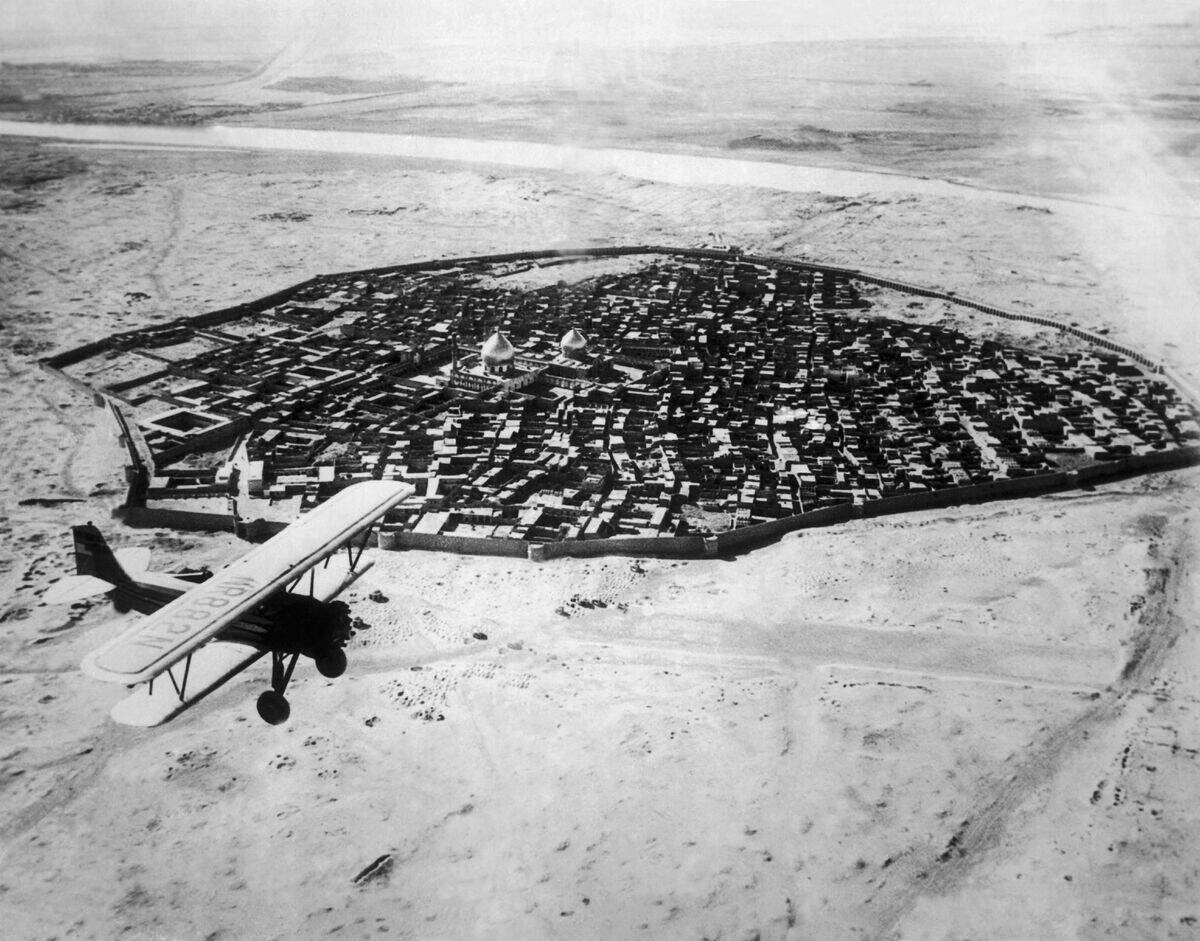
This shows Baghdad in 1930, showing the historic city along the Tigris River during a period of major transition. The plane flying above offers a rare perspective of the old city’s dense neighborhoods, traditional architecture, and winding streets, before the rapid urban expansion that would transform the Iraqi capital in the decades that followed.
At the time, Iraq was a newly established kingdom under British influence, having gained independence from the British Mandate just a few years earlier. Baghdad remained a center of Middle Eastern culture, trade, and history, with landmarks and communities that reflected centuries of civilization along the Tigris.
The Statue of Liberty covered in scaffolding during its 1980s renovation
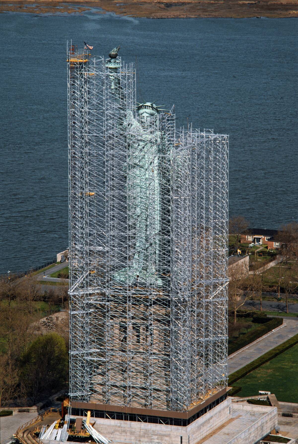
The Statue of Liberty was hidden beneath a massive network of scaffolding during its restoration in the mid-1980s. The renovation was undertaken to repair decades of weather damage, replace deteriorating materials, and prepare the monument for its centennial celebration in 1986. From above, the structure’s familiar silhouette was temporarily transformed into an industrial-looking construction site.
The restoration project addressed issues including corrosion in the iron framework and the replacement of the original torch, which had been damaged over time. After extensive work, the Statue of Liberty reopened to the public in July 1986, marking 100 years since its dedication and preserving one of America’s most recognizable landmarks for future generations.
The view from the world’s first Ferris wheel, Chicago World’s Fair, 1893
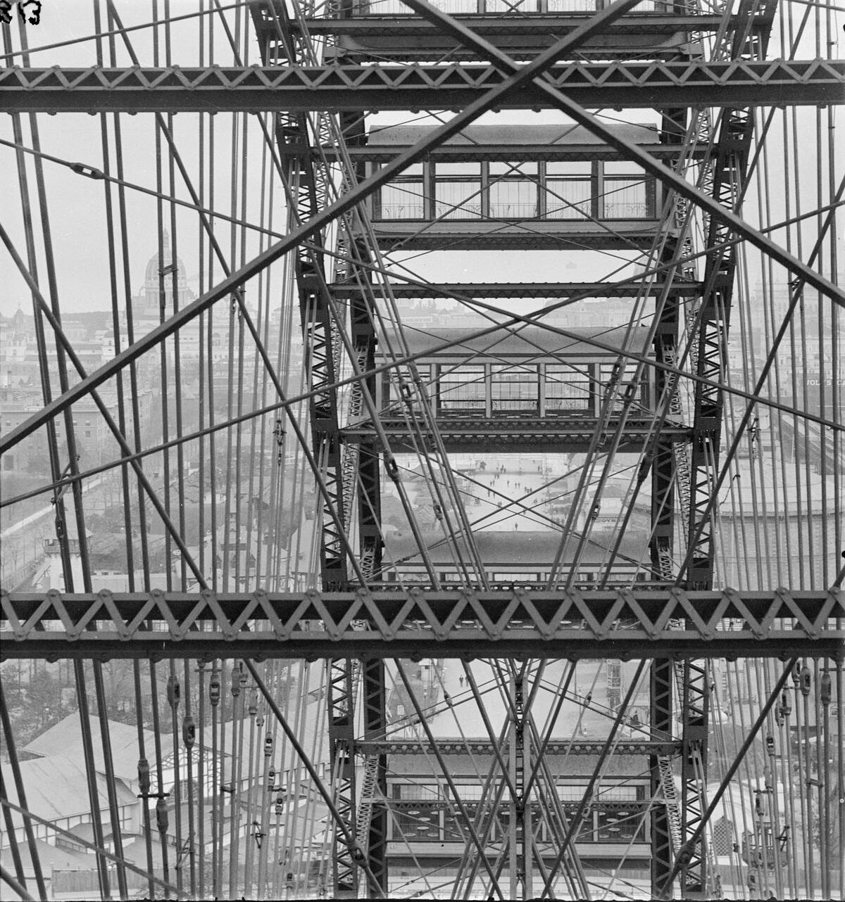
This perspective captures the view from the original Ferris wheel built for the 1893 World’s Columbian Exposition in Chicago. Designed by engineer George Washington Gale Ferris Jr., the enormous wheel towered about 264 feet above the fairgrounds, offering visitors a never-before-seen view of the city, Lake Michigan, and the sprawling exhibition grounds below.
Created as America’s answer to the Eiffel Tower, the Ferris wheel became the centerpiece of the fair and a symbol of innovation during the Industrial Age. Each rotation carried more than 2,000 passengers in its 36 passenger cars, introducing a new form of entertainment that would inspire amusement parks around the world for generations.
Dwight Eisenhower’s inauguration from above, January 1953
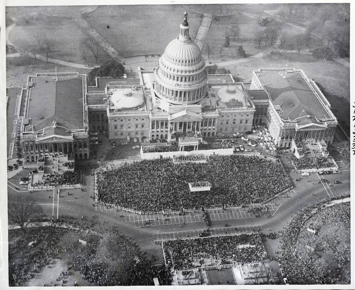
This bird’s-eye view captures the massive crowds gathered in Washington, D.C., for Dwight D. Eisenhower’s first presidential inauguration on January 20, 1953. Thousands of spectators filled the area around the U.S. Capitol and National Mall to witness the former Allied commander of World War II take office as the 34th president of the United States.
The ceremony marked the beginning of a new era as America entered the Cold War’s postwar period. Eisenhower’s inauguration drew one of the largest crowds ever seen for a presidential ceremony at the time, reflecting his immense popularity and the nation’s admiration for his wartime leadership. The aerial perspective highlights the scale of the historic event and the symbolism of the Capitol setting.