Unusual weather prediction methods before modern forecasting
Long before radar loops and push alerts, people sized up tomorrow’s sky with what they could see, smell, and feel. Mariners tracked swell and sky color at dawn, farmers watched dew and plant behavior at daybreak, and everyone paid attention to wind shifts that hinted at nearby fronts. The practice wasn’t magic—it was pattern recognition. In mid-latitudes, many changes ride in with traveling low- and high-pressure systems, and those systems leave telltale signatures in clouds, winds, and even the way smoke rises.
Some tools were literal: the mercury barometer dates to Evangelista Torricelli in 1643, and aneroid versions spread in the 19th century. But most “forecasting” stayed eyeball-simple: cirrus feathering up ahead of a warm front, a sudden cool gust front preceding a thunderstorm, or a sticky, still afternoon that screams convection. Even animals cue off the same physics, reacting to shifts in pressure, humidity, and electric fields that precede storms.
Red Sky at Night: The rhyme everyone’s grandpa swears by
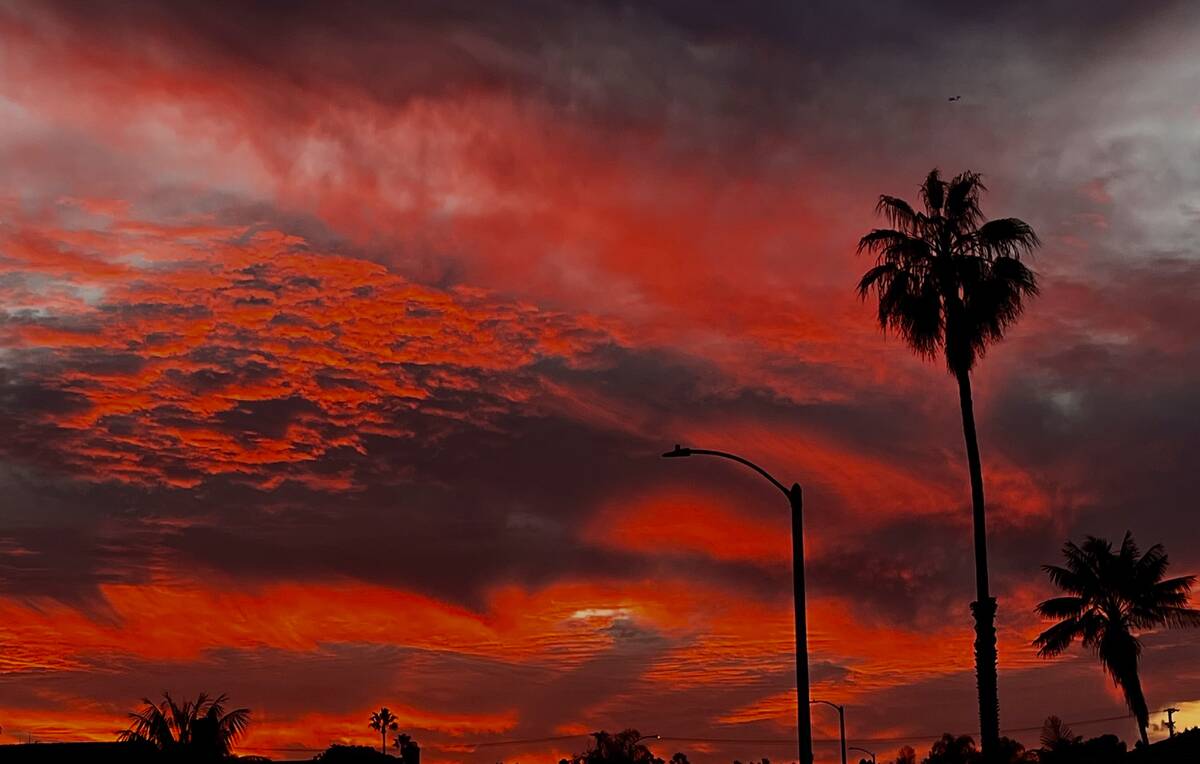
“Red sky at night, sailor’s delight. Red sky in morning, sailors take warning.” The color comes from Rayleigh scattering: when the sun is low, its light travels through more atmosphere, scattering blue wavelengths and letting reds dominate. In mid-latitudes, weather usually moves west to east. A red sunset often means clear, dry air and high pressure to the west—fair weather heading your way.
A crimson dawn can signal dry air to the east and approaching moisture and clouds from the west.
It’s not foolproof, especially in the tropics where weather patterns differ, but it’s grounded in optics and typical storm tracks. Dust and aerosols can deepen the reds, too, which is why wildfire smoke or desert dust can supercharge the effect. Mariners recorded versions of this proverb for centuries, and the logic still appears in modern forecasts: the mix of sky color, cloud type, and wind direction can quickly sketch the coming day.
Moon Halos and Starry Rings: Counting circles to call for rain

A pale ring around the moon—often about a handspan wide—is the classic 22-degree halo. It’s formed when moonlight refracts through millions of tiny, hexagonal ice crystals in high cirrostratus clouds. Those ice-crystal decks frequently precede warm fronts by 12–36 hours, so a halo can be an early hint of incoming precipitation. The geometry is neat: the minimum deviation angle through a hexagonal prism lands near 22 degrees, which is why the ring’s radius is so consistent.
Folklore says, “Ring around the moon, rain or snow soon,” and some people “count stars” inside the ring to time the arrival. The counting part is just playful, but the basic signal holds: high, uniform sheets of cirrostratus are classic front runners. Halos around the sun work the same way, though staring at those isn’t recommended. If the halo looks blurry or double, you may be seeing variations like parhelia (sun dogs) when crystal orientation gets fancy.
Cloud Gossip: Reading mares’ tails, mackerel skies, and anvil tops

Mares’ tails are wispy cirrus uncinus—ice-crystal streamers shaped by strong winds aloft. They often herald a strengthening jet and moisture arriving at altitude, a common prelude to a warm front. “Mackerel sky” refers to rippled altocumulus or cirrocumulus resembling fish scales. The old rhyme goes, “Mackerel sky, mackerel sky, never long wet, never long dry,” capturing that it often signals changeable weather as mid-level instability builds.
Anvil tops are the flat, spreading crowns of mature cumulonimbus.
When a storm’s updraft slams into the tropopause, it mushrooms outward downwind, pointing like an arrow toward the storm’s travel direction. A well-ventilated anvil with overshooting tops warns of a strong or even severe thunderstorm, and mammatus pouches can appear in turbulent, sinking air beneath. Spotting these shapes is basic skycraft: high feathery cirrus often first, then thicker mid-level patches, and finally towering convection if instability and lift line up.
Wind in the Willows: Direction, feel, and smell as homegrown barometers
Wind direction in the Northern Hemisphere often lines up with air mass origin: southerly flow tends warmer and moister, northerly cooler and drier. A backing wind (turning counterclockwise with time) can precede an approaching low, while veering (clockwise) frequently follows a frontal passage. Sea breezes pop up on sunny afternoons when land heats faster than water, pulling in cooler marine air.
A sudden, cool, dusty gust out of a blue-gray shelf cloud? That’s a thunderstorm’s outflow boundary arriving first.
Your skin and nose notice, too. Humid air feels heavier because sweat evaporates more slowly, and scents carry farther when moisture and stable air trap aromas near the surface. Ahead of storms, falling pressure and rising humidity can make soil, plants, and even city odors seem stronger. After passage, a crisp, dry northwest wind often scrubs the sky. Simple rule of thumb: shifts in direction and temperature—especially rapid ones—mean boundaries are crossing.
Chimney Smoke Secrets: When smoke sinks, grab the umbrella
Watch a chimney on a cool morning. If smoke rises straight up, the boundary layer is mixing well and winds aloft are light—often fair conditions. When smoke slouches and spreads along rooftops, a temperature inversion is trapping it near the ground. Inversions commonly build ahead of warm fronts and during high-humidity, stable setups that can precede low clouds and drizzle.
The same physics explains why pollution spikes under stagnant, pre-frontal conditions.
Smoke behavior can also hint at wind shear. A column that bends sharply indicates a stronger flow just above the surface, while puffs that tumble and eddy suggest turbulent mixing. None of this is a guarantee of rain—you need moisture and lift—but persistent, low, trapped smoke pairs suspiciously well with gray, low-ceiling days. In rural areas, even campfire or woodstove plumes offer a pocket-sized readout of stability and impending gloom.
Hair Today, Humid Tomorrow: Frizz, curls, and static as storm sirens

Human hair is hygroscopic—keratin absorbs water. In high humidity, hydrogen bonds rearrange along the fiber, causing swelling and shape change. Translation: curls spring tighter and frizz blooms when moisture surges, a frequent prelude to rain in warm seasons. That’s why salons talk dew point, not just relative humidity; higher dew points mean the air holds more actual water vapor, and your hair knows it.
If your bangs double in volume by lunch, moisture is on the move.
Static is the opposite tale. Dry, wintry air lowers surface conductivity, so charges don’t leak away and hair stands up after a hat pull. Ahead of warm fronts, as humidity climbs, static snaps usually fade. Some people notice “heavier” hair hours before storms; rising dew points reduce evaporation from skin and strands alike. While hair can’t tell you the arrival time, it’s a decent barometer for the moisture piece of the precipitation puzzle.
Achy Knees and Stormy Seas: Joints as living pressure gauges
Plenty of people swear their joints forecast storms, and the science is mixed but intriguing. Barometric pressure does change the external load on tissues, and humidity and temperature can influence pain perception. A 2019 smartphone-based study in the UK (“Cloudy with a Chance of Pain”) found higher pain reports on humid, windy, low-pressure days among people with chronic pain. Other large studies have found weaker or inconsistent links, suggesting sensitivity varies by individual and condition.
Mechanically, cartilage and synovial fluid respond to pressure and temperature, and inflamed tissues may swell slightly when external pressure drops. That could tweak nerves enough to notice. Still, cognitive bias plays a role: memorable storm-pain pairings stick, pain-free rainy days don’t. If your knees nudge you to pack a raincoat, take the hint—but back it up with a glance at the radar or, at least, a sky check for thickening mid-level clouds.
Cows, Cats, and Chickens: Barnyard animals sounding the alarm
Animal lore piles up fast: cows lie down before rain, cats get restless, chickens roost early. Solid data are scarce, but the physics they sense is real. Falling pressure and rising humidity can make scents carry farther and sound travel differently, which may change behavior. Chickens often head in when skies darken because light levels drop. Cats and dogs sometimes act skittish before thunderstorms—studies show they detect low-frequency rumbles and changes in the electric field that humans miss.
As for cows, they lie down to ruminate multiple times a day, rain or shine. Some herds do huddle or seek lower ground ahead of severe weather, likely reacting to wind, temperature drops, and distant thunder. The safest takeaway: animals respond to immediate environmental changes—light, wind, and sound—rather than predicting distant storms. If the barnyard goes unusually quiet with a green-gray sky and a cool gust, though, everyone may have read the same warning.
Birds Flying Low: Swallows, swifts, and the bug-barometer trick
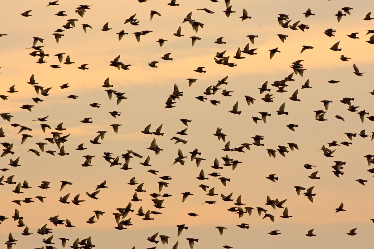
Why do swallows and swifts sometimes skim low before rain? Their menu explains it. Many small insects ride thermals to higher altitudes on sunny, stable days. As pressure falls and humidity rises, those insects often fly lower or get knocked down by turbulence and thicker air. Aerial hunters follow the buffet. Ornithologists have documented changes in foraging height with weather, and pilots know swallows over a runway can mean a sticky boundary layer and unsettled air.
It’s not just about bugs, either.
Ahead of storms, winds can shear and become gusty aloft, making high-altitude flight less efficient for small birds. Low cloud ceilings also physically limit usable airspace. Flocks of martins and swallows strafing just above fields, paired with thickening altocumulus and a soupy feel, is a fair, folksy hint that showers or a front aren’t far behind—even if the timing stays fuzzy without instruments.
Bugs and Beetles: Woolly bears, ants, and other tiny forecasters
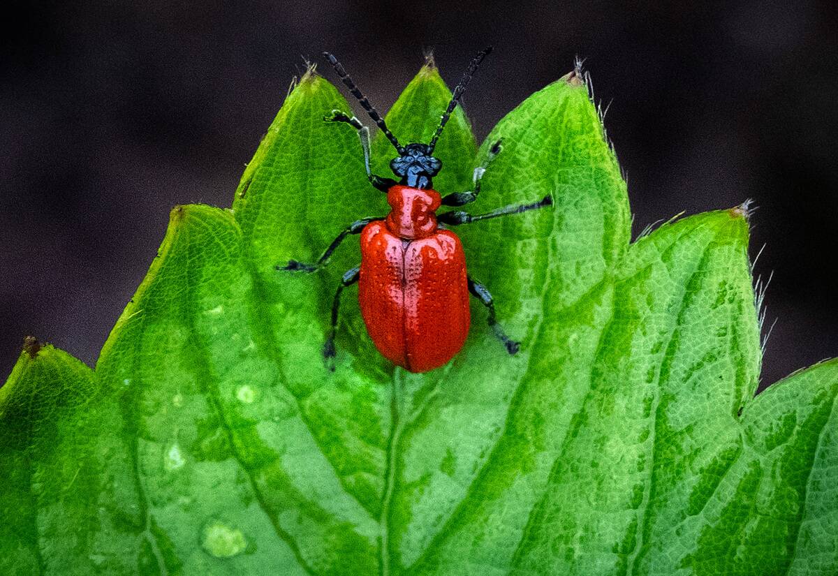
The woolly bear caterpillar’s stripe supposedly predicts winter severity. Fun, but false. The rusty band varies with species, age, and growth conditions of the current year, not the coming one. Studies and naturalists agree: cute, not clairvoyant. What insects do excel at is pressure sensing. Laboratory work has shown some moths and butterflies reduce mating or flight when barometric pressure drops, a smart tactic to avoid storm damage.
Mosquito activity also shifts with humidity, often increasing when the air is moist and warm.
Ant behavior gets buzz, too. Many species respond to moisture by shoring up nests or closing entrances before heavy rain to prevent flooding. You might see frantic lines before a downpour because foragers are racing a clock. None of this offers weeklong forecasts, but sudden pressure drops and humidity spikes ripple quickly through insect worlds. When the porch light draws fewer fluttering visitors under a lowering sky, even the bugs are hedging bets.
Frog Choir Forecast: Croaks, croons, and pond-side predictions

Frogs sing for love, not meteorology, but their timing tracks weather nicely. Males call more on warm, humid nights because sound carries farther in moist air and because those are prime conditions for amphibians to avoid drying out. Species like spring peepers and chorus frogs often erupt after spring rains fill vernal pools, making chorus intensity a handy proxy for recent and near-term moisture. If the pond is thundering with calls, the night air is almost certainly muggy.
Before storms, rising humidity and a falling pressure can kickstart calling as evening sets in, and the first warm rains of the season are a reliable trigger. Conversely, sudden cold snaps quiet the choir. Biologists use these patterns to time surveys, knowing that weather—not the calendar—sets the stage. So while frogs aren’t predicting next week, their chorus reliably shouts, “It’s warm and wet right now,” which often means more showers are in the mix.
Spider Sense Tingling: Web-building as a fair-weather flag
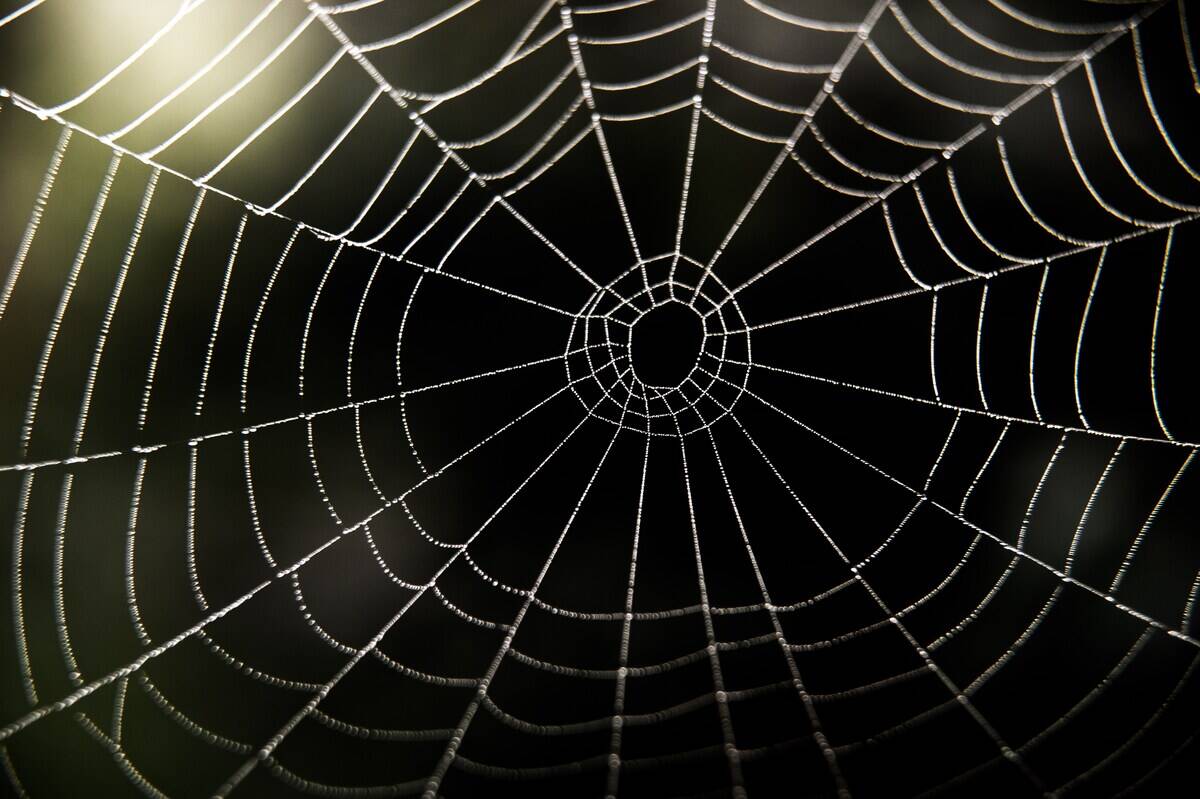
Spiders tailor web-building to conditions. Silk softens and sags when wet, and high winds shred delicate strands, so many orb-weavers build or repair more actively on calm, dry nights. That’s why sparkling, dew-beaded webs on a clear morning often follow a stable night sky. Conversely, foul weather reduces both prey flight and web longevity, so spiders may hunker down and conserve silk during blustery, rainy spells.
Observers have noted fewer fresh webs after stormy nights, a sensible energy-saving strategy.
Spider silk also responds to humidity in fascinating ways: some capture spirals become stickier as moisture rises, improving prey capture on damp nights that aren’t rainy. But there’s no robust evidence that spiders “predict” storms beyond reacting to present cues like wind and moisture. If you spot elaborate new webs strung across garden paths at dawn and the wind is light, the day probably started stable—fair weather’s friend—though fronts can still muscle in later.
Pine Cones and Plant Whispers: Flora that opens, closes, and hints at rain
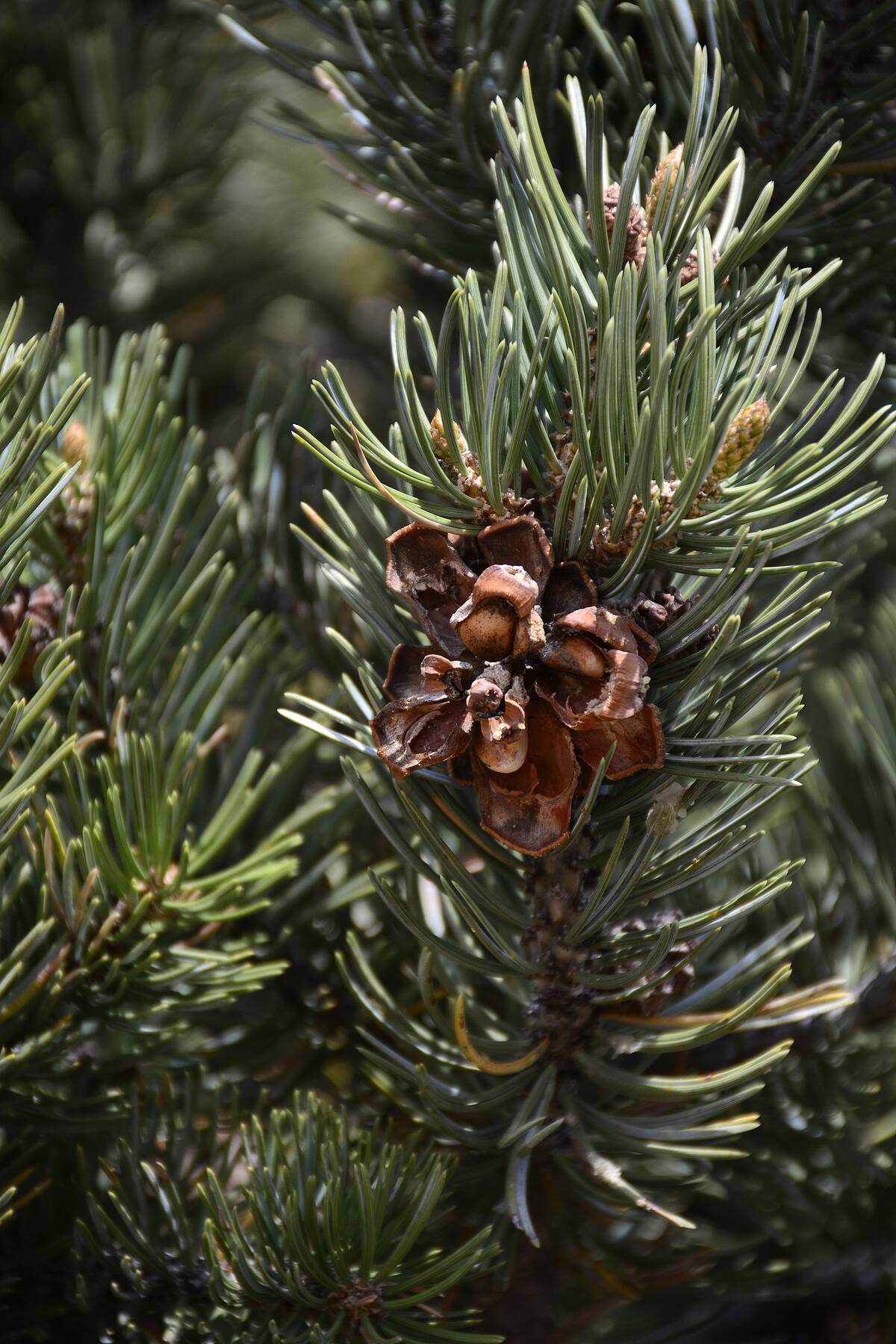
Pine cones are classic hygrometers. Their scales open in dry air to release seeds and close when humid to protect them—pure physics driven by moisture-swelling fibers oriented in different directions. Put a cone on a windowsill and you’ll watch it subtly open on sunny days and clamp down before a damp spell. Some flowers, like morning glories, open and close with light and humidity, while clover leaves can droop when moisture is high and light is low.
These aren’t long-range forecasts, but they telegraph the air’s current mood. In Scandinavian museums, you’ll even find novelty “weather cones” mounted on sticks as rustic humidity gauges. Gardeners know buds stay tight on gray, moist mornings and unfurl in dry sun, and seed heads fluff when the air is crisp. If the cones are clenched and the lawn feels sticky at breakfast, those cues, plus an advancing sheet of cirrostratus, make rain a decent bet.
Onion Skins, Corn Husks, and Other Kitchen Omens

Proverbs claim, “Onion skins very thin, mild winter coming in; onion skins thick and tough, winter coming rough.” Charming, but plant tissue thickness reflects variety and growing conditions, not a crystal ball. Corn husks, too, vary with hybrid and field moisture. What your kitchen can tell you, however, is real-time humidity. Salt clumps faster on damp days, sugar turns lumpy, and cracker snap fades as starches absorb water. Those little clues mirror a rising dew point, common before rain.
Old-timers also watched window condensation and pantry smells. When outdoor dew points climb, cool glass sweats and musty odors intensify as moisture activates latent scents. In summer, a soupy kitchen at dawn plus a southeast breeze is a solid hint that a marine air mass has moved in. So keep the folklore for fun, and use the food science for facts: clumpy salt and soft chips mean the air is wet right now.
Dew on the Grass: Shiny lawns as tomorrow’s sunshine hint
Dew forms when surfaces radiate heat to a clear night sky, dropping below the air’s dew point so water vapor condenses. Clear skies, light winds, and relatively dry air aloft are the recipe—exactly the setup that often leads to a sunny morning. If a heavy dew greets you at dawn, the night likely lacked thick clouds or strong wind, both of which inhibit dew formation. Gardeners use this as a quick read on overnight radiational cooling.
There’s a flip side: when cloud cover increases overnight ahead of a front, surfaces don’t cool as much and dew is sparse, even if humidity is high. So a bone-dry lawn at sunrise with a gray ceiling can actually mean rain is closer than it feels. Dew can also signal microclimate quirks—low spots pool cool air and dew first. Combined with the day’s forecast winds and clouds, that sparkle can be a fair-weather wink.
Scent of Rain: Petrichor, ozone, and the nose knows

That earthy smell before or after rain has a name: petrichor, coined in 1964 by Australian researchers Isabel Bear and R. G. Thomas. It’s a blend of plant oils and geosmin—a compound made by soil-dwelling actinomycete bacteria. When raindrops hit dry ground, they trap air and burst into tiny bubbles that aerosolize these scents. A 2015 MIT study even filmed this splash effect in slow motion, showing how raindrops efficiently launch petrichor into the air.
Storms add another note: ozone.
Lightning splits oxygen and nitrogen molecules; some recombine into ozone, which has a sharp, chlorine-like scent. Gust fronts can carry that smell far ahead of the rain itself. People often report “smelling” a storm miles away on a muggy evening—that’s real chemistry on the wind. Stronger odors in general also ride with humidity, as water vapor helps airborne molecules linger near the surface and reach your nose more readily.
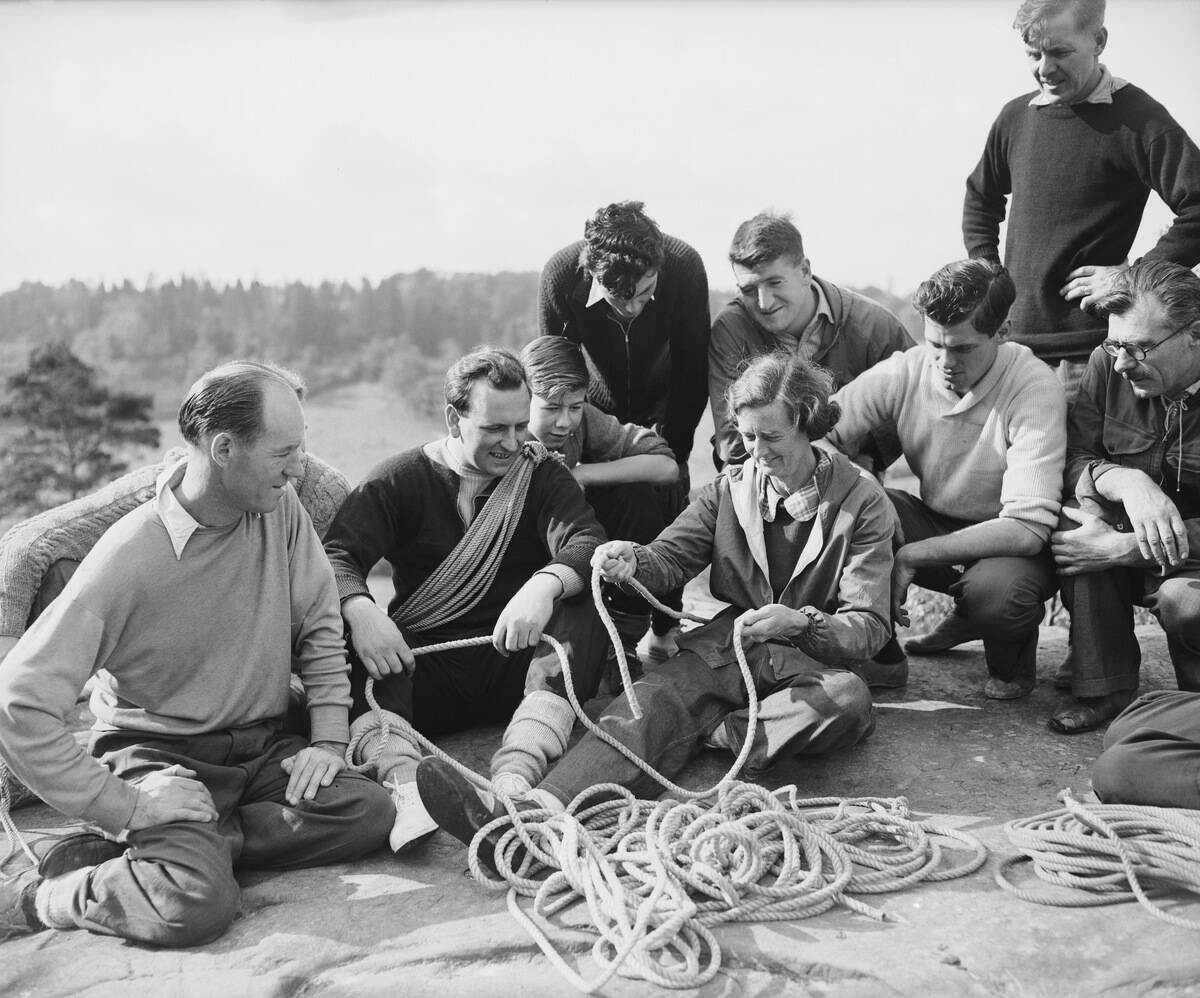
Sailors’ Lore: From rhymes, reefs, and saints at sea

Centuries at sea honed rules worth keeping. Reef early, reef often: if you’re wondering whether to shorten sail, it’s already time—gust fronts hit fast. Long-period swells from one direction hint at a distant storm there, even under local blue skies. Watch the barometer; a steady fall, especially faster than about 1 millibar per hour, warns of a strengthening low. And yes, that “red sky” rhyme shows up in ship logs because mid-latitude storm tracks are so dependable.
Then there’s St. Elmo’s fire—glowing discharges at mast tips in strong electric fields before thunderstorms. It’s not a forecast by itself, but it signals high charge in the air. Mariners also read clouds religiously: a lowering, thickening deck from cirrus to altostratus screams warm front, while towering cumulus with crisp edges promise squalls. Even today, with satellite weather, veteran skippers keep one eye on the horizon and one on the barometer.
Almanacs and Lunar Logic: Planting by the moon and long-range guesses

The Old Farmer’s Almanac has printed since 1792, offering long-range outlooks based on solar cycles, climatology, and proprietary formulas. It famously claims high accuracy, though independent checks often find results closer to chance over many months. Planting by the moon—scheduling crops around lunar phases—is tradition-rich. While the moon rules tides and can tweak nighttime light levels for pollinators, there’s no strong scientific evidence it meaningfully steers day-to-day weather patterns on land.
That said, the moon does nudge our atmosphere: slight tidal oscillations exist, and lunar phases can shift nocturnal brightness that influences animal behavior. For gardeners, the practical wins still come from local frost dates, soil temperature, and short-range forecasts. If aligning tasks with the waxing moon adds rhythm to the season, enjoy it—but for rain next Tuesday, your best bet is still a modern model and a look at real clouds.
Bottled Storms and Magic Glass: Leeches, storm glasses, and DIY barometers
Victorian showman-science produced the storm glass: a sealed vial of ethanol, water, and camphor that grows feathery crystals. Admiral Robert FitzRoy popularized it in the 1800s. The catch? The crystals mostly respond to temperature, not future weather, so predictive power is poor. Better DIY? A simple water barometer—an inverted bottle over a jar of colored water—rises and falls with pressure changes, giving a real (if rough) readout of the atmosphere’s push.
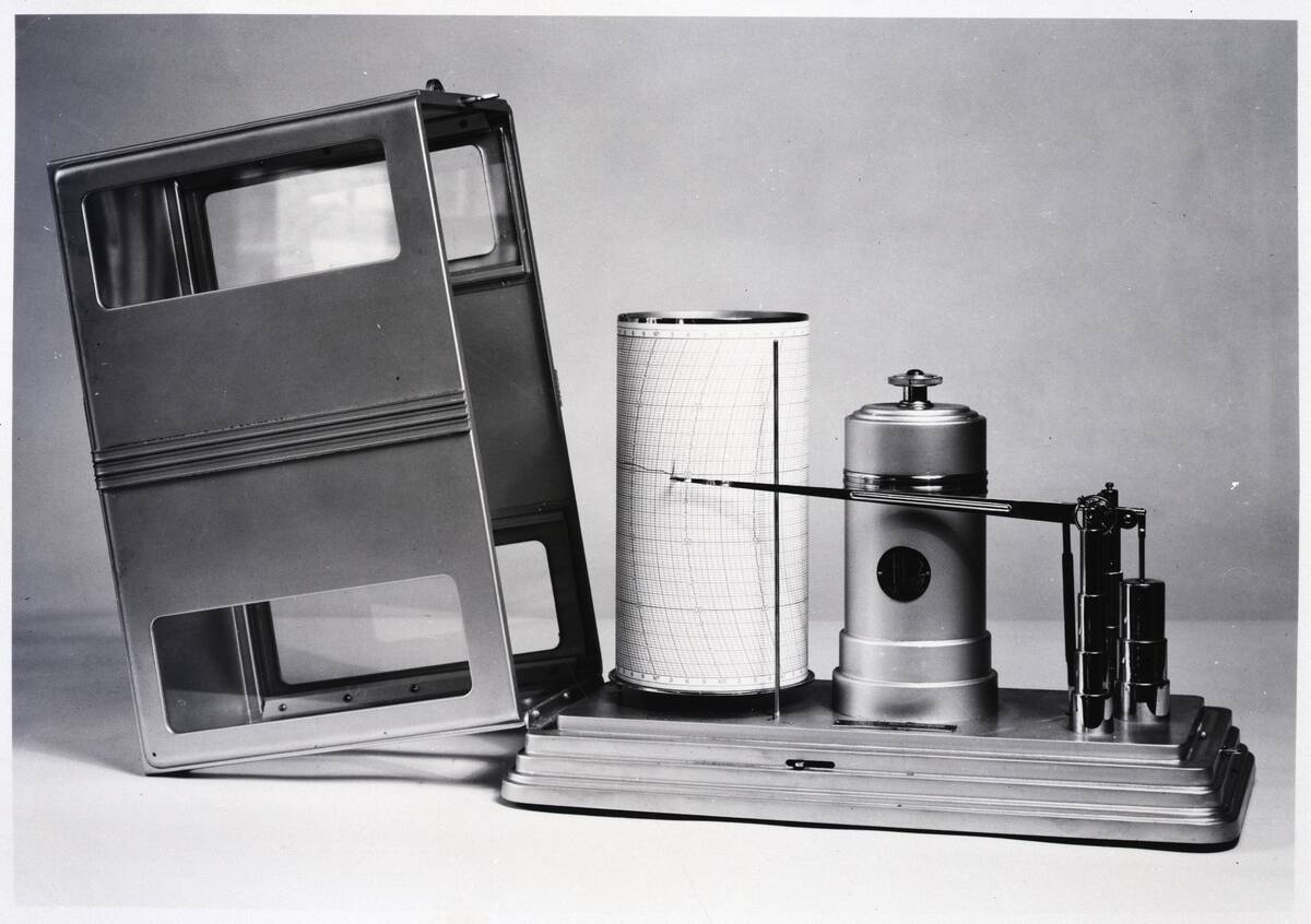
Then there’s George Merryweather’s 1851 “Tempest Prognosticator,” a contraption of leeches in bottles that supposedly rang a bell before storms. It charmed crowds at the Great Exhibition but never proved reliable. Real barometers, however, are gold: Torricelli’s mercury version in 1643 and later aneroid models remain staples. A steady fall flags an approaching low; a rise signals high pressure. Pair that trend with wind shifts and cloud types, and you’ve got solid, old-school forecasting.
Candlemas to Groundhogs: Holiday traditions that double as forecasts

February 2 carries weather lore on both sides of the Atlantic. An old English rhyme goes, “If Candlemas Day be fair and bright, winter will have another flight; if Candlemas Day be cloud and rain, winter is gone and won’t come again.” It lines up roughly with the mid-point of winter, when a sunny, cold high is common—hardly a crystal ball.
German settlers brought similar lore to Pennsylvania, swapping hedgehogs for groundhogs.
Enter Punxsutawney Phil, prognosticating since 1887. If he “sees” his shadow, six more weeks of winter; if not, early spring. It’s charming theater, not skillful forecasting: historical tallies put Phil’s accuracy well below 50% when compared to subsequent temperatures, and NOAA says the groundhog’s hits and misses are about even with chance. Still, the tradition highlights a real seasonal pivot when longer days and shifting jet streams start reshaping weather maps.
Crackling Fires and Popping Logs: Hearth-side humidity hacks
Wood pops because sap and moisture trapped in the log flash to steam, bursting pockets with little explosions. Fresh or poorly seasoned wood contains far more water; properly seasoned firewood aims for under about 20% moisture. On damp days, even dry wood may hiss more as surface moisture steams off, and draft can weaken if the temperature difference between flue and outdoor air shrinks.
That can signal a milder, cloudier air mass—common ahead of a front.
A roaring, steady draft on a cold, dry night matches strong radiational cooling under high pressure. Conversely, smoky backdrafts can arise in low ceilings and inversions when outside air is near saturation and stable. While barometric pressure alone doesn’t pop a log, the package—humidity, temperature, and stability—plays out audibly in the hearth. If your fire suddenly struggles under a lowering, gray sky, the air outside may be primed for drizzle.
Weather Witches and Wind Knots: Buying a breeze the old-fashioned way
Folklore from the North Atlantic speaks of sailors buying winds from “witches,” sometimes as ropes tied with three knots. Untying one knot released a gentle breeze, two brought a stiffer wind, and the third unleashed a gale—so the story goes from places like the Orkney and Shetland Islands. It’s myth, of course, but it reflects just how vital wind was when canvas decided survival and speed, long before diesel and forecasts.
The real physics behind “tied winds” is pressure gradient force: air accelerates from high to low pressure, steered by the Coriolis effect and tempered by friction. Tighten the gradient—those packed isobars on a map—and you’ve effectively “untied a knot.” Even today, coastal fishers and small-craft sailors still eyeball whitecaps, flags, and smoke to judge wind strength on the fly, then pick a course or cove accordingly.
The Weather Rock: The world’s simplest, silliest “instrument”

You’ve seen the sign: “Weather rock.” If the rock is wet, it’s raining. If it’s white, it’s snowing. If it’s swinging, it’s windy. If it’s gone, tornado. It’s a joke with a point: observation beats overthinking. A quick step outside—feel the wind, check the clouds, smell the air—often tells you more than squinting at a single number, especially in the last hour before a front or thunderstorm arrives.
As gaggy as it is, the rock teaches good habits: verify. Is that dark base of cloud growing and lowering? Do shadows look sharp (dry air) or washed out (haze and humidity)? Are birds flying high or hugging the field? When the backyard “instrument” ensemble agrees—the rock is wet, the wind is gusty, and the sky is stacked in layers—you don’t need a supercomputer to pack a raincoat.
Reading the Horizon: Mirage, haze, and far-off thunder as early alerts
A shimmering road mirage isn’t water; it’s refraction as light bends through a steep temperature gradient above hot pavement. Over water, superior mirages and looming can make distant ships rise and warp when cold air hugs the surface and warmer air sits above. Haze thickens under moist, stagnant air, scattering light and muting distant hills—conditions that often precede low clouds or fog. Crystal-clear visibility usually partners with dry, subsiding air beneath high pressure.
Sound carries clues, too. Low-frequency thunder can travel 10 miles or more under temperature inversions, arriving long before rain. A steady, distant rumble with a growing, flat anvil on the horizon is a stronger warning than a single crack. Farmers and hikers watch for building towers with crisp edges (vigorous updrafts) that soften and spread into anvils—classic signs a storm field is maturing and marching closer, even if your sky is still deceptively blue.


