Historical maps that revealed new continents and trade routes
Historical maps are more than just artistic depictions of the world; they are time capsules that reveal how societies understood their place on Earth. These maps, each with its own story, offer a fascinating glimpse into the past.
From the detailed charts of explorers to the speculative visions of mapmakers, historical maps have shaped our understanding of geography and history. Let’s journey through time to explore some of the most intriguing maps and the stories they tell.
The Age of Exploration: Charting New Horizons
The Age of Exploration, spanning the 15th to the 17th centuries, was an era of unprecedented global discovery. European explorers set sail to find new trade routes and lands, leading to the creation of detailed maps charting these new horizons.
These maps were not only tools for navigation but also symbols of national pride and ambition. They documented the expanding world, featuring newly discovered lands, and reflecting the explorers’ adventurous spirit and curiosity about the planet.
Ptolemy’s World Map: The Ancient Cartographic Marvel
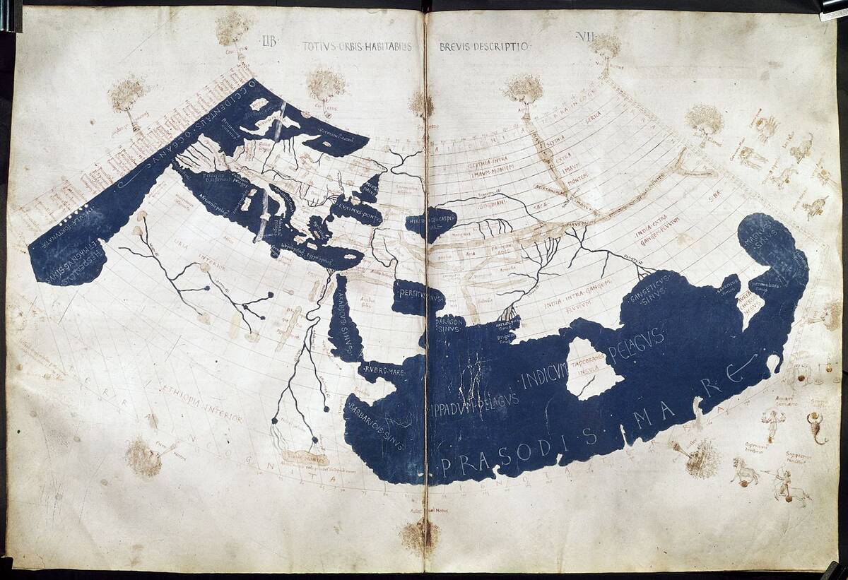
Claudius Ptolemy, a Greek-Egyptian scholar who may have also been a Roman citizen, crafted a map in the 2nd century that would influence cartography for over a millennium. His Geographia included a world map based on a grid system, a revolutionary concept at the time.
Though inaccurate by modern standards, Ptolemy’s map was a marvel of its day, offering a structured way to represent the world. It incorporated latitude and longitude, laying the groundwork for future mapmakers to refine and expand upon.
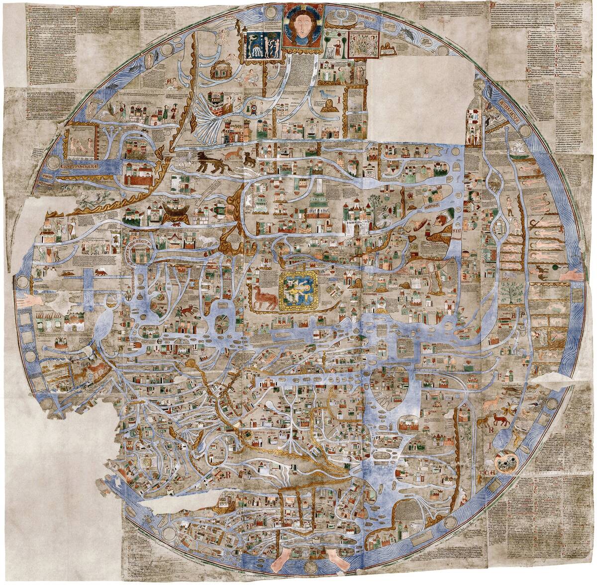
The Mappa Mundi: Medieval Maps and Their Mysteries
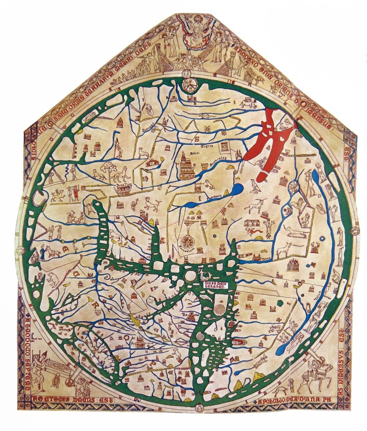
The Mappa Mundi, such as the famous Hereford Map, are medieval maps that blend geography, mythology, and theology. These maps were not intended for navigation but served as educational tools to convey the medieval worldview.
They often placed Jerusalem at the center, with the known world radiating outward. While not geographically accurate, the Mappa Mundi captures the medieval mind, highlighting the era’s religious beliefs and cultural knowledge.
Portolan Charts: Navigational Breakthroughs of the Middle Ages
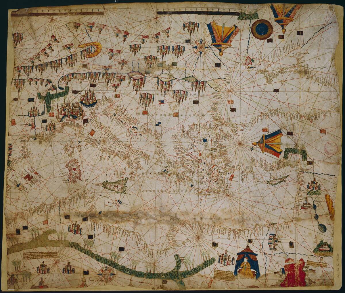
Emerging in the 13th century, Portolan charts represented a significant advancement in nautical navigation. These charts depicted coastlines with remarkable accuracy, thanks to information provided by sailors.
Unlike previous maps, Portolan charts used a network of compass roses to aid navigation across the Mediterranean and beyond. Their precision and practicality made them indispensable tools for mariners, facilitating the age of exploration and trade.
The Cantino Planisphere: Portugal’s Secret Weapon
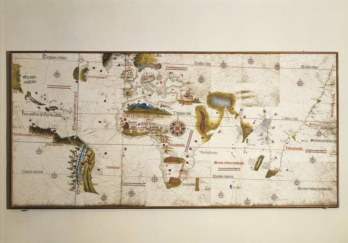
The Cantino Planisphere, created in 1502, was a clandestine triumph for Italy. This map was smuggled out of Portugal by an Italian spy named Alberto Cantino, revealing the latest geographic discoveries.
It was one of the first maps to depict the Americas, showcasing Portugal’s exploration prowess. The map’s detailed representation of coastlines and islands highlights the era’s geopolitical intrigue and the competitive nature of European exploration.
Martin Waldseemüller’s World Map: Naming America
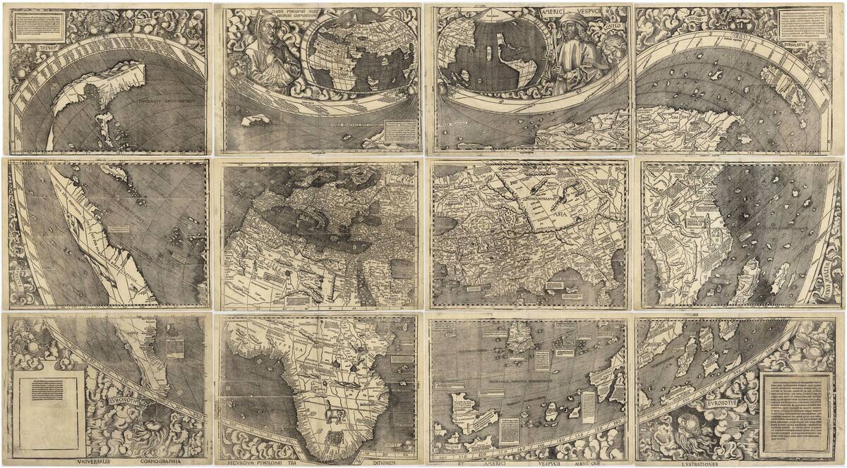
In 1507, German cartographer Martin Waldseemüller published a map that would make history by naming the New World ‘America,’ after explorer Amerigo Vespucci. Waldseemüller’s map was groundbreaking, featuring a separate continent west of Europe and Africa.
It was one of the first maps to suggest that the Americas were distinct landmasses, challenging the prevailing belief that they were part of Asia. This map marked a pivotal moment in cartographic history.
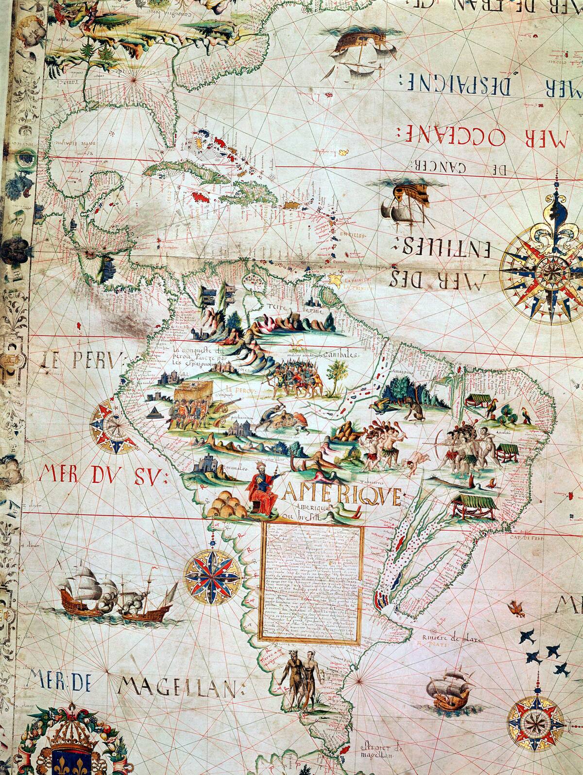
The Dieppe Maps: Speculating Southern Continents
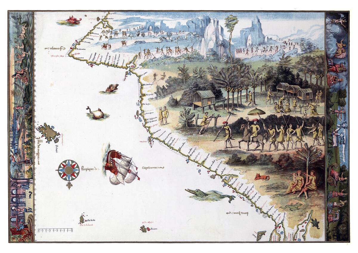
The 16th-century Dieppe maps, crafted by French cartographers, are renowned for their speculative depiction of Terra Australis, a hypothesized southern continent. These maps, adorned with exotic animals and peoples, reflected European curiosity and imagination.
Despite lacking concrete evidence of such a landmass, mapmakers included it to balance the world’s geography. The Dieppe maps remain a testament to the blend of knowledge and conjecture in early cartography.
Gerardus Mercator: Revolutionizing Map Projections
In 1569, Gerardus Mercator introduced a map projection that would change navigation forever. His Mercator projection allowed sailors to plot straight-line courses over long distances, revolutionizing sea travel.
By representing the globe on a flat surface, Mercator’s innovation addressed the navigational challenges of his day. Though it distorts landmasses near the poles, the Mercator projection remains a vital tool for navigation and has left an indelible mark on cartography.
The Ebstorf Map: Blending Faith and Geography
The Ebstorf Map, created around the 13th century, is a striking example of a medieval mappa mundi that intertwines faith and geography. This circular map places Jerusalem at its center, surrounded by biblical and classical references.
With its rich imagery, the Ebstorf Map served as a didactic tool, illustrating the medieval fusion of Christian theology and worldly knowledge. Its destruction in World War II underscores the fragility of historical artifacts.
Abraham Ortelius: The First Modern Atlas
In 1570, Abraham Ortelius published Theatrum Orbis Terrarum, widely considered the first modern atlas. This comprehensive collection of maps standardized cartographic practices and provided a cohesive view of the known world.
Ortelius’s atlas was unique for its uniform map style and inclusion of historical and geographical commentary. It set a new standard for mapmaking and became a vital resource for scholars and explorers alike.
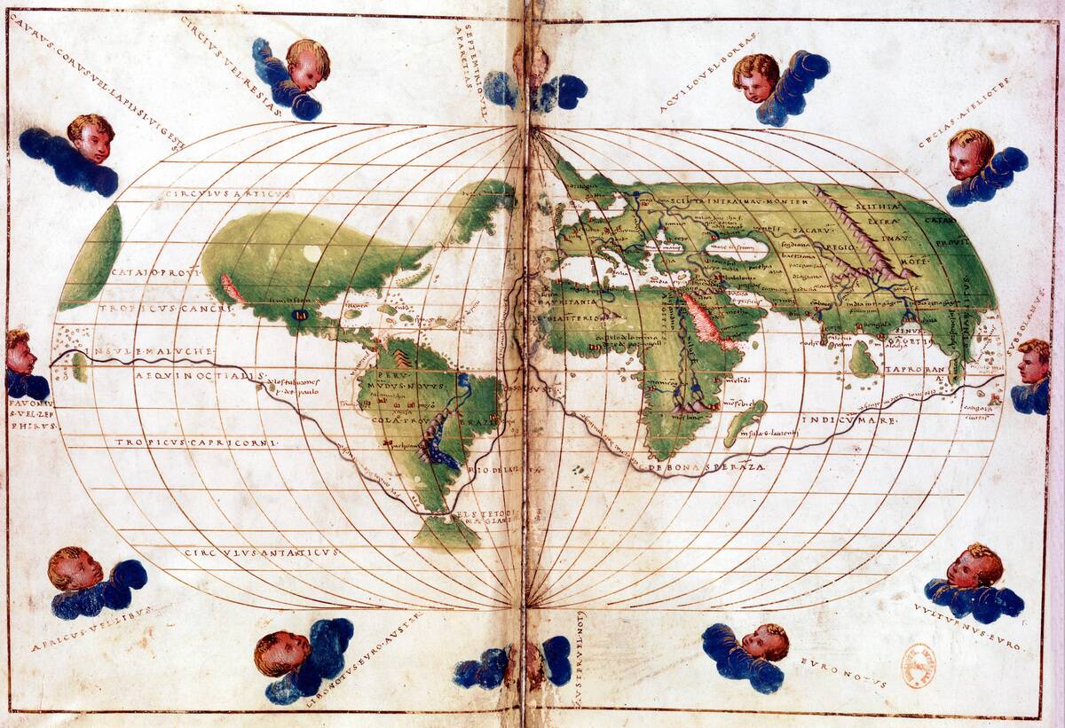
The Fra Mauro Map: Bridging the East and West
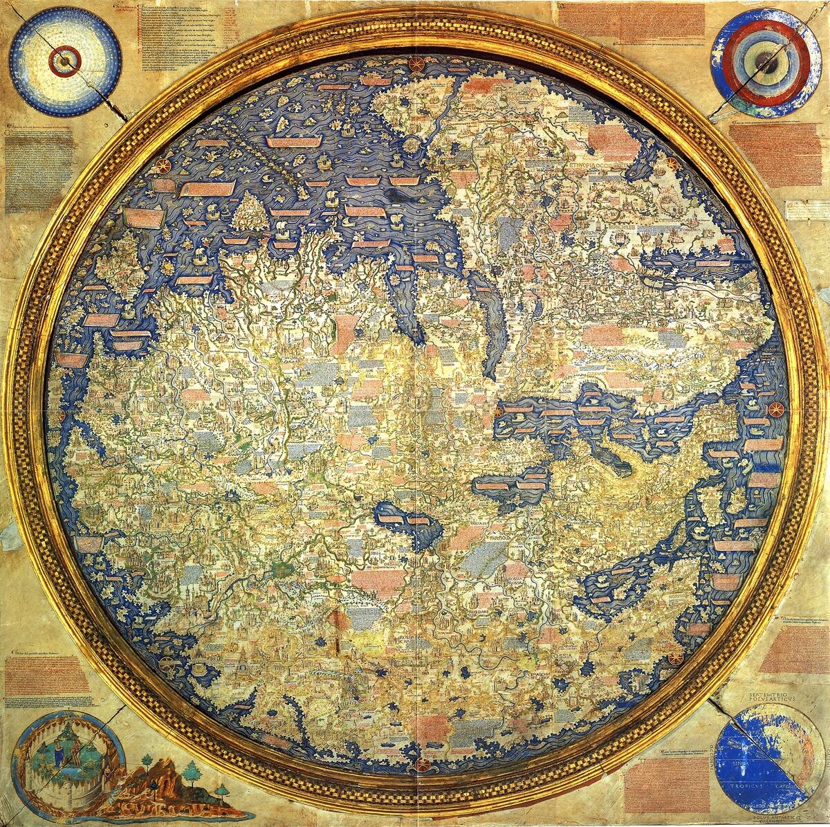
The Fra Mauro Map, created in the mid-15th century by a Venetian monk, is a masterpiece of medieval cartography. It offers a detailed view of the world, combining information from European, Islamic, and Asian sources.
Unlike traditional maps, it placed the South at the top, challenging Eurocentric perspectives. The Fra Mauro Map represents a unique attempt to bridge Eastern and Western geographical knowledge during a time of limited global communication.
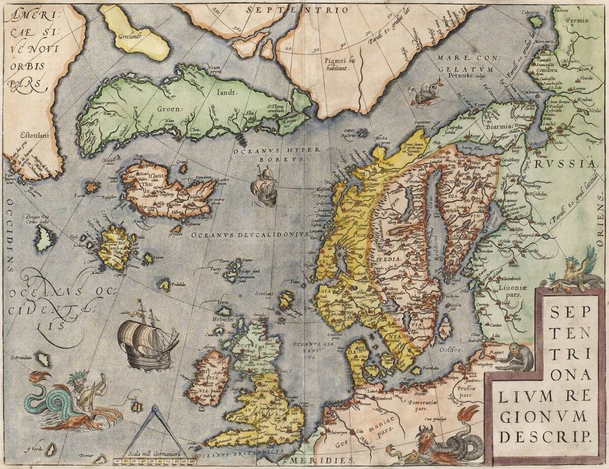
The Carta Marina: Scandinavia’s Detailed Seafaring Guide
The Carta Marina, completed in 1539 by Swedish cartographer Olaus Magnus, is a richly detailed map of Scandinavia and its surrounding waters. It was the first map to provide a detailed depiction of the Nordic region, complete with intricate illustrations of sea monsters and ships.
Magnus’s work was invaluable for understanding the geography and folklore of the North, offering insights into the seafaring culture and challenges faced by Scandinavian sailors (or at least an interpretation of those challenges).
John Speed’s “New and Accurat Map”: Introducing the New World
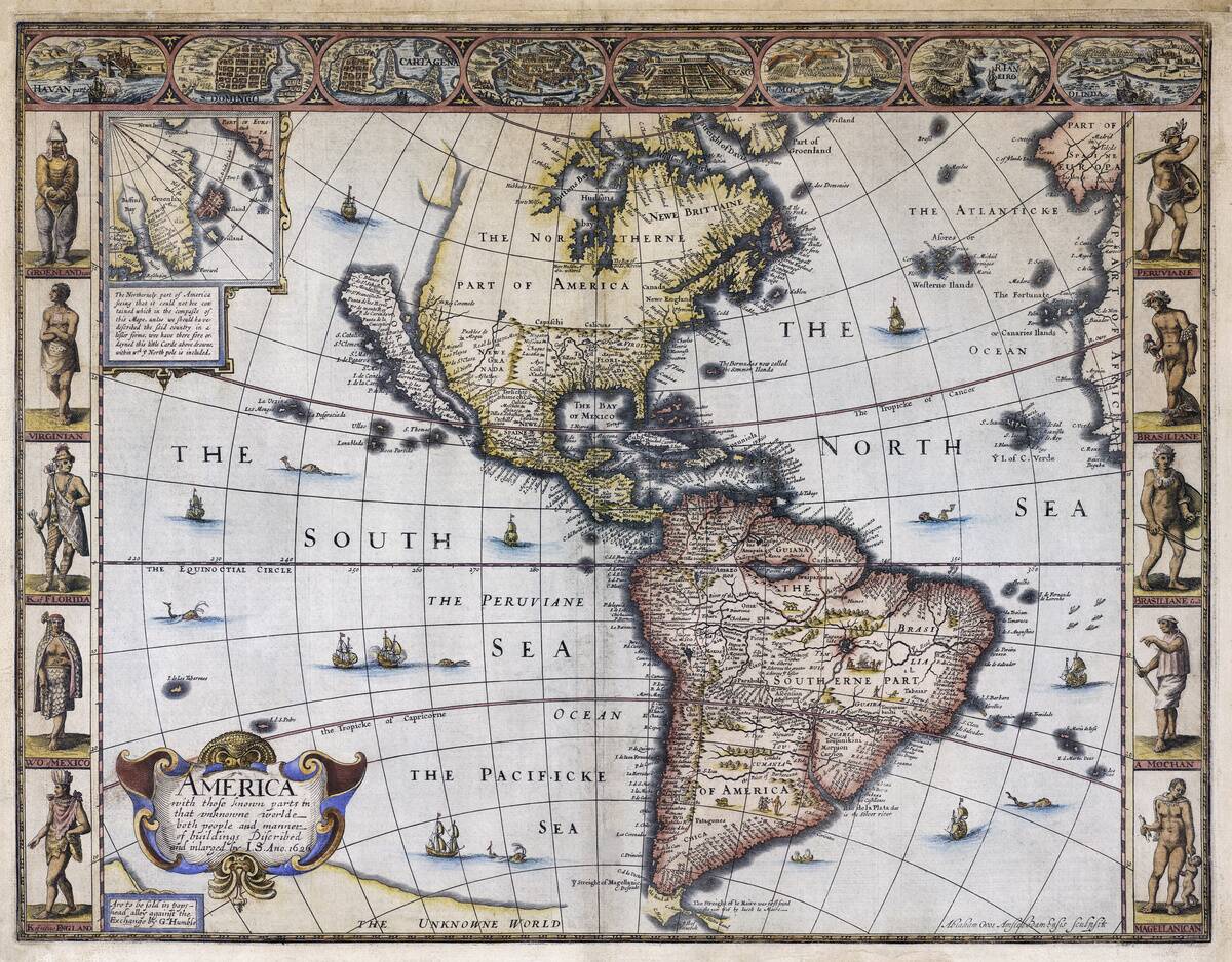
In 1627, John Speed unveiled his New and Accurat Map of the World, a double-hemisphere map that introduced the New World to English audiences. Speed’s map incorporated the latest discoveries, reflecting the growing European interest in the Americas.
It was notable for its decorative elements, including vignettes of explorers and indigenous peoples. This map not only provided geographic information but also fueled curiosity and imagination about distant lands.
The Kangnido Map: Asia’s Expanding Worldview
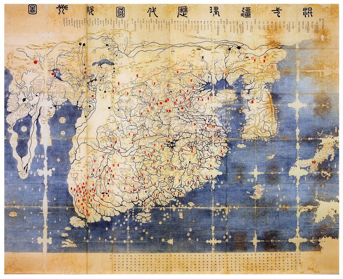
The Kangnido Map, created in Korea in 1402, is a remarkable artifact that illustrates Asia’s expansive worldview. It combines Chinese, Korean, and Japanese geographical knowledge, depicting the known world with surprising accuracy for its time.
The map’s inclusion of Africa and Europe demonstrates the exchange of information along trade routes. The Kangnido Map highlights the interconnectedness of cultures and the early appreciation for global geography in East Asia.
Joan Blaeu’s Atlas Maior: The Grandest Atlas of the 17th Century
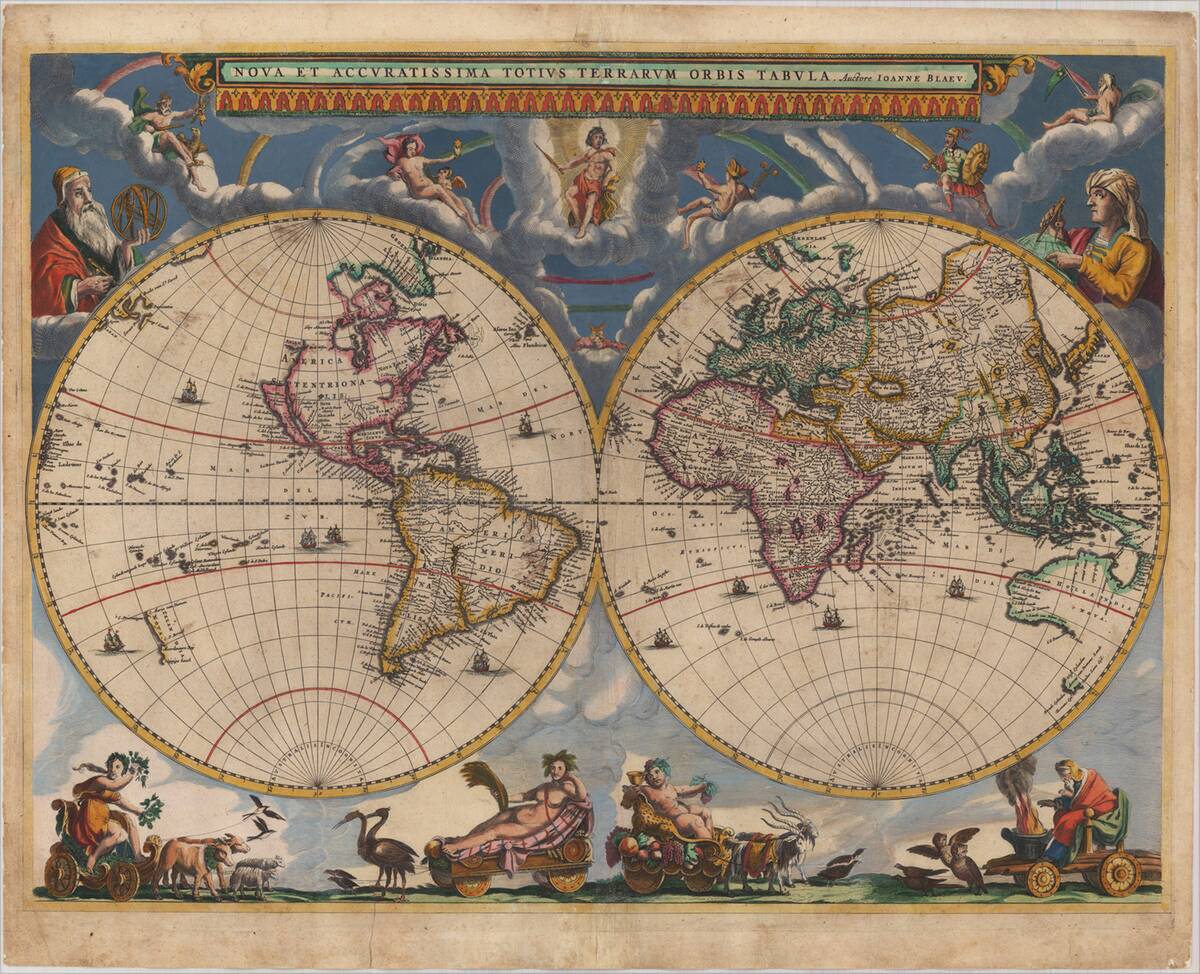
Published in the mid-17th century, Joan Blaeu’s Atlas Maior was a monumental achievement in cartography. This multi-volume atlas contained 594 detailed maps, showcasing the world’s geography with unprecedented accuracy and artistry (at least for the time).
Blaeu’s work was a testament to the Dutch Golden Age, reflecting the era’s scientific and cultural advancements. The Atlas Maior was more than a collection of maps; it was a comprehensive representation of contemporary knowledge and exploration.
The Cassini Maps: France’s First Accurate Topographic Maps
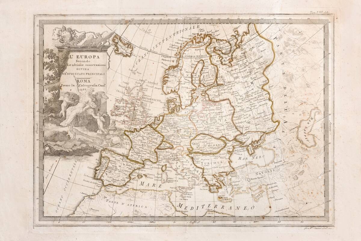
The Cassini family, starting with Giovanni Domenico Cassini, produced the first topographic maps of France in the 18th century. These maps, known as the Cassini maps, were part of an ambitious project to survey the entire country.
Using innovative triangulation techniques, the Cassinis created detailed maps that were ahead of their time in precision. Their work laid the foundation for modern cartography and significantly contributed to the field of geography.


