Explore The U.S.’s Wackiest Geographical Quirks
The United States is home to a plethora of geographical quirks that defy simple explanation. From towns that straddle state lines to rivers seemingly defying gravity, these oddities capture the imagination.
Each unique feature tells a story of how boundaries and nature can create fascinating anomalies. Join us as we explore these curious locales across the country.
The Town Where You Can Walk From One State To Another in Minutes
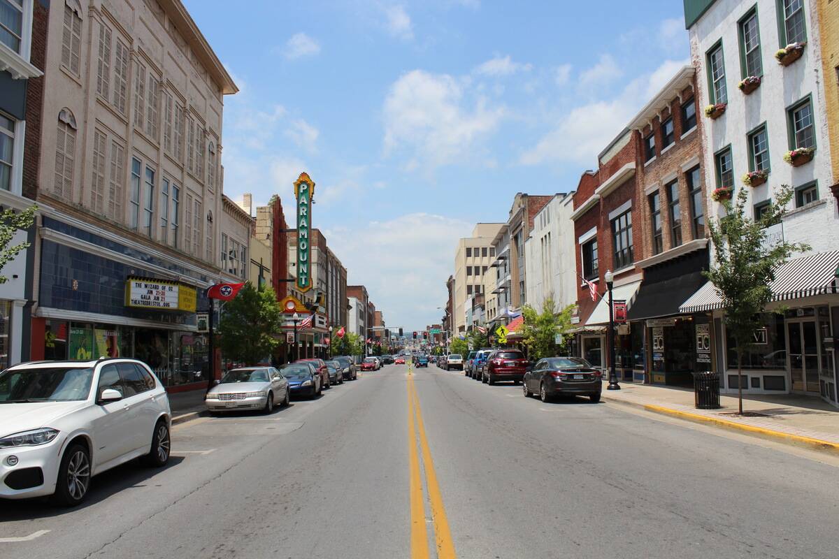
Bristol, straddling the line between Virginia and Tennessee, offers a unique chance to stroll between two states in a matter of seconds. State Street marks the border, with one side in Virginia and the other in Tennessee.
This unusual setup makes it easy to step from one state into another, making it a popular spot for visitors seeking a novel experience.
The Mystery of the Four Corners Monument
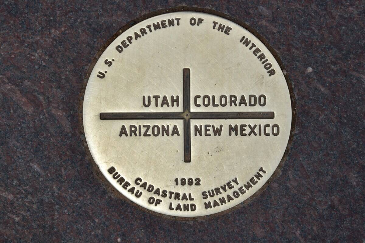
The Four Corners Monument is the only point in the United States where four states —Arizona, New Mexico, Utah, and Colorado — meet. Visitors flock here to stand in four states simultaneously, a curious geographical oddity.
However, some surveys suggest the monument might be slightly off its intended mark, adding a layer of mystery to this iconic site.
The Town Split by a Time Zone Change
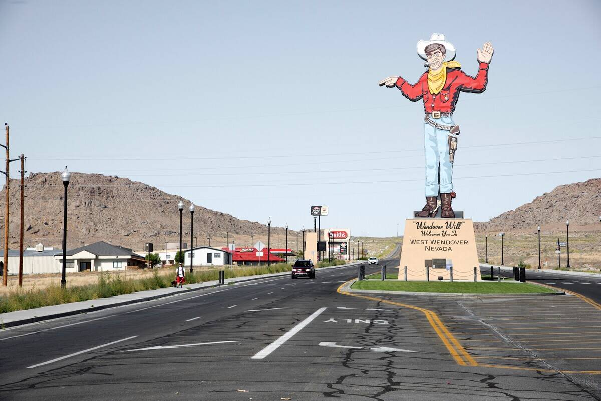
West Wendover, Nevada, offers a rare glimpse into life split by time. Though officially in the Pacific Time Zone, it observes Mountain Time like its neighboring Utah town, Wendover.
This adjustment accommodates tourism and local business needs, blending two time zones seamlessly and creating a unique temporal identity for its residents.
The State with the Most Coastline That Isn’t What You Think
While Florida and California boast extensive coastlines, it’s Alaska that leads the pack with over 6,600 miles of coastline. Its rugged, expansive shores surpass those of other states, thanks to its multitude of inlets and bays.
This surprising fact highlights Alaska’s vast and varied landscape, often underestimated in such comparisons.
The Invisible Border: The Mason-Dixon Line
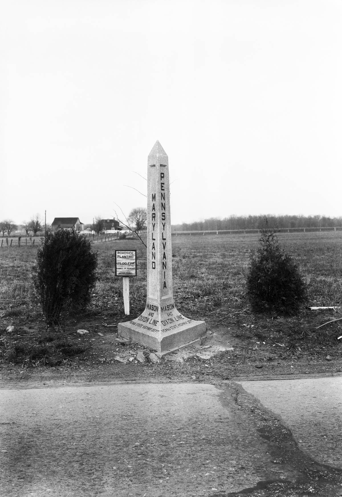
The Mason-Dixon Line isn’t just a historical reference; it’s a geographical marker separating Pennsylvania, Maryland, Delaware, and West Virginia.
Originally surveyed in the 1760s to resolve boundary disputes, it became symbolic as the divide between the North and South. Today, it remains a cultural and historical icon, steeped in American history.
The Town with Two Names and Two Identities
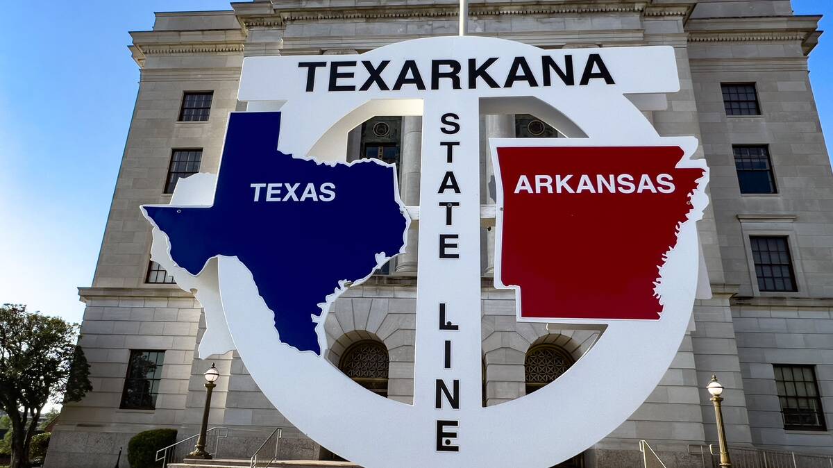
Texarkana is a town with a foot in both Arkansas and Texas, hence its dual identity. Each side of State Line Avenue operates under its own jurisdiction, yet the community thrives as one.
This unique arrangement creates an interesting blend of cultures, embodying the spirit of cooperation and shared identity between two states.
The Only Place in the U.S. Where You Can See Russia
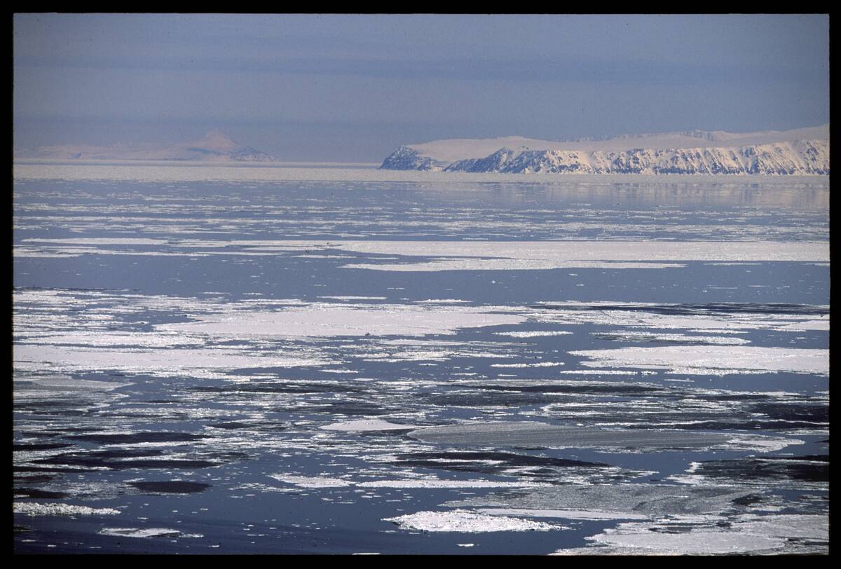
From Little Diomede Island in Alaska, on a clear day, one can catch a glimpse of Russia’s Big Diomede Island across the Bering Strait.
Just about 2.4 miles separate the two, making it the closest point between the U.S. and Russia. This proximity highlights the geographical closeness of two nations often perceived as worlds apart.
The State Divided by the Continental Divide
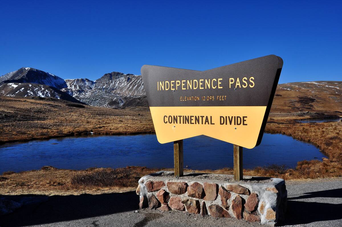
Colorado is uniquely split by the Continental Divide, which runs from north to south through the state. This natural boundary separates the watersheds that drain into the Pacific Ocean from those flowing toward the Atlantic.
The divide not only defines Colorado’s geography but also its diverse climate and ecosystems on either side.
The Town That’s Always on the Move

Centralia, Pennsylvania, is a town that’s literally disappearing due to an underground coal mine fire that has been burning since 1962. The fire led to the evacuation and abandonment of the town, with only a few residents remaining.
Although Pennsylvania’s governor Ed Rendell attempted to have these residents formally evicted in 2009, an agreement has since allowed the remaining residents to live out their lives before their property falls under eminent domain.
The Longest Straight-Line Border in the World
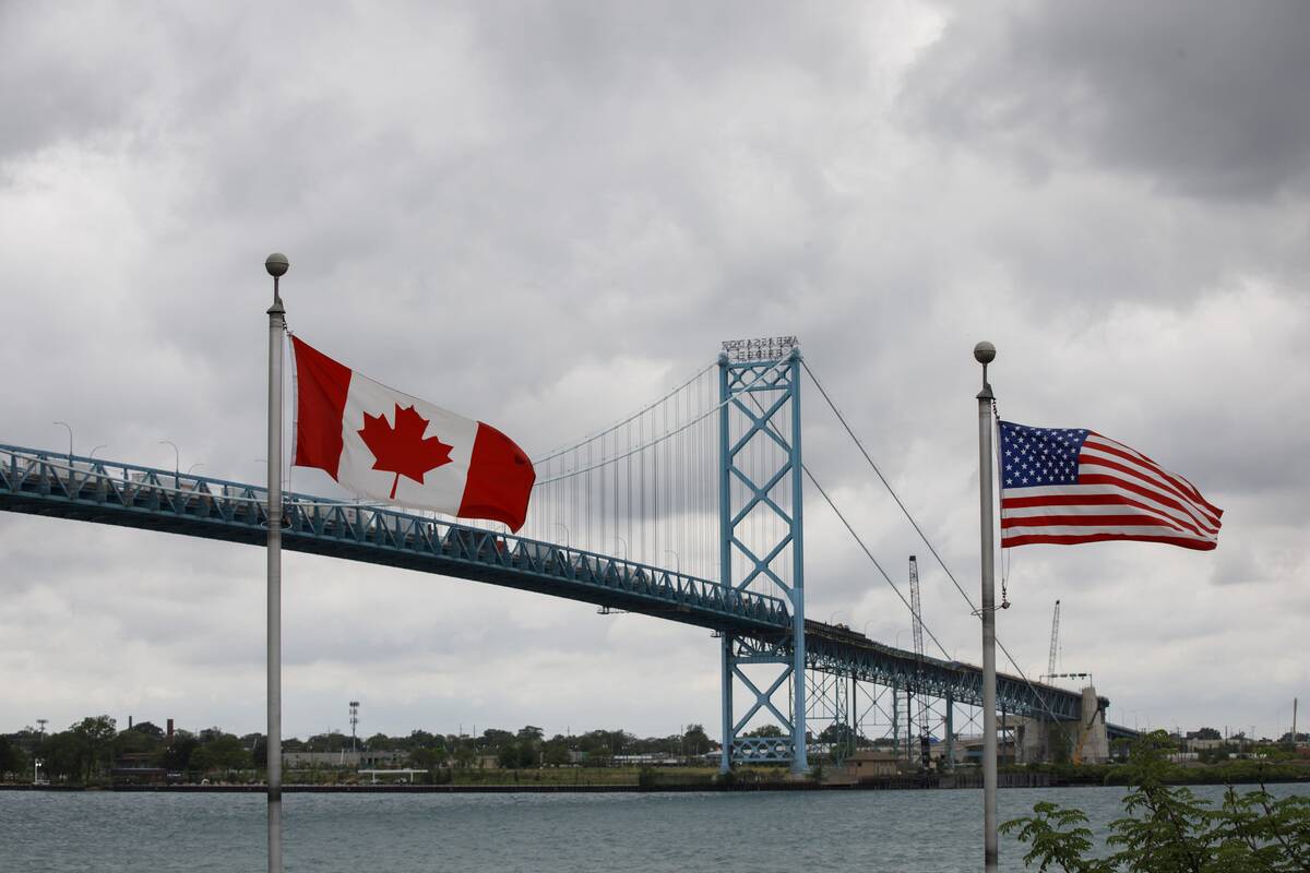
The U.S.-Canada border boasts the longest straight-line international border, stretching approximately 5,525 miles. This line, set by the 1846 Oregon Treaty, accounts for much of the peaceful border shared by the two nations.
Its length and straightness make it a geographical marvel, symbolizing the long-standing cooperation between neighbors.
The State with the Most Lakes: Not Minnesota!
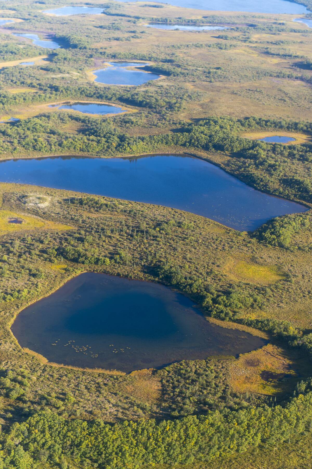
Despite Minnesota’s nickname, ‘Land of 10,000 Lakes,’ Alaska takes the crown with over 3 million lakes. The vast number of bodies of water in Alaska stems from its glacial past and expansive terrain.
This surprising fact highlights Alaska’s incredible natural diversity, often overshadowed by more well-known lake-heavy states like Minnesota.
The Tiny Town That’s a Part of Two Countries

Derby Line, Vermont, is a small town straddling the U.S.-Canada border, sharing its space with Stanstead, Quebec.
The border runs through buildings like the Haskell Free Library and Opera House, where one country can be seated in the audience while the other performs. This unique setup fosters a blend of cultural influences from both nations.
The Only State with a One-Syllable Name

Maine holds the distinction of being the only U.S. state with a one-syllable name. While this might seem like a trivial fact, it sets Maine apart linguistically.
Despite its short name, Maine boasts a rich history, stunning landscapes, and a cultural heritage that belies its simple moniker, offering much more than meets the eye.
The U.S. Town That’s Closer to Africa Than to D.C.
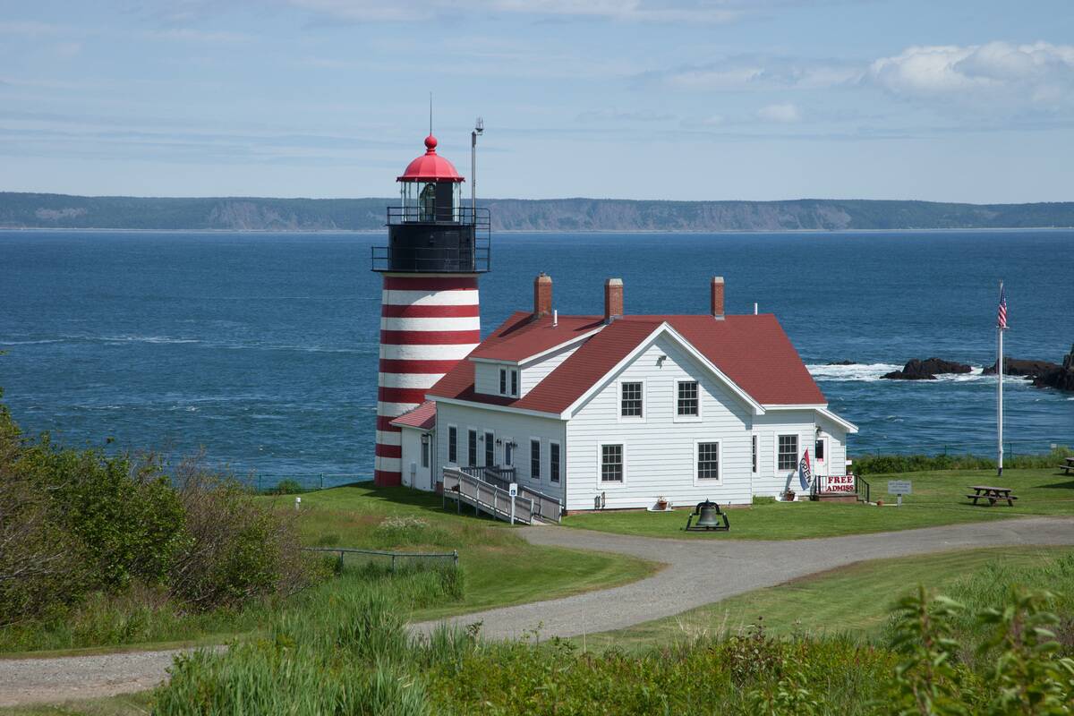
Quirky as it seems, the town of Quoddy Head in Maine is geographically closer to parts of Africa than it is to Washington, D.C. Located at the easternmost point of the continental U.S., it brings a surprising twist to geographic proximity.
This fun fact highlights the unexpected ways geography can play tricks on our perceptions of distance.


