Lost islands that appeared on maps for centuries before vanishing
Welcome to the captivating realm of lost islands, where myth and reality blur into an intriguing tapestry of adventure. These islands, often depicted on ancient maps, have fascinated explorers and mapmakers for centuries.
They represent the unknown, the mysterious corners of the Earth that beckon with the promise of discovery. While some islands were merely cartographic errors, others were born from tales and legends that have stood the test of time, inviting us to explore their secrets.
The Fascination with Cartography’s Mysteries
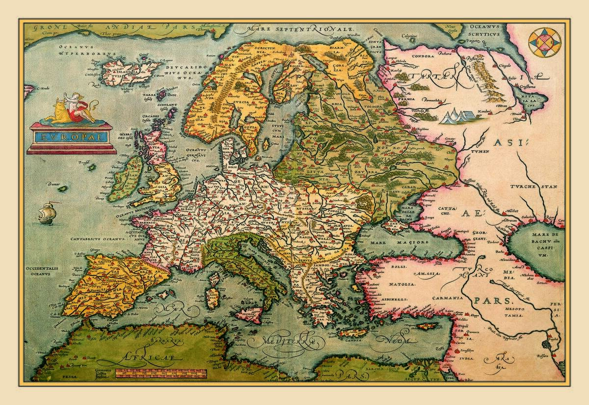
Cartography, the art and science of mapmaking, has always been a blend of accuracy and imagination. Throughout history, mapmakers have faced the daunting task of charting the vast, uncharted territories of our planet.
As a result, maps have often included speculative features, including phantom islands. These islands served as placeholders for the unknown, tantalizing explorers with the possibility of new lands. The allure of these map-born mysteries lies in their blend of fact and fiction, sparking the imagination of adventurers and scholars alike.
Hy-Brasil: The Vanishing Isle of Irish Folklore
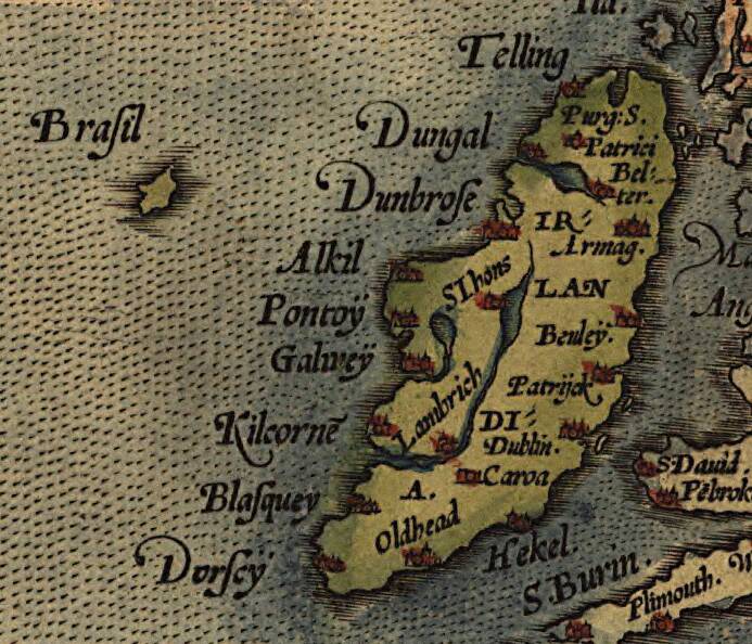
Hy-Brasil, an island steeped in Irish folklore, was said to appear once every seven years off the west coast of Ireland. It was reputedly a utopia, shrouded in mist, inhabited by an advanced civilization.
Although it vanished from maps in the 19th century, Hy-Brasil has inspired countless legends. Some conjecture it was a misidentified rock formation or optical illusion, while others speculate it was the basis for Atlantis myths. Its ephemeral presence on maps and in stories keeps its legend alive today.
The Phantom Island of Bermeja in the Gulf of Mexico

Bermeja was a small island once depicted in the Gulf of Mexico, referenced in maps from the 16th to the 19th centuries. Its existence was significant due to potential oil reserves in the area. However, modern searches have failed to locate it, leading to speculation and conspiracy theories.
Some suggest it was a victim of cartographic error or natural erosion, while others propose more exotic explanations. The mystery of Bermeja highlights the challenges of cartography and the enduring allure of lost lands.
Sandy Island: Google’s Missing Spot in the Coral Sea

Sandy Island, once visible on Google Maps in the Coral Sea, perplexed scientists when they found only open water upon visiting the location. First noted by Captain James Cook in the 18th century, it remained on maps until 2012 when its nonexistence was confirmed.
The island’s inclusion was likely due to a combination of navigational errors and perpetuated myths. Sandy Island’s disappearance from contemporary maps underscores the evolving accuracy of modern cartography and the occasional persistence of historical inaccuracies.
The Disappearing Act of the Island of Buss
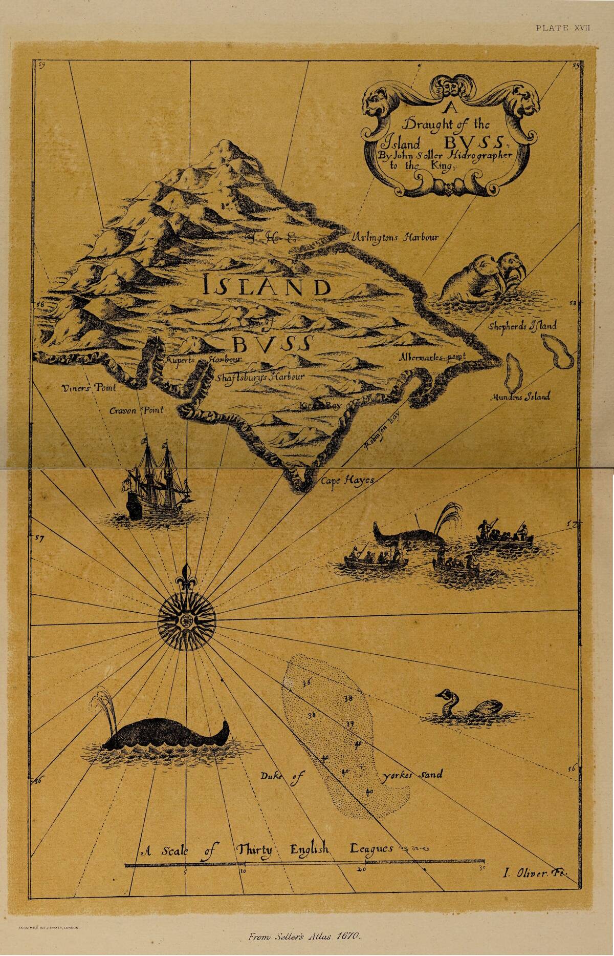
The Island of Buss, reportedly discovered by explorer Martin Frobisher in the 16th century, was said to lie in the North Atlantic. Despite its initial inclusion on maps, Buss Island later vanished from charts, as explorers failed to relocate it.
Theories abound as to its disappearance, ranging from navigational mistakes to geological changes. Buss Island serves as a testament to the challenges faced by early explorers and the shifting nature of the Earth’s geography as understood through the lens of time.
Antillia: The Island of Seven Cities
Antillia, or the Island of Seven Cities, has fascinated historians and adventurers alike. Supposedly located in the Atlantic Ocean, Antillia was believed to be a refuge for Christian bishops fleeing the Moors in the 8th century.
Legends spoke of a wealthy, mystical land with advanced civilization. Though never found, Antillia influenced explorers during the Age of Discovery. Its myth, intertwined with tales of lost cities and riches, underscores the potent blend of hope and myth that propelled European exploration.
The Curious Case of the Island of Rupes Nigra
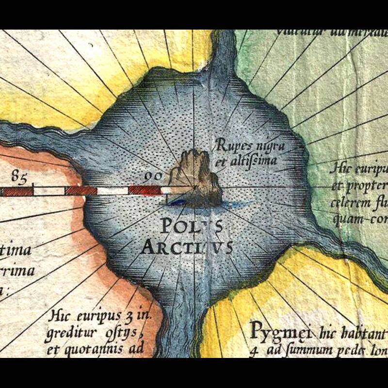
Rupes Nigra, a legendary black rock island at the North Pole, appeared in maps as a colossal magnetic mountain. This mythical island was thought to explain compass variations experienced by early explorers. Its concept originated from the 16th-century writings of Mercator and others, who imagined it as a magnetic phenomenon.
Although modern science has debunked Rupes Nigra, the tale highlights the imaginative efforts of early cartographers to rationalize the unknown, blending myths with scientific curiosity in their works.
The Floating Island of Frisland in the North Atlantic
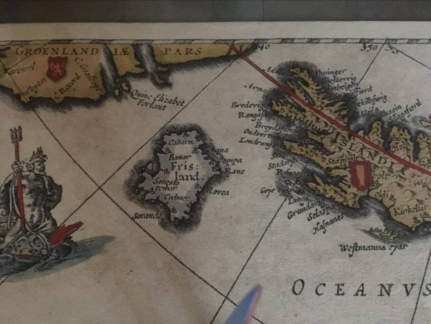
Frisland, a supposed island in the North Atlantic, frequently appeared on maps from the 16th to the 17th centuries. Popularized by the Zeno Map published in 1558, Frisland’s existence was widely accepted until explorers failed to locate it.
Likely a mapping error or confusion with existing land, Frisland exemplifies how inaccuracies persisted in early cartography. The island’s enduring presence on historical maps reflects the period’s challenges in distinguishing reality from misinterpretation, and its story remains a curious chapter in maritime exploration.
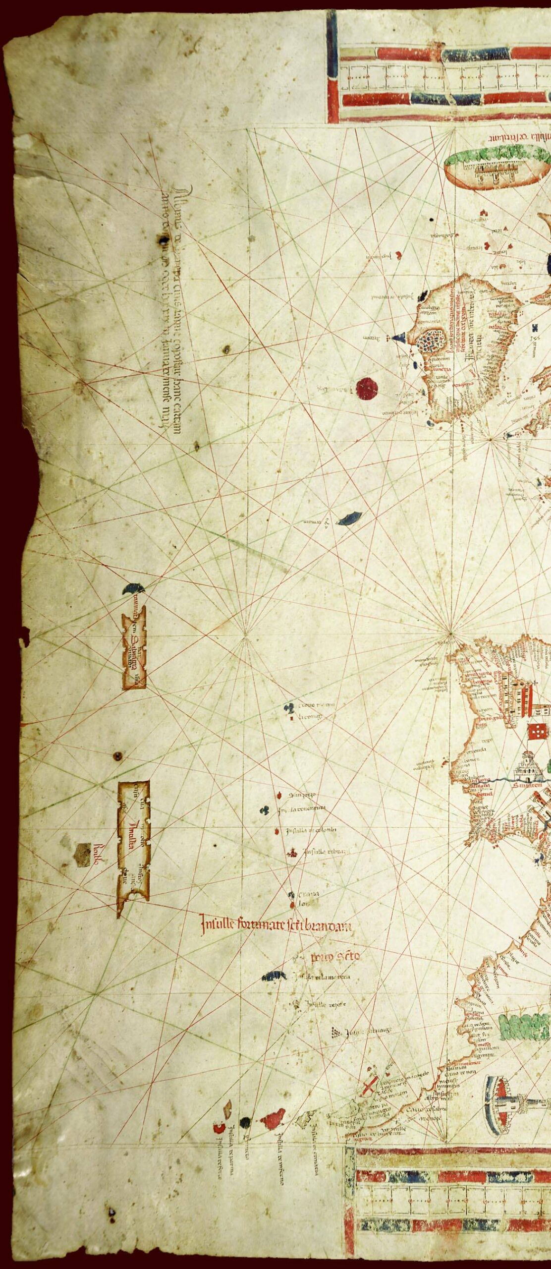
The Mystery of the Island of Saint Brendan
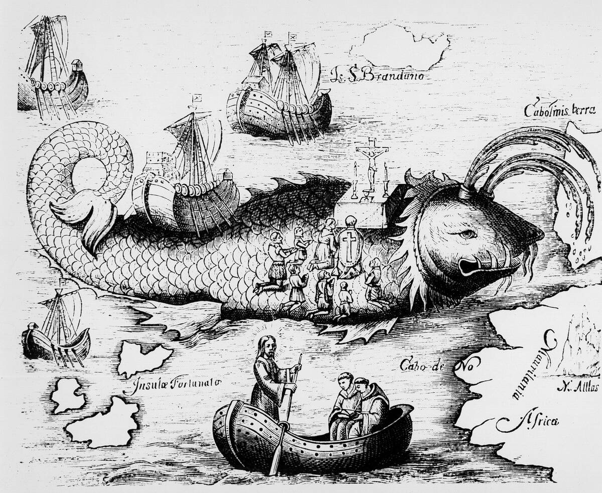
Saint Brendan’s Island, named after the Irish monk who supposedly discovered it, was a legendary island in the Atlantic Ocean. Descriptions of its lush, paradisiacal landscape captivated medieval imaginations. Though never found, the legend of Saint Brendan’s Island inspired medieval and early modern exploration.
The island’s allure lay in its depiction as a divine promise of unspoiled lands. Its legend underscores how religious narratives and exploration were often intertwined, driving adventurers to seek out new worlds as both spiritual and physical quests.
The Lost Island of Thule: A Frozen Legend
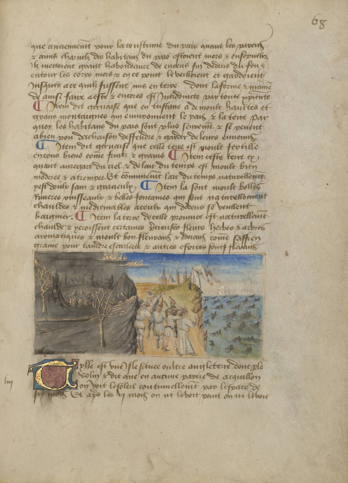
Thule, often referred to as the end of the known world, was described by ancient Greek explorer Pytheas as a distant northern land. Its exact location has been debated, with theories ranging from Norway to Iceland.
Thule came to symbolize the ultimate, unreachable frontier, a metaphor for exploration’s limits. As a concept, it has inspired generations of literature and exploration, its name evoking mystery and the allure of the unknown. Thule remains a symbol of humanity’s quest to transcend boundaries.
The Illusory Island of Dougherty in the South Pacific
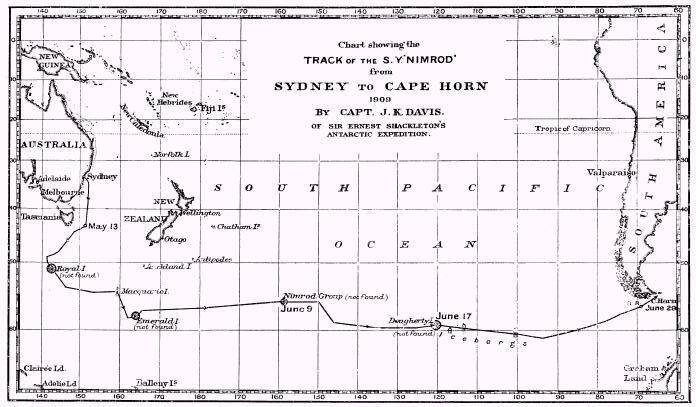
Dougherty Island, reported in the 19th century by Captain Dougherty, was charted in the South Pacific. Despite numerous attempts to find it, the island eluded explorers, leading to its removal from maps.
Likely a result of navigational errors or mirages, Dougherty Island represents a common theme in maritime history: the difficulty of precise mapping in vast, open seas. Its story is a reminder of the challenges faced by sailors and mapmakers in accurately documenting the world’s remote and mysterious corners.
The Intriguing Tale of the Island of Taprobana
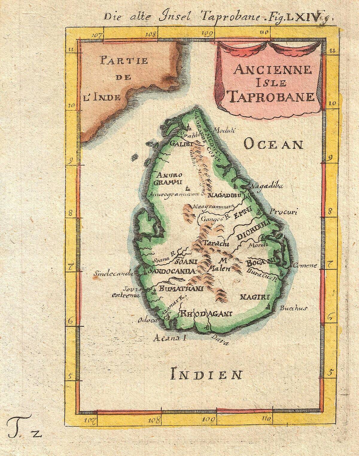
Taprobana, an island referenced in ancient texts, has been variously identified with Sri Lanka and Sumatra. Greek and Roman writers described it as a land of wealth and exotic animals. Over time, its exact identity became obscured, fueling speculation and exploration.
Taprobana’s allure lay in its depiction as a tropical paradise, a place of wonder and riches. Its story highlights the allure of distant lands and the role of ancient texts in shaping the perception and pursuits of explorers throughout history.
How Cartography Evolved: From Myths to Reality
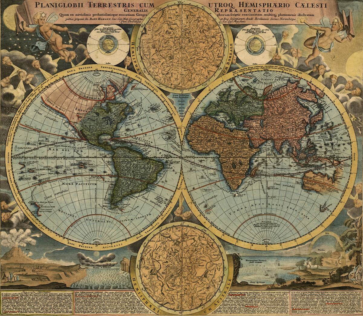
Cartography has undergone significant evolution, from medieval maps filled with mythical creatures and phantom islands to today’s precise satellite imagery. Advances in navigation, technology, and scientific understanding have transformed mapmaking, dispelling many myths that once pervaded.
Early maps often reflected the limits of geographical knowledge, projecting human imagination onto unknown areas. Modern cartography, however, strives for accuracy and detail, allowing us to explore the world with unprecedented clarity. This evolution reflects humanity’s ongoing quest to understand and accurately document our planet.
Why These Islands Captured the Imagination of Explorers
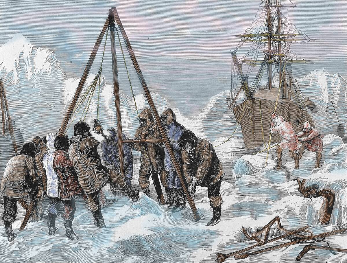
Phantom islands captured the imagination of explorers due to their promise of discovery and adventure. These islands represented uncharted territories, potential wealth, and the allure of the unknown.
The prospect of finding new lands and civilizations fueled expeditions during the Age of Discovery. Moreover, tales of these islands often included elements of mystery and intrigue, enhancing their appeal. For explorers, they were more than just places on a map; they were symbols of hope and the human spirit’s relentless pursuit of knowledge.


