Ancient maps that depicted lands no one had officially discovered
Ancient maps are not just geographical documents; they are windows into the minds of past explorers and mapmakers. These maps, often embellished with mythical creatures and lands, reflect the limited knowledge and boundless imagination of their creators.
While they may not always be accurate, they offer fascinating insights into how our ancestors viewed the world. From the mysterious coastlines to uncharted territories, ancient cartography is a treasure trove of historical intrigue.
The Mystery of the Piri Reis Map
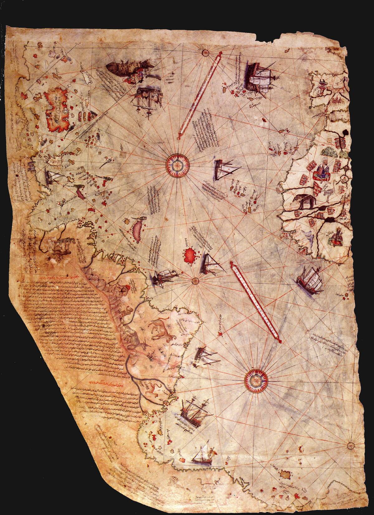
The Piri Reis Map, created in 1513, is a marvel of ancient cartography. This Ottoman map is famed for its remarkably accurate depiction of the coastlines of Africa, Europe, and even parts of South America.
The most intriguing aspect is its inclusion of Antarctica, a continent not officially discovered until 1820. Scholars have debated how Piri Reis gained such accurate information, with some suggesting he used long-lost ancient sources, but mainstream scholarship holds that the southern landmass shown is a distorted extension of South America, not Antarctica.
The Vinland Map: A Viking Voyage?
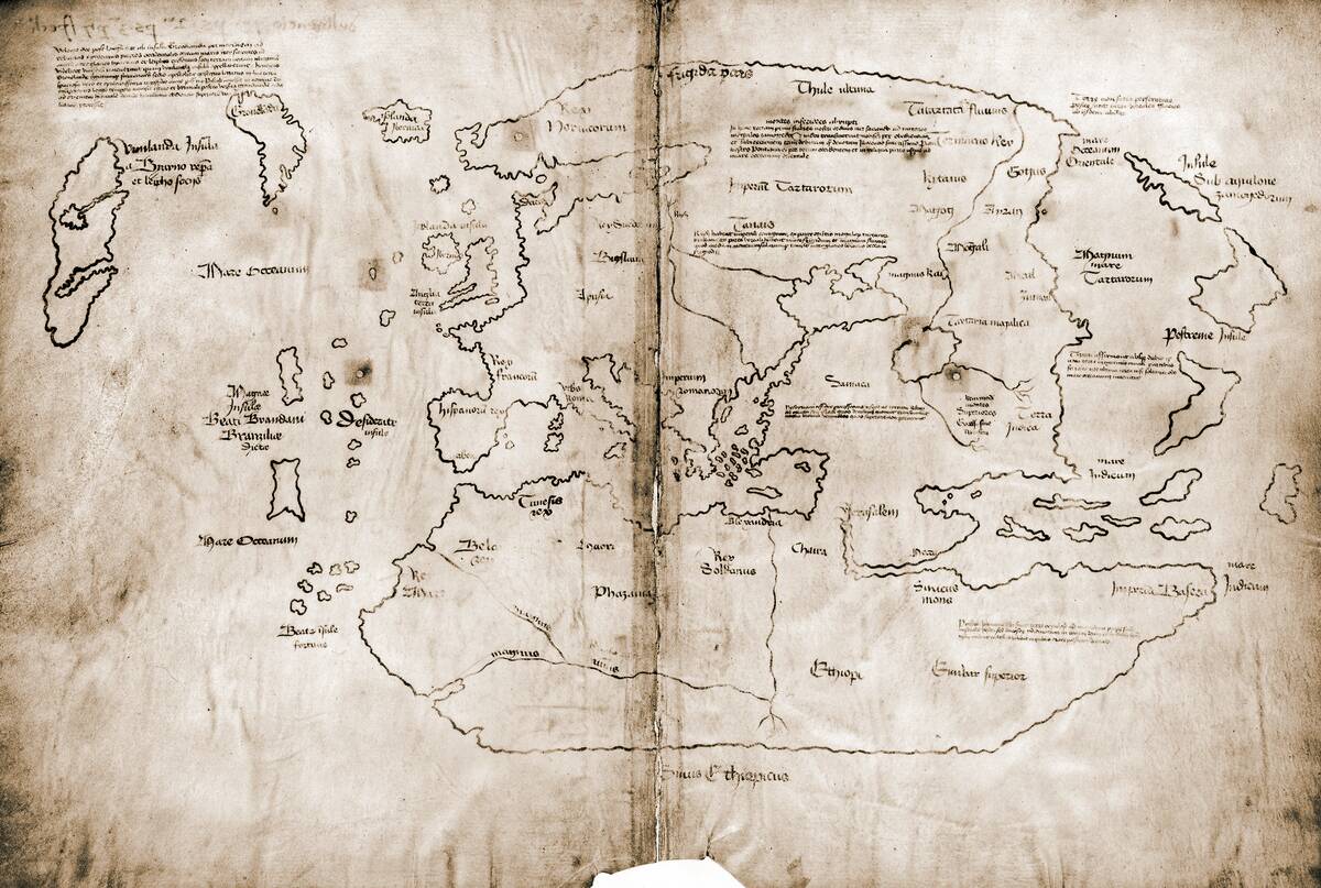
The Vinland Map, supposedly dating back to the 15th century, depicts parts of North America long before Columbus’s voyage. This tantalizing piece of cartography suggests that Norse explorers may have reached the New World centuries earlier.
Although now widely regarded as a modern forgery, the Vinland Map attracted public attention.
The Zeno Map: Myth or Misinterpretation?
The Zeno Map, published in 1558, claims to portray the travels of the Zeno brothers in the North Atlantic during the 14th century. It includes fictitious islands like Frisland, leading many to dismiss it as a work of fiction.
While a minority have speculated about possible links to earlier voyages or oral traditions, most historians regard the Zeno Map as a 16th-century fabrication or heavily fictionalized work with little historical reliability.
The Da Vinci Globe and Its Enigmatic Lands
Leonardo da Vinci, the quintessential Renaissance man, is said to have created a small globe in 1504. This intricate piece is believed to be the oldest known globe to depict the New World.
Carved onto ostrich eggs, it features enigmatic lands and creatures, reflecting both the discoveries of the time and da Vinci’s own imaginative flair. While some question its authorship, the globe represents the blend of art and science that characterized da Vinci’s work.
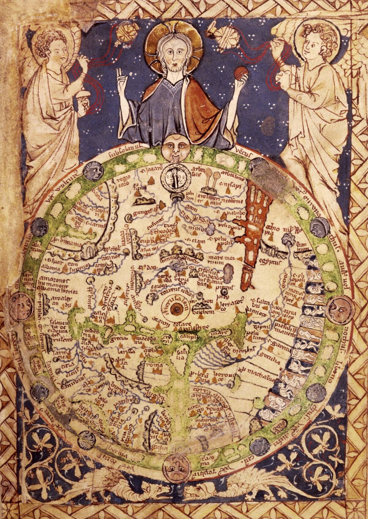
The Ebstorf Map: A Medieval Marvel
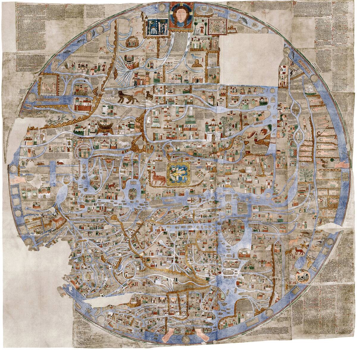
The Ebstorf Map, a 13th-century creation, is a circular mappa mundi with Jerusalem at its center. This massive map was destroyed during World War II, but photographs and descriptions preserve its intricate details.
It featured a blend of biblical stories, historical events, and mythical creatures. The map is notable for its allegorical representation of the world, highlighting the medieval mindset that intertwined geography with religion and mythology.
The Carta Marina: Sea Monsters and Lost Lands
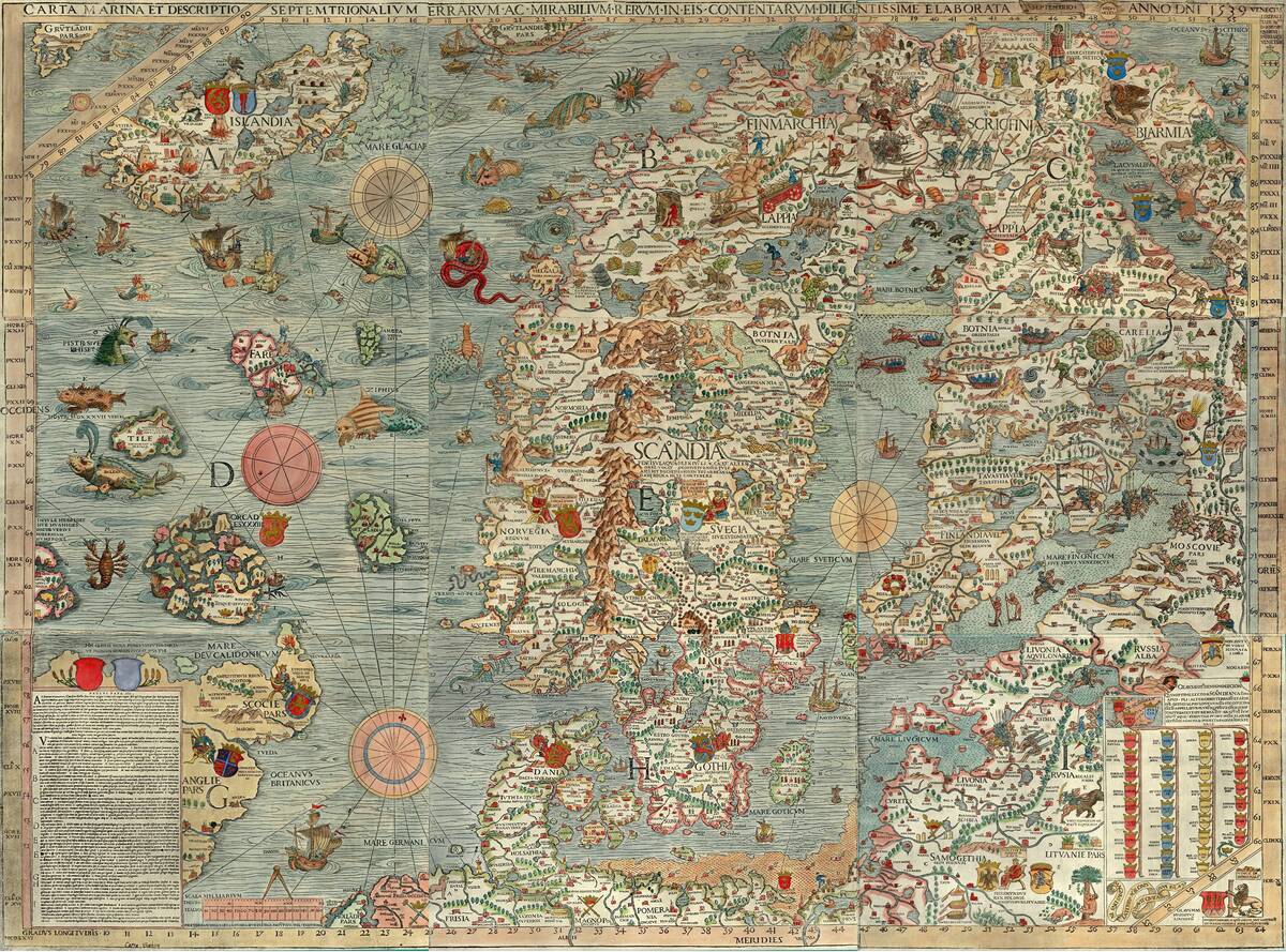
The Carta Marina, created by Olaus Magnus in 1539, is famous for its detailed depiction of the Nordic countries and the array of sea monsters populating its waters.
This map, the first of Scandinavia to be reasonably accurate, includes illustrations of fantastical creatures like sea serpents and giant squids. Magnus’s work is a blend of fact and folklore, reflecting the awe and fear that the unknown inspired in early explorers and mapmakers.
Antarctica on the Orontius Finaeus Map
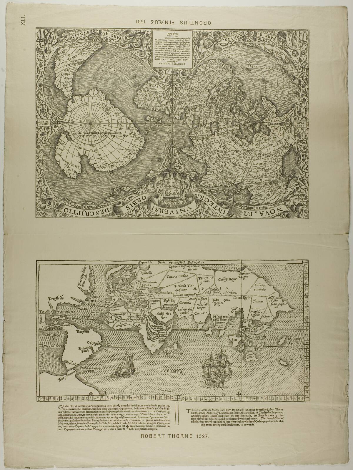
The Orontius Finaeus Map from 1531 intriguingly depicts a large hypothetical southern continent, which was initially associated with Antarctica. This Renaissance map’s depiction of the continent’s ice-free coastline has fueled various theories, including the possibility of ancient civilizations possessing advanced geographical knowledge.
Critics, however, argue that the map’s inaccuracies suggest it is more a product of speculative cartography than genuine discovery. It is now established that the map depicts Terra Australis, a common feature in Renaissance cartography.
The Hereford Mappa Mundi: Fact Meets Fantasy
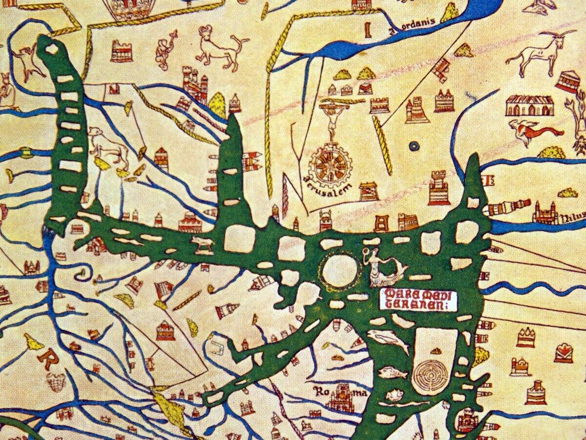
The Hereford Mappa Mundi, created around 1300, is the largest medieval map still in existence. Housed in Hereford Cathedral, it combines geography with mythology and religious symbolism.
The map features over 1,000 inscriptions, illustrating biblical stories, mythical lands, and historical events. Its blend of the factual and the fantastical provides a unique glimpse into the medieval worldview, where the spiritual and the earthly were inextricably linked.
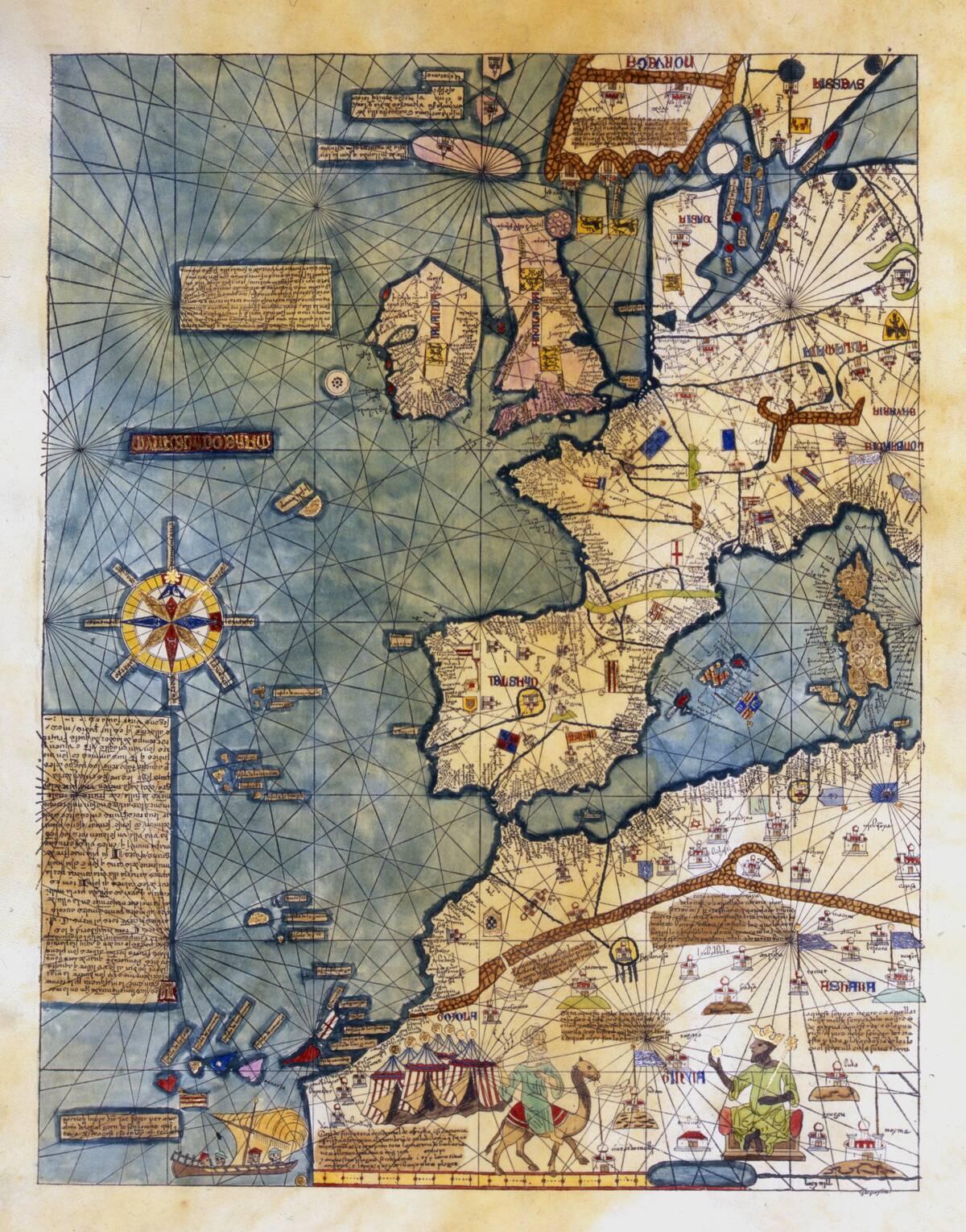
The Cantino Planisphere: A Portuguese Puzzle
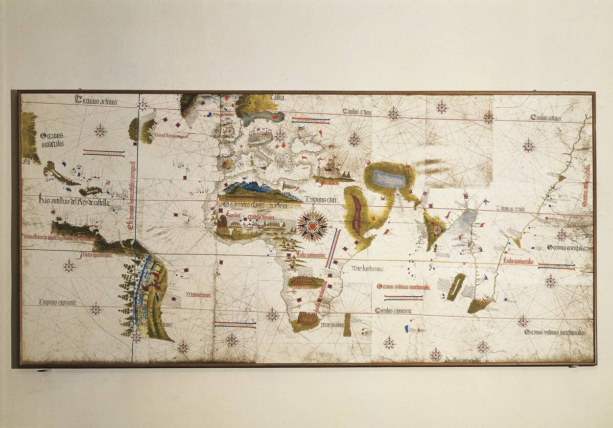
The Cantino Planisphere, dating from 1502, is a crucial document in the history of exploration. This Portuguese map provides a detailed depiction of the known world following Vasco da Gama’s voyage to India.
Smuggled out of Portugal by an Italian spy, it reveals the extent of Portugal’s maritime discoveries. The map’s accuracy and detail make it a valuable artifact of the Age of Discovery, showcasing the advancements in navigation and cartography of the period.
The Fra Mauro Map: A Venetian Vision
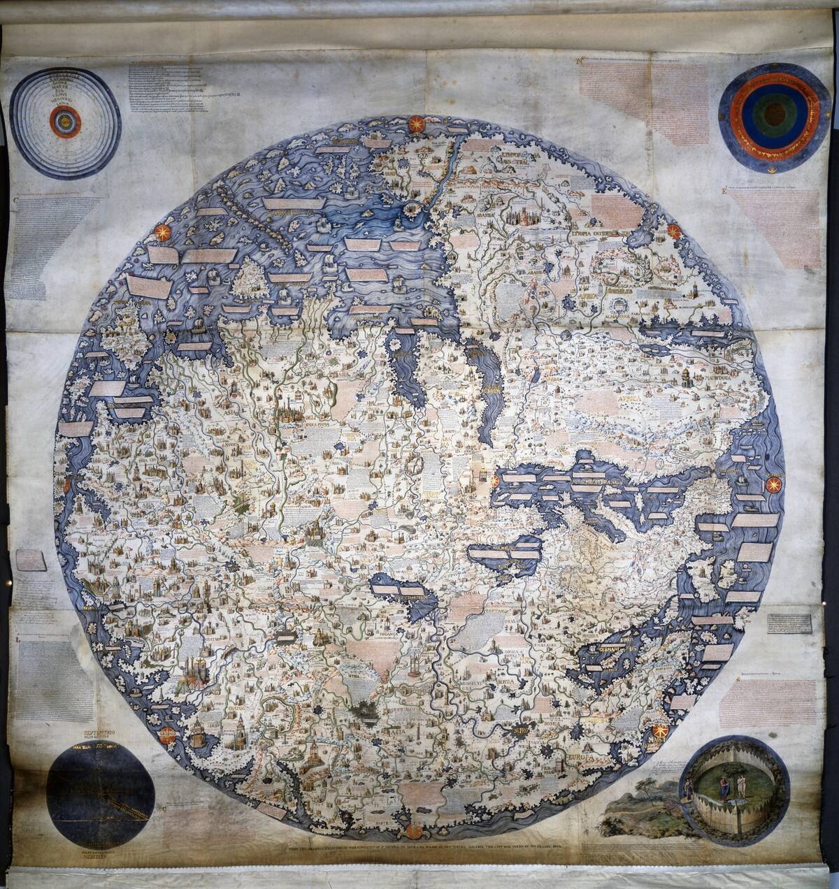
The Fra Mauro Map, completed around 1459, is a masterpiece of medieval cartography. Created by the Venetian monk Fra Mauro, it offers a detailed depiction of the world, incorporating information from various explorers and travelers.
Notably, it places south at the top, a common practice in Islamic maps. The map’s wealth of detail and annotations make it a rich resource for understanding the geographical knowledge of the 15th century and the interconnectedness of different cultures.
The Waldseemüller Map: Naming a New World
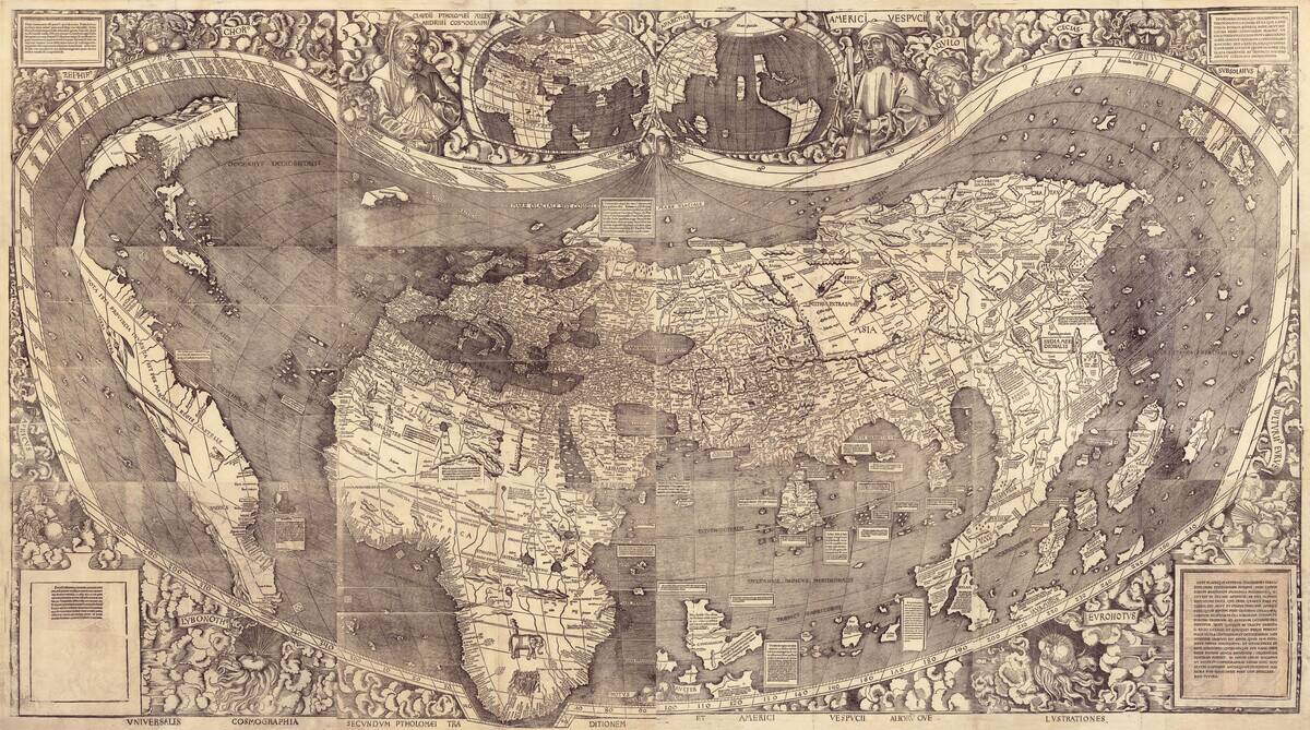
The Waldseemüller Map of 1507 is renowned for being the first to use the name ‘America,’ in honor of explorer Amerigo Vespucci. This map, created by German cartographer Martin Waldseemüller, provides a surprisingly accurate view of the Atlantic Ocean’s eastern and western shores.
Only one copy of this revolutionary map survives today, housed in the Library of Congress, serving as a testament to the transformative period of exploration and the birth of the modern world.
The Tabula Rogeriana: A Medieval Masterpiece
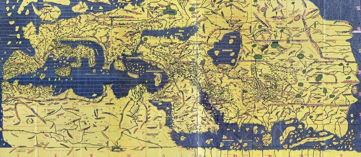
The Tabula Rogeriana, created by the Arab geographer Muhammad al-Idrisi in 1154, is one of the most advanced medieval maps. Commissioned by King Roger II of Sicily, it provides an extensive view of the world, with detailed descriptions of various regions.
The map is notable for its south-up orientation, reflecting the Islamic cartographic tradition. Al-Idrisi’s work remains an invaluable resource for understanding the geographical knowledge and intercultural exchanges of the medieval period.
The Psalter Map: Jerusalem at the Center
The Psalter Map, dating from the 13th century, is a small but significant medieval map that places Jerusalem at its center. This orientation reflects the religious significance of the city during the Middle Ages.
The map’s circular design symbolizes the world as a divine creation, with biblical and historical references surrounding the central city. Despite its limited geographical accuracy, the Psalter Map provides insight into the spiritual perspective of its time.
The Catalan Atlas: A Blend of Myth and Reality
Created in 1375, the Catalan Atlas is an exquisite example of medieval cartography, blending accurate geographical information with mythical elements. This map, attributed to the Majorcan cartographer Abraham Cresques, features detailed descriptions of regions, trade routes, and fantastical creatures.
It reflects the interconnectedness of the medieval world, where explorers and merchants shared stories and knowledge. The Catalan Atlas remains a fascinating testament to the blend of fact and fantasy in historical maps.
The Rimini Map: A Ptolemaic Perspective
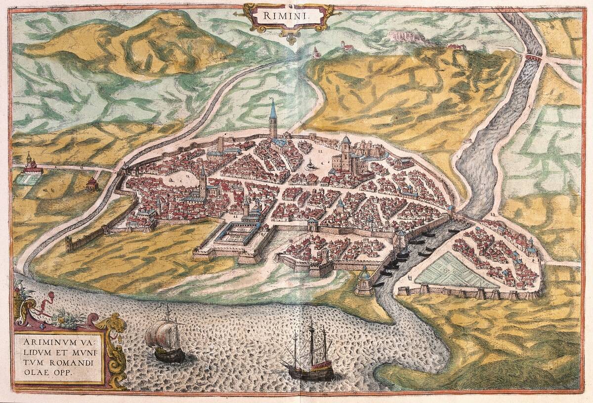
The Rimini Map, created around 1502, is one of the earliest known maps to incorporate the rediscovered works of Ptolemy. It reflects the resurgence of classical knowledge during the Renaissance, blending ancient geographical concepts with contemporary discoveries.
The map showcases Europe, Asia, and Africa with remarkable accuracy for its time, highlighting the enduring influence of Ptolemaic principles. Its creation marks a significant moment in the evolution of cartography, bridging the gap between ancient and modern worlds.
The Impact of Ancient Maps on Modern Exploration
Ancient maps have profoundly influenced modern exploration, serving as both inspiration and practical guides for adventurers. While many of these maps contained inaccuracies, they sparked curiosity and the desire to explore uncharted territories.
The legends and myths depicted on these maps fueled imaginations, leading explorers to seek out new lands and confirm or debunk their existence. Today, these historical maps are valued not only for their artistic and historical significance but also for their role in shaping our understanding of the world.