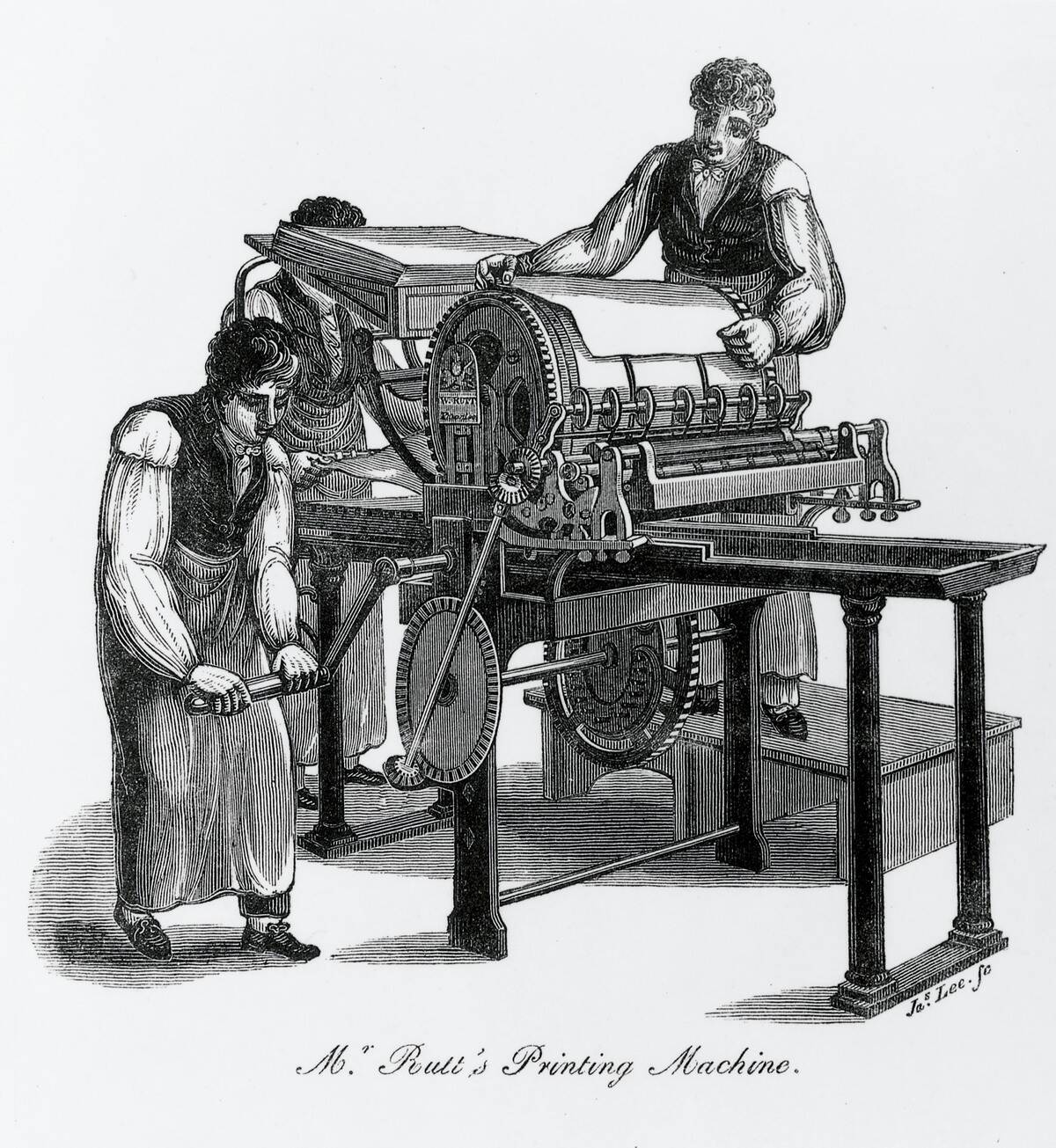
21 ways Americans traveled before highways
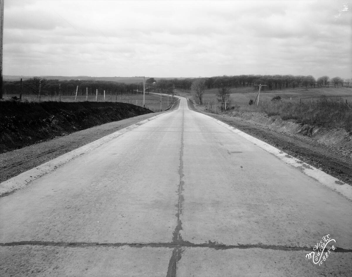
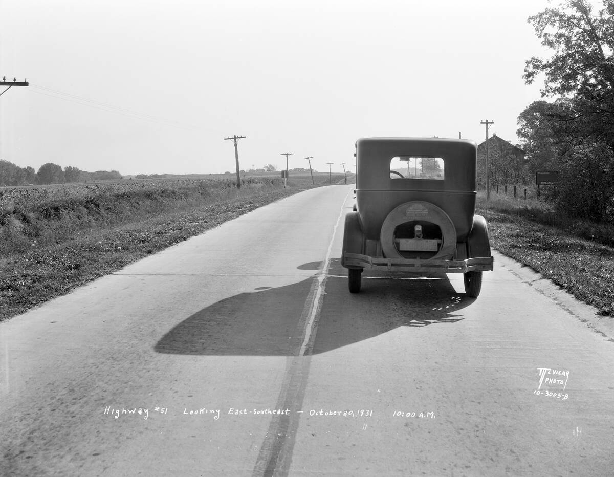
Before numbered highways (the U.S. Highway System debuted in 1926) and well after, long-distance driving meant stitching together county roads, farm lanes, and a few paved stretches. Average speeds on rural routes often hovered around 15–25 mph because surfaces alternated between ruts, gravel, and the occasional brick or concrete. The Federal Aid Road Act of 1916 helped fund improvements, but in many states the best path still detoured through town squares, courthouse steps in view, because bypasses just weren’t a thing yet.
It wasn’t only the roads that made trips slow; cars struggled too. Radiators boiled on mountain grades, hand-cranked engines balked on cold mornings, and tire punctures were routine. A “good” day might cover 150 miles, if the weather cooperated and you didn’t spend an hour hunting a river ferry. Long-haul travelers packed like mechanics, carried paper maps that contradicted each other, and traded tips with locals because directions hinged on landmarks more than mile markers.
From wagon ruts to auto trails: America’s patchwork paths across the map
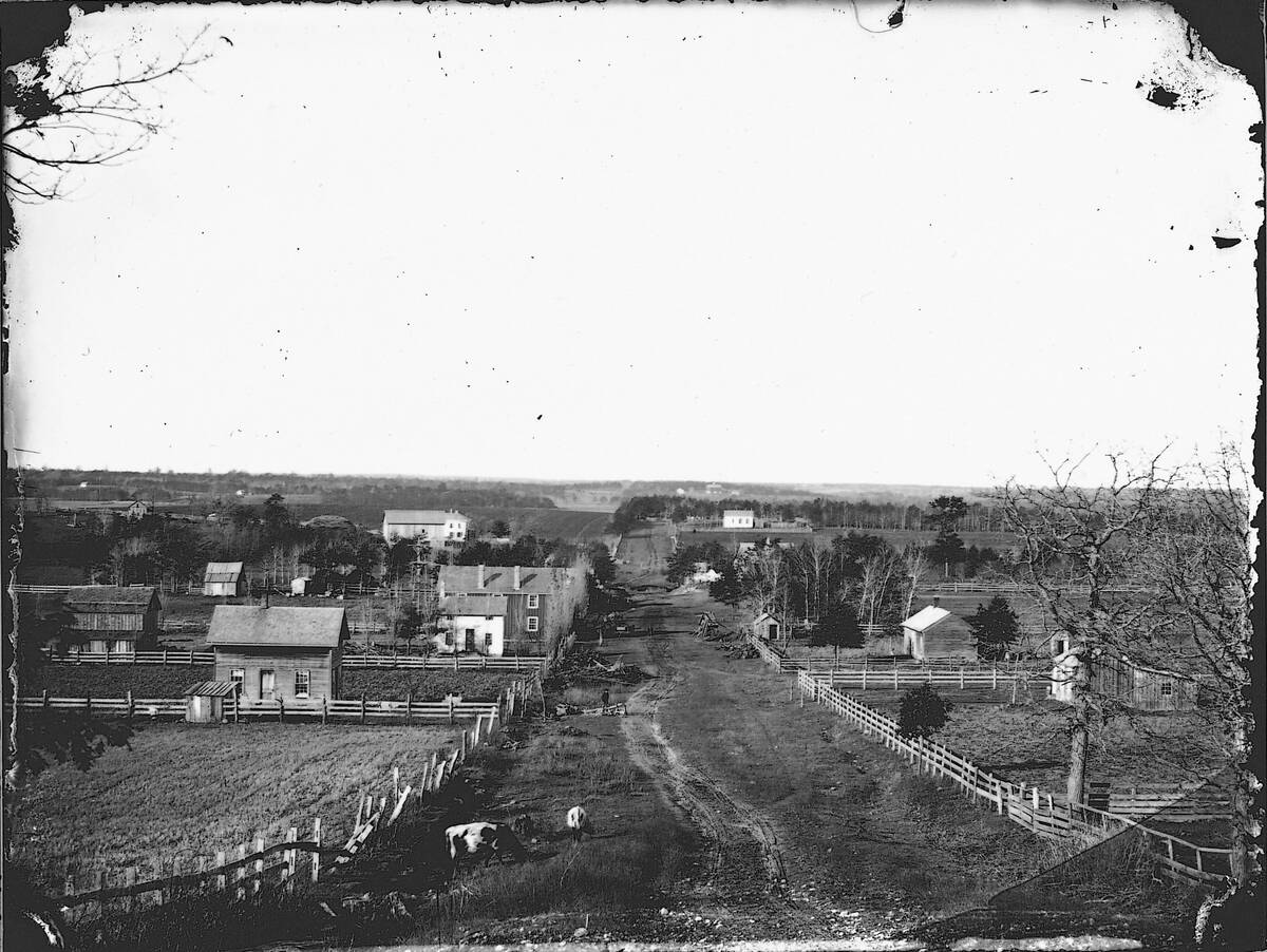
America’s earliest overland routes were wagon tracks and post roads like the National Road, started in 1811, which crept west from Maryland toward Illinois. Trails such as the Oregon and Santa Fe left visible ruts that 20th‑century motorists sometimes still followed, especially where counties simply graded old alignments. By 1900, most of the nation’s millions of road miles were local, unpaved, and maintained by nearby farmers under “statute labor” requirements rather than professional crews.
As cars multiplied, private groups drew lines across the map and christened them with grand names. These “auto trails” weren’t official roads so much as marketing: volunteers posted symbols, painted poles, and published guidebooks that stitched together existing byways. The same town might sit on three overlapping routes, each promoted by a different association. It was a colorful system—and confusing—until states and the federal government began numbering routes and standardizing signs in the mid‑1920s.
The Good Roads crusade and how it stitched towns together
The Good Roads Movement began with bicyclists in the 1880s—especially the League of American Wheelmen—who lobbied for smoother surfaces than the muddy lanes of the day. Rural Free Delivery postal service, rolled out nationally after 1896, added political muscle because reliable mail demanded reliable roads. By the early 1900s, magazines like Good Roads championed drainage, grading, and gravel surfacing, and engineers started to replace seasonal volunteers as the people maintaining county routes.
Federal dollars followed. The Federal Aid Road Act of 1916 created a program to match state funds for “post roads,” and the Federal Highway Act of 1921 focused money on connected state highway systems. Those investments helped link county seats, knit together farm-to-market corridors, and gave small towns a lifeline to regional hubs. Good Roads wasn’t just smoother travel; it was economic policy, turning wagon paths into year‑round arteries for milk trucks, school buses, and the new touring public.
The Lincoln Highway, Dixie Highway, and the era of named routes
The Lincoln Highway arrived in 1913 as a coast‑to‑coast idea from New York to San Francisco, roughly 3,389 miles on paper, assembled from existing roads and improved in patches by the Lincoln Highway Association. It wasn’t a single new pavement; it was a promise and a publicity machine that planted concrete markers and prodded counties to upgrade muddy gaps. Businesses along the line painted “L” emblems on poles and sold travelers on the romance of a transcontinental motor road.
Down south, the Dixie Highway launched in 1915 with support from promoter Carl G. Fisher, forming a network of roughly 5,000 miles tying the Midwest to Miami along eastern and western legs. Towns angled to get on the map because a name could mean tourists, freight, and status. By 1926, the new U.S. Highway numbers began to replace names on signs, but the era left a legacy of corridor identity that echoes today on routes like U.S. 1 and U.S. 30.
Stagecoaches to Model Ts: a changing cast of road travelers
Before cars, stagecoaches ran scheduled routes linking depots, post offices, and railheads—Wells Fargo coaches pounded Western roads in the 19th century, changing teams every few hours. Early motorists literally shared those alignments, easing past coaches and farm wagons while kicking up dust. Buses emerged in the 1910s and 1920s as towns bought motor stages to replace horse lines, and intercity carriers strung together longer hauls that shadowed named auto trails.
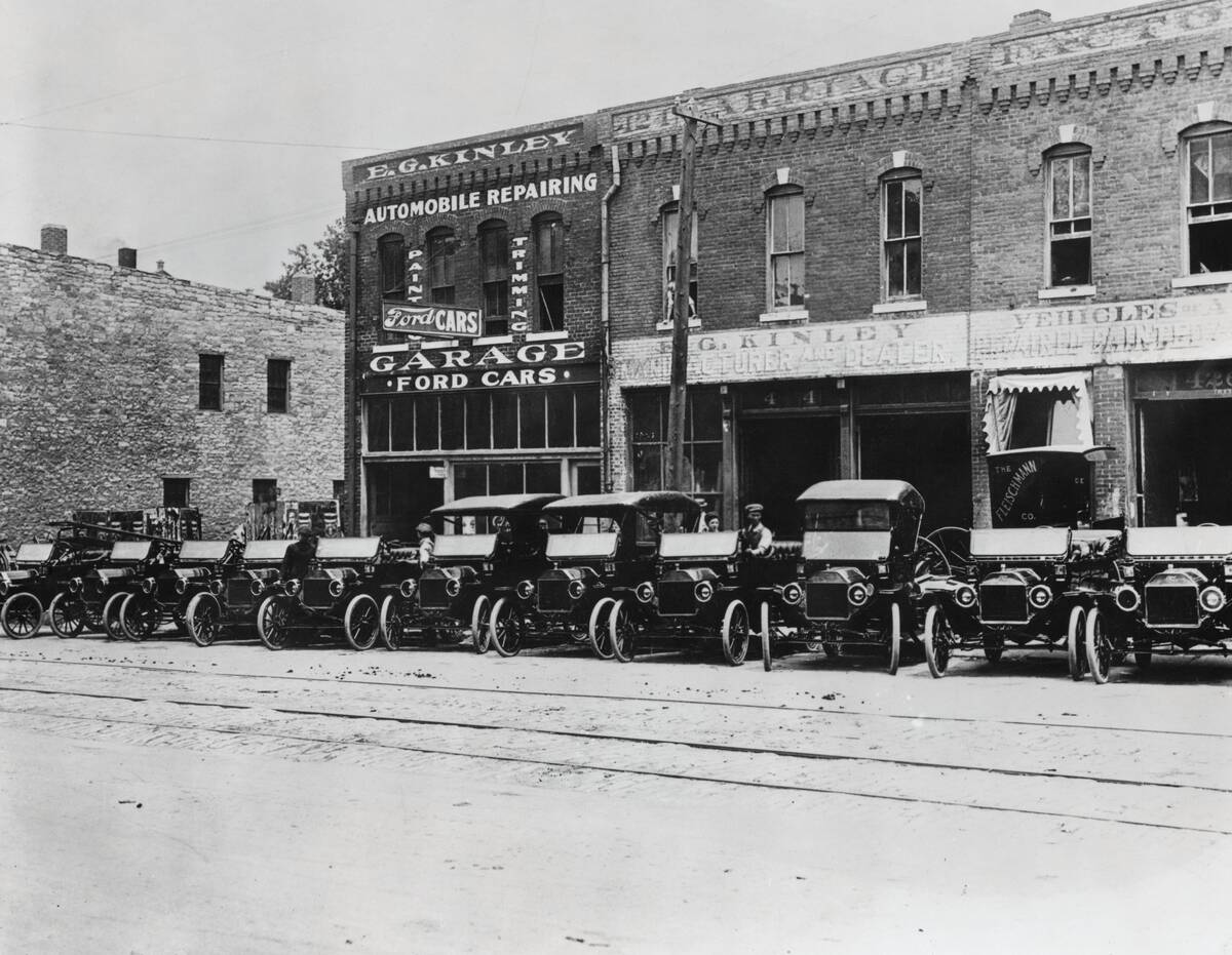
Then came the everyman car. Ford’s Model T, built from 1908 to 1927, surpassed 15 million units, putting families, salesmen, and small-town doctors on the same rutted roads. Tourists strapped trunks and spare tires to the back; traveling salesmen lived from sample cases; doctors and midwives prized the ability to reach remote farms in bad weather. Gasoline delivery, tire shops, and auto camps all grew to serve that expanding, wonderfully mixed crowd of travelers.
Hand-cranks, manual chokes, and starting the day without a key
Early motorists faced a pre-breakfast workout: hand‑cranking. With the spark retarded and choke set, you pulled up carefully—never thumb over the handle—in case of a backfire. Broken wrists were common until Charles Kettering’s electric self‑starter debuted on the 1912 Cadillac, a breakthrough that spread through the industry in the 1910s and 1920s. Many cars still used manual chokes and mixture levers well into mid‑century, and a cold snap could turn a simple start into a carburetor‑soaked ritual.
Keys were hardly universal at first. A Model T used a small switch key and, more importantly, a magneto and coil box, so “starting” involved setting levers, flipping the ignition, and cranking—no modern tumbler lock required. Drivers learned to prime the engine, adjust idle with a dashboard rod, and even hand‑throttle on hills. It felt more like tending a machine than commanding it, which is why a good toolkit and spare plugs lived under so many seats.
Maps that argued with reality: Blue Books, AAA strip maps, and local lore
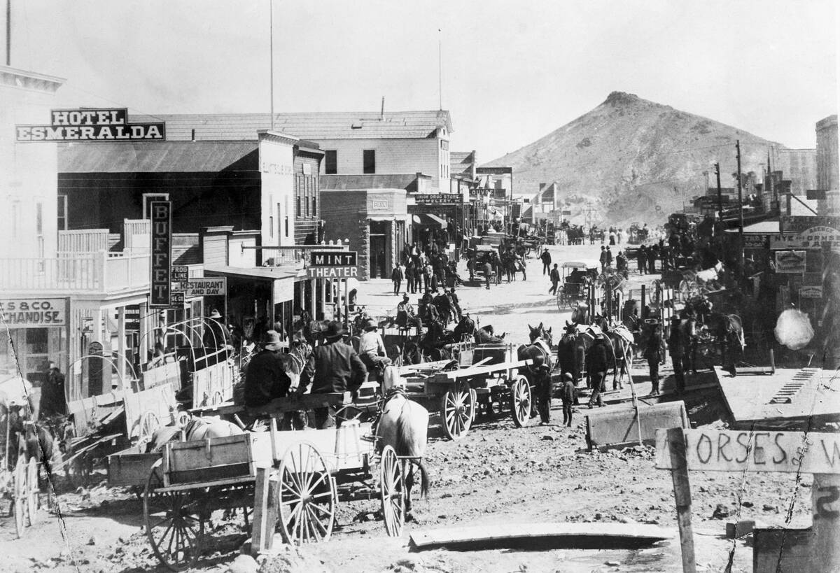
Before clean shields and exit numbers, motorists relied on the Automobile Blue Book (published 1901–1929) with turn‑by‑turn directions anchored to landmarks: “Bear left at red barn; church spire on right.” AAA and regional clubs offered “strip maps” in the 1910s and 1920s that unrolled a single corridor with mileages and hazards. Rand McNally printed Auto Trails maps that painted routes with colored lines, while state maps might still label the same road by an entirely different nickname.
Odometers were essential because instructions called for turns at 3.6 miles from a courthouse or 1.2 past a railroad crossing. If a barn burned or a bridge washed out, the guidebook was instantly wrong. Locals were the ultimate GPS, and travelers learned to ask at depots, blacksmiths, or general stores. Wisconsin pioneered numbered state highways in 1917, a hint of the clarity coming in 1926 when U.S. Highway shields began to tame the cartographic chaos.
Painted poles and roadside arrows: wayfinding when signs were optional
In the 1910s, volunteer crews from trail associations daubed utility poles with color bands and tacked tin arrows to fences. The Lincoln Highway’s red‑white‑blue stripes were famous, and in 1928 Boy Scouts set more than 3,000 concrete Lincoln Highway markers across the country. Other routes used stencils or logos, sometimes painted right on barns. It was folksy—and fragile—because a new paint job or a trimmed tree could erase a turn.
Standardization crept in as states formed highway departments.
The U.S. Highway shield debuted in 1926, and the first edition of the Manual on Uniform Traffic Control Devices followed in 1935, bringing order to shapes, colors, and symbols. Until then, a crossroads might sport a dozen competing emblems—or none at all. Drivers learned to read the road itself: wagon wear suggested the “main” path; cinder ballast meant a railroad was near; fresh grader tracks hinted you were still on someone’s official route.
Mud, dust, and “gumbo”: weather as your most opinionated co-pilot
Summer turned dirt roads to talcum, dust coating goggles and carburetors alike. Spring and fall brought the real villain: “gumbo,” the sticky, high‑clay soil common on the Plains and in the Midwest that could swallow a wheel to the hub. Chains and shovel came out, and travelers waited for road drags to smooth ruts after storms. In 1904, the U.S. had roughly 2.3 million miles of public roads, but only around 150,000 were surfaced with gravel or better—weather decided your itinerary.
By the 1920s and 1930s, paved mileage grew steadily, yet rain could still strand a convoy when a single timber bridge floated off its footings. Drivers planned by season as much as by map: deserts at dawn to avoid overheating, mountains by midday to dodge afternoon storms, river bottoms only when the creek ran clear. Every cloud front rewrote the schedule, and every sunny stretch felt like found time in the bank.
Plank roads, corduroy stretches, and even beach “highways”
Early builders fought mud with wood. Plank roads—timbers laid side‑by‑side—appeared in the mid‑1800s and lingered where traffic was light. In swamps, crews set logs perpendicular to travel to create “corduroy” roads: bumpy but passable. One of the most famous experiments was California’s Old Plank Road across the Algodones Dunes, first installed in 1915 for the route that became U.S. 80, maintained with turnouts until concrete finally replaced it in the 1920s.
Where nature offered pavement, motorists gladly used it. Ormond‑Daytona Beach in Florida doubled as a highway and speedway; from 1903 to the mid‑1930s, land‑speed trials ripped across its hard‑packed sand at triple‑digit velocities. Washington State’s Long Beach Peninsula and stretches of the Jersey Shore also hosted driveable sands. Beach driving came with tides, salt spray, and the occasional stuck axle—yet for a generation, the oceanfront was literally a road with a view.
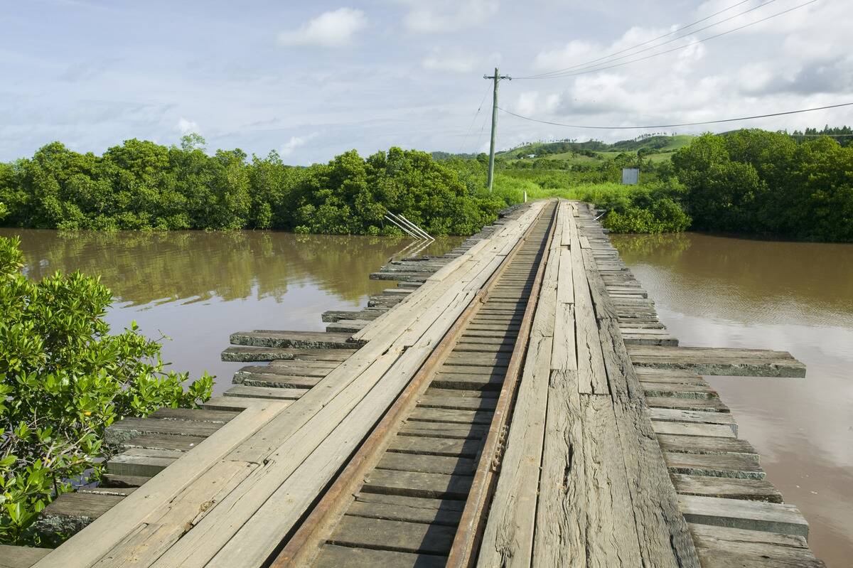
River crossings the slow way: fords, ferries, and the hunt for a bridge
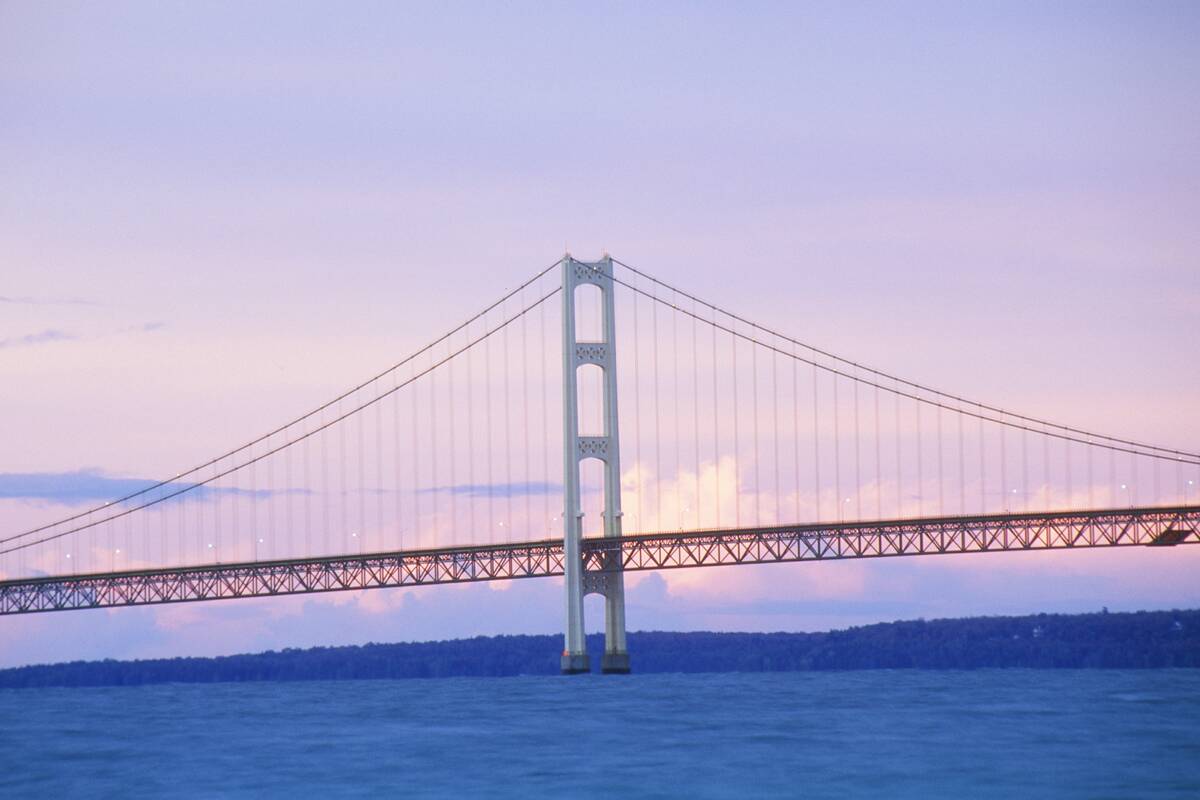
A river could turn a day’s plan into a gamble. Shallow fords worked in dry seasons, but a rainstorm raised stakes fast. Ferries did the heavy lifting: scows poled across small streams, cable ferries served wider channels, and bigger waters used powered boats. On the Columbia River, a vehicular ferry linked Vancouver and Portland until the Interstate Bridge opened in 1917, and across the Straits of Mackinac, state‑run car ferries hauled autos until the Mackinac Bridge debuted in 1957.
Bridges came unevenly. Cities built trusses to downtowns long before rural crossings made sense on a county budget. Motorists sometimes followed a river for miles to the nearest span, then doubled back on the opposite bank. Seasonal ferries kept odd hours; a late arrival meant camping with bullfrogs for company. When big bridges finally opened—think San Francisco–Oakland Bay Bridge in 1936 and the Golden Gate in 1937—they re‑drew maps overnight for everyone on four wheels.
Tools in the trunk: spare tubes, patches, jacks, and plenty of grit
Pneumatic tires were blessings and curses. Early clincher tires pinched tubes; nails and sharp stones guaranteed punctures. Drivers carried demountable rims, spare tubes, a vulcanizing kit, and a hand pump. Ford didn’t offer demountable rims on the Model T until 1919, so before that a roadside tube swap could be an hour’s affair. A screw jack, pliers, and a spark‑plug wrench were standard kit, and tire chains rode along for mud or snow.
Engines expected attention. Grease guns fed dozens of zerks, fan belts stretched, and water pumps wanted packing. Magnetos and coils made ignition reliable, but plugs fouled and carburetors needed cleaning after dusty days. Many cars shipped with a basic toolkit and owner’s manual that really taught maintenance, not just glovebox etiquette. If you couldn’t patch a tube or set points, you learned fast—or you resigned yourself to whistling at every passing truck for a tow into town.
Gas, water, and air: when filling stations were rescue stations
Before the classic canopy stations, general stores sold gasoline from drums or curbside dispensers. In 1913, Gulf Refining opened what’s widely credited as the first purpose‑built drive‑in filling station on Baum Boulevard in Pittsburgh, complete with a hose and uniformed attendant. Visible pumps with glass cylinders—calibrated so you could see ten gallons ready to flow—became common in the 1910s and 1920s, reassuring buyers who’d heard stories of short measures.
Stations sold more than fuel. Radiators boiled on grades, so attendants topped off water, checked fan belts, and loaned a length of hose. Air compressors turned a dreaded hand‑pump job into a two‑minute stop. In the desert Southwest, you’d see canvas “desert water bags” for sale to hang from the bumper and keep cool by evaporation. Windshield squeegees, road maps at the counter, and a spare fuse from the drawer could be the difference between pressing on and pitching camp.
Keep it rolling: roadside repairs, blacksmith shops, and general stores
If your rear spring leaf snapped, the friendliest face in town was often a blacksmith’s. Smithies heated and re‑arched springs, peened rivets, and brazed cracked brackets while you swapped tires in the shade. General stores stocked fan belts, lanterns, and motor oil beside flour and nails, and more than a few kept gasoline behind the counter for after‑hours sales. Early garages doubled as machine shops, happily fabricating a missing bolt from bar stock.
Telephones connected the dots. A depot agent or operator could find the nearest tow truck—often just a farm rig with a boom—and you paid by the muddy mile. Rail towns usually had better parts thanks to daily express shipments. National chains were rare outside big cities until the 1920s, so improvisation reigned: a length of baling wire, a leather belt for a water pump, a boot patch on a sidewall. If it held until the next county seat, it was a win.
Auto camps, cabin courts, and the sleepy pre-motel night
Long before neon motor courts, towns built municipal auto camps—often free or for a token fee—to lure tourists. By the early 1920s, there were thousands nationwide; trade journals counted more than 2,000 city‑run camps by 1922, many with wood stoves, water spigots, and picnic shelters. Families pitched canvas next to touring cars, kids chased fireflies, and a caretaker sold ice and postcards. A good camp made the local paper; a bad one acquired a reputation fast among travelers.
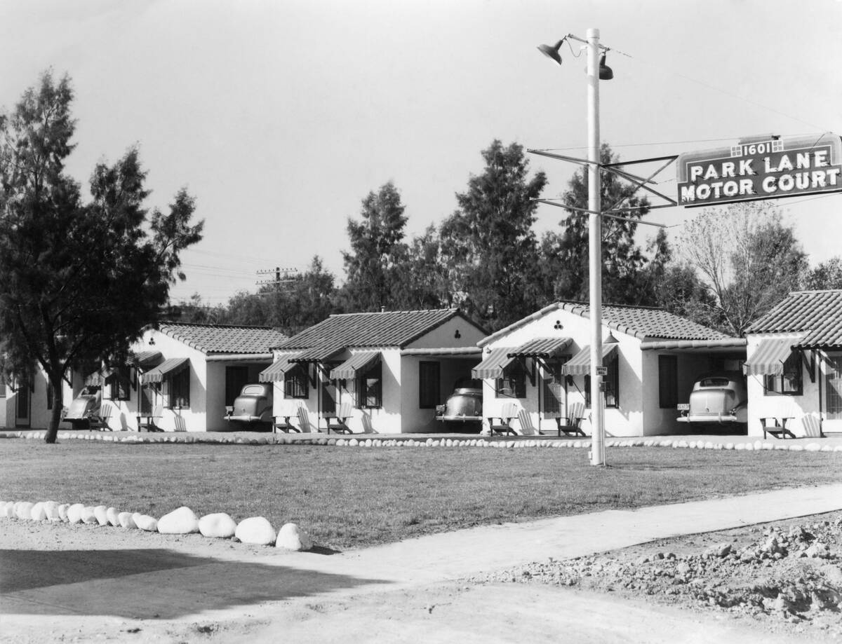
Private “cabin courts” followed, renting simple one‑room units with a shared bath house and a place to park. Owners added comforts—screen doors, electric lights, later private showers—competing for overnight trade on named routes. The very word “motel” dates to 1925, when the Milestone Mo‑Tel opened in San Luis Obispo, California, aimed at motorists hopping the coast. But well into the 1930s, a blanket under the stars at a tidy auto camp was still a classic night on the road.
Coffee, pie, and chili: the golden age of diners and lunch counters
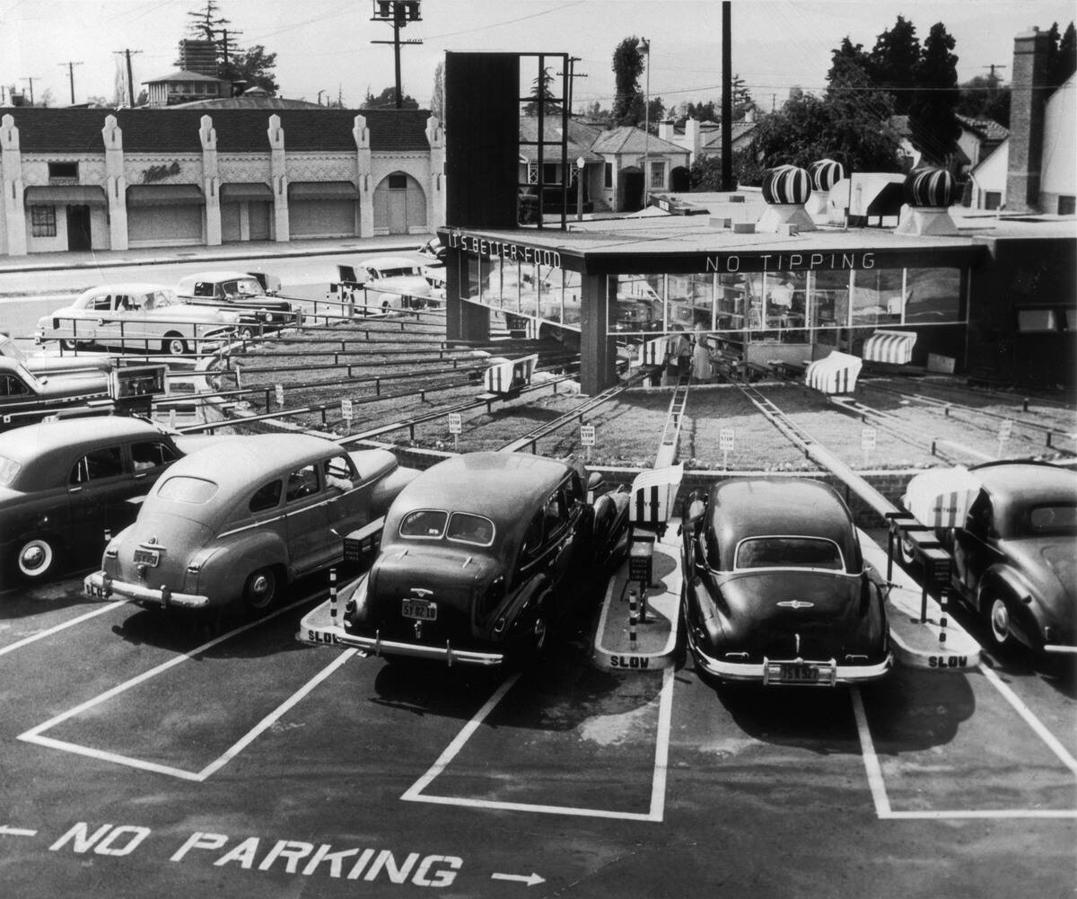
Road food found its voice in the diner. Starting from lunch wagons in the late 1800s—Walter Scott’s Providence cart in 1872 is often cited—prefab dining cars spread along highways by the 1920s. Stainless steel, stools, and a griddle meant coffee in a minute and a short‑order in five. The “blue‑plate special” became shorthand for an honest, affordable meal, while chili parlors and barbecue shacks along busy routes served regional staples from Cincinnati five‑ways to Texas brisket.
Chains joined the party. White Castle, founded in 1921 in Wichita, standardized the quick stop, and roadside bakeries hawked pies by the slice to caffeine‑hungry drivers. Countermen traded weather reports and road gossip; pie crust doubled as a map edge while someone drew a pencil arrow to the best bridge. In an era before interchanges, these storefronts sat on the through street, so you refueled stomach and radiator without wandering far from the day’s line on the map.
Segregated roads and The Green Book: traveling while Black
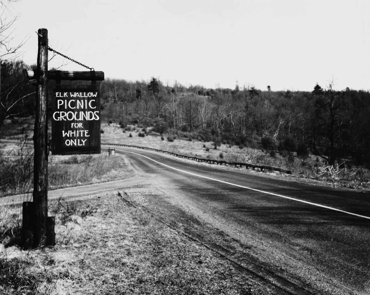
For Black travelers, the open road came with closed doors. Jim Crow laws and “sundown town” policies meant lodging, restaurants, and even service stations could refuse service or worse. In 1936, Victor H. Green, a Harlem postal worker, published The Negro Motorist Green Book to list welcoming hotels, tourist homes, cafes, and garages. By the late 1930s it covered much of the United States, and by 1949 it included entries in Canada, Mexico, and the Caribbean.
The listings were practical lifelines: addresses, phone numbers, and notes like “by reservation only.” Families packed food and extra fuel to reduce risky stops, and many relied on networks of churches and fraternal lodges. The Civil Rights Act of 1964 outlawed discrimination in public accommodations, and the Green Book ended its run after 1966. But for three decades, safe travel often depended less on the car you drove than on the pages you carried.
Hitchhikers, caravans, and clubs: safety in numbers and stories to swap
Hitchhiking surged in the 1930s, part thrift, part necessity, with college kids, job seekers, and even soldiers thumbing rides. Caravanning offered another layer of safety: parties teamed up to push through mud, share tubes, and spot detours. In 1919, the U.S. Army’s Transcontinental Motor Convoy rumbled along the Lincoln Highway to test roads and equipment, averaging barely 6 mph some days—an endurance lesson that future highway planners, including a young Dwight D. Eisenhower, didn’t forget.
Clubs made the road feel smaller. AAA formed in 1902 from nine motor clubs, publishing maps and offering hotel recommendations. The Tin Can Tourists, founded in 1919 in Tampa, gathered campers and trailer owners into cheerful rallies that mixed practical tips with social fun. Local auto clubs hosted reliability runs, lobbied for bridges, and posted signs. Wherever gasoline and gossip met, travelers traded intel on the next ferry, the best chili, and the shortcut that really wasn’t.
Billboard poetry and Burma-Shave: advertising as entertainment
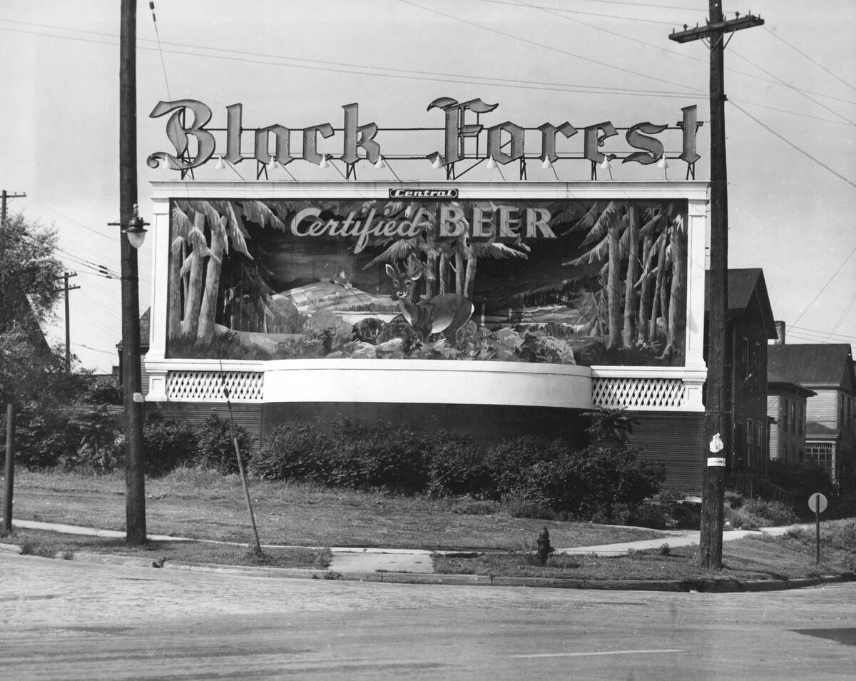
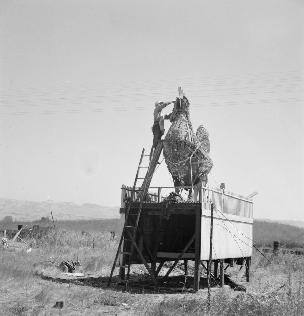
Long miles bred roadside theater. Starting in 1926, Burma‑Shave strung sequences of small red signs with white rhymes, five lines setting up a punchline and a sixth delivering the brand. At its peak, the company maintained thousands of sets in 40‑plus states, with verses warning about speeding or celebrating whiskers. Drivers looked forward to the next stanza, and kids learned to spot the first sign like a game opening on the horizon.
Billboards sold tourist traps and miracles, too—mystery spots, alligator farms, and ice‑cold orange juice promised just 12 miles ahead. Towns debated aesthetics even then, and later the Highway Beautification Act of 1965 reined in the clutter along new expressways. But on two‑lanes, hand‑lettered barn roofs and painted rock faces were part of the scenery, a rolling variety show that broke up stretches where the next curve, the next cloud, and the next couplet were equally big news.
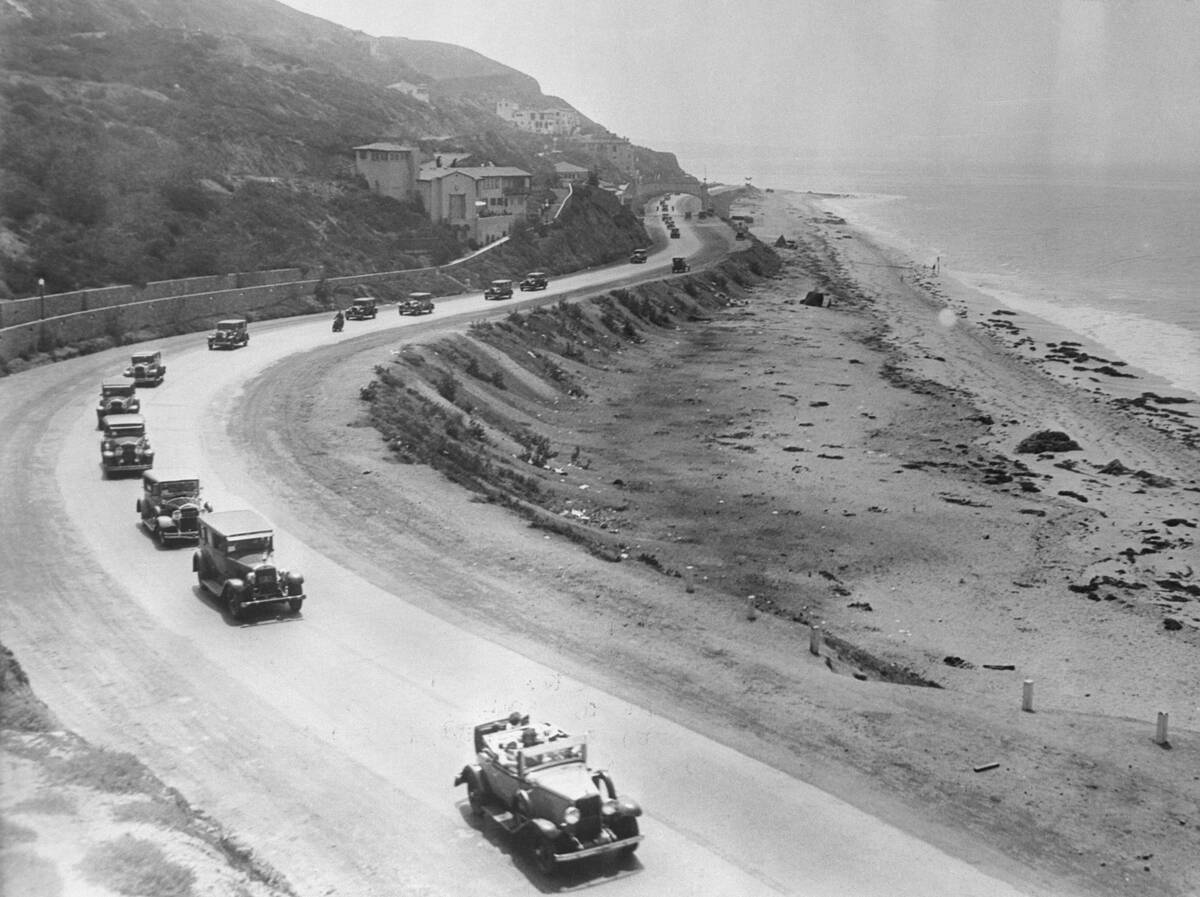
Parkways and early expressways: fancy detours before the Interstates
Before the Interstate era (authorized in 1956), a handful of limited‑access parkways hinted at tomorrow. New York’s Bronx River Parkway, begun in 1907 and opened in stages through the 1920s, blended scenic design with grade separations and controlled access. Connecticut’s Merritt Parkway, opened 1938–1940, combined graceful bridges with lush plantings—and banned trucks—to create a fast, stylish bypass of town centers. These roads moved people and sold motorists on the idea that driving could be both efficient and beautiful.
Out West, Los Angeles opened the Arroyo Seco Parkway in 1940, often cited as the region’s first freeway, linking Pasadena to downtown with medians and ramps. Elsewhere, Lake Shore Drive in Chicago and parkways around Washington, D.C., showcased divided lanes and limited crossings. They were not yet coast‑to‑coast solutions, but they changed expectations. After a taste of merging traffic and no stoplights, two‑lane detours through business districts felt positively 19th century.
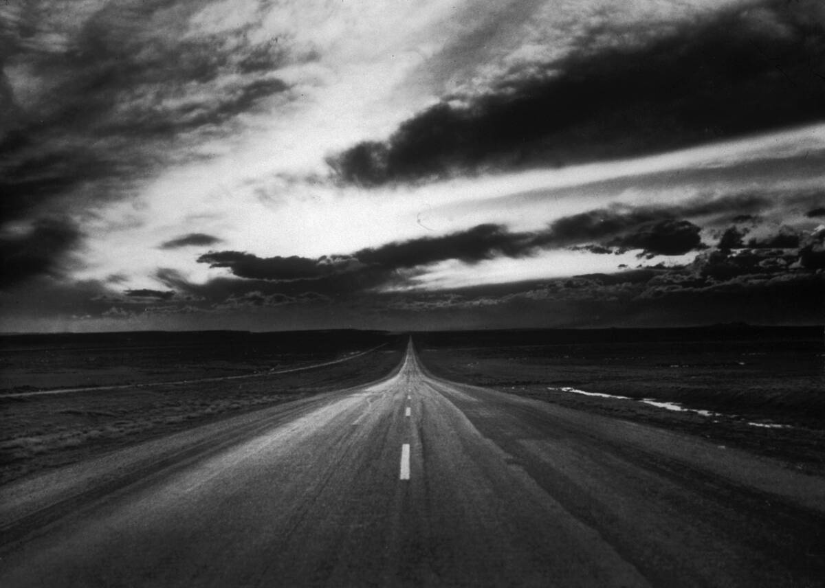
Route 66, myth vs. mileage: small towns, slow speeds, big memories
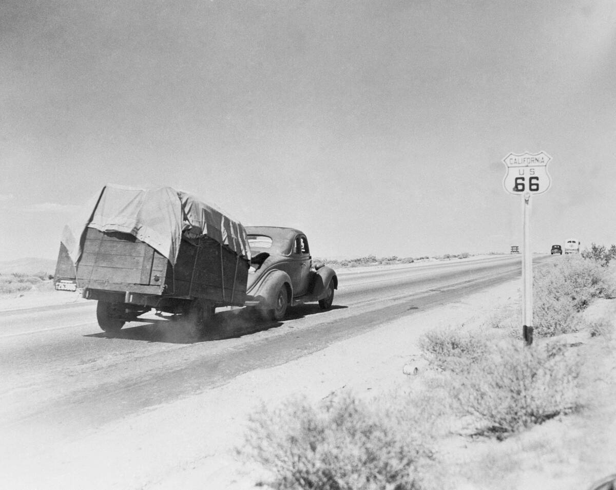
Commissioned in 1926, U.S. 66 ran about 2,448 miles, linking Chicago to Los Angeles and later signed through to Santa Monica. It became the Dust Bowl diaspora’s path west in the 1930s—John Steinbeck’s 1939 “Mother Road” moniker stuck—and by 1938 the route was completely paved. But it was never a racetrack: through countless small towns, speed limits dropped, stoplights multiplied, and diagonal crossings of main streets turned “making time” into an art of patience.
The road’s magic lived in its mosaics: trading posts, motor courts, neon signs, and mom‑and‑pop garages trading on reputation. Big realignments and bypasses in the 1950s began to siphon traffic, and the highway was decommissioned in 1985, replaced by Interstates. Yet the fragments endure—historic alignments in Illinois, the curvy 1920s concrete in Oklahoma, the high‑desert miles in Arizona—where you can still taste a malt, read a Burma‑Shave set, and remember why two lanes became a legend.
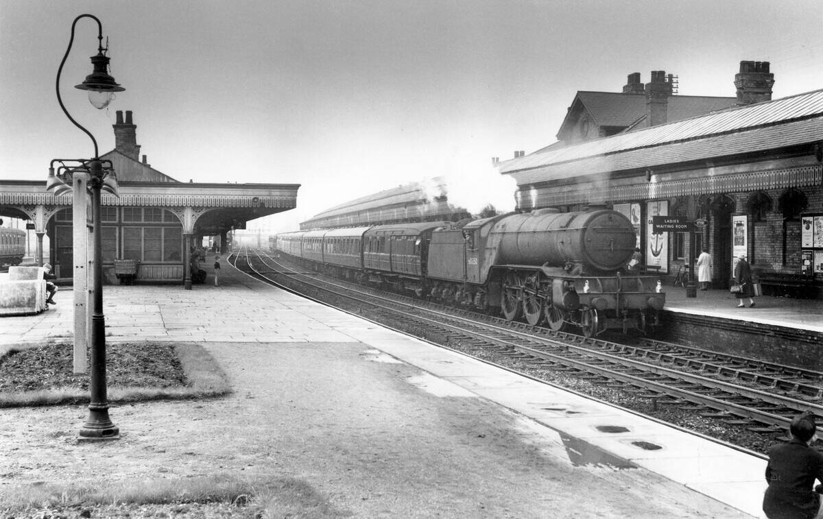
When the train still won: cross-country by rail and car ferries across big waters
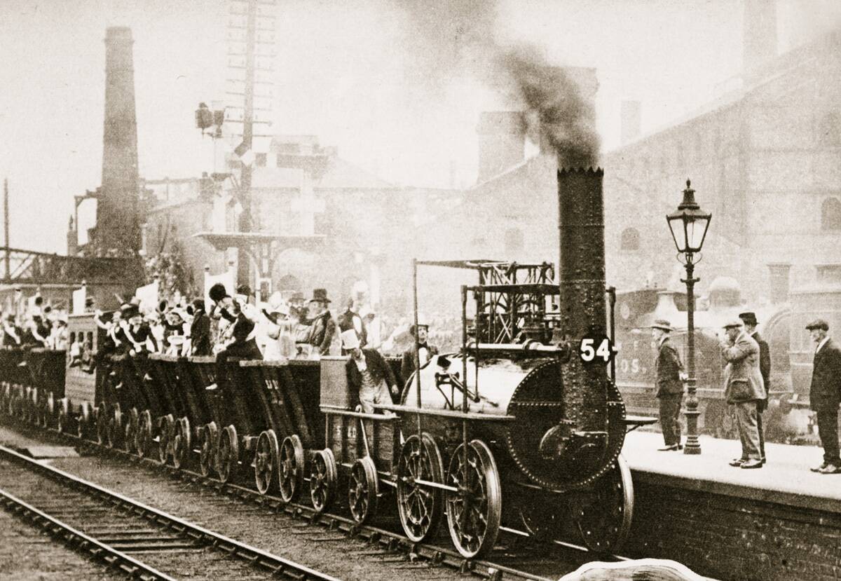
For truly long distances, rail was king well into the automobile age. U.S. railroad mileage peaked around 254,000 miles in 1916, and transcontinental trains crossed the country in four or five days with sleepers and dining cars—no mud required. Cars matched that only with heroic endurance runs. Many road trips actually combined modes: drive to a depot, load onto a car ferry or carfloat, then continue on the far shore without the detour.
Ferries were not just for rivers. Across Lake Michigan, rail‑and‑auto ferries linked Ludington, Michigan, to Wisconsin ports for decades; the SS Badger, launched in 1952, still sails as a seasonal auto ferry today. On San Francisco Bay, auto ferries bustled until the Bay Bridge opened in 1936 and the Golden Gate in 1937. The car may have promised freedom, but until pavement and bridges caught up, the timetable and the tide chart quietly held many of the cards.


