15 ancient maps that amazed with their accuracy
Maps have long been the windows through which we view our world, offering insights into the geographical understanding of past civilizations. The allure of ancient maps lies in their blend of art, science, and history, showcasing how our ancestors perceived their surroundings.
From simple sketches to detailed illustrations, these maps tell stories of exploration and discovery. They are more than just navigation tools; they are historical artifacts that reveal the evolution of human understanding.
Early Cartographers: The Pioneers of Map-Making

The earliest cartographers were ingenious thinkers who laid the groundwork for modern map-making. Anaximander, a Greek philosopher from the 6th century BCE, is credited as one of the first to create a map of the known world.
His work inspired others to venture into cartography, blending mythology with geographical knowledge. Over time, these early maps became more sophisticated, incorporating new discoveries and expanding the horizons of their creators.
Ptolemy’s Geographia: A Masterpiece Ahead of Its Time
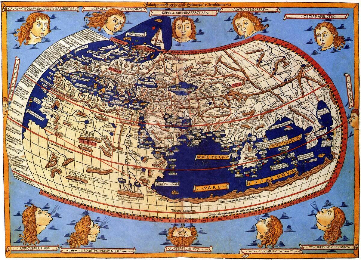
Ptolemy’s ‘Geographia,’ compiled in the 2nd century CE, marked a significant advancement in cartographic tradition. This work was groundbreaking for its use of a coordinate system, enabling maps to represent the spherical shape of the Earth more accurately.
Ptolemy’s influence persisted through the ages, with his methods forming the basis of map-making until the Renaissance. His work demonstrated the potential of combining mathematical principles with geographic exploration.
Anaximander’s World Map: A Visionary Concept
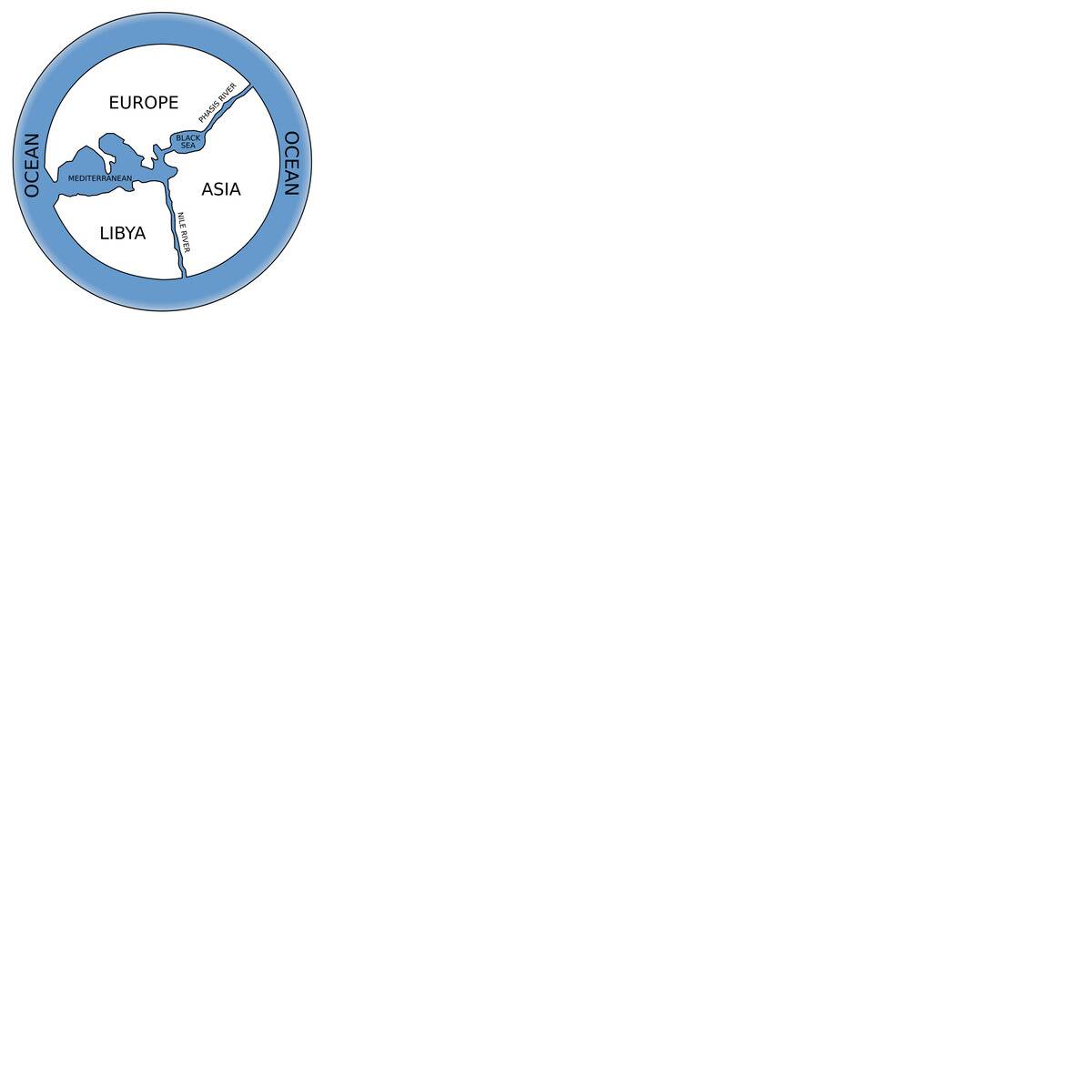
Anaximander’s map, though rudimentary by today’s standards, was revolutionary for its time. Created around 610 BCE, it depicted the world as a flat disk surrounded by ocean, a common belief among ancient Greeks.
Anaximander’s map was among the first to attempt to chart the world beyond local territories, sparking interest in the broader geographical landscape. It was a testament to early human curiosity and a precursor to more detailed maps that followed.
The Peutinger Map: An Ancient Roman Roadmap
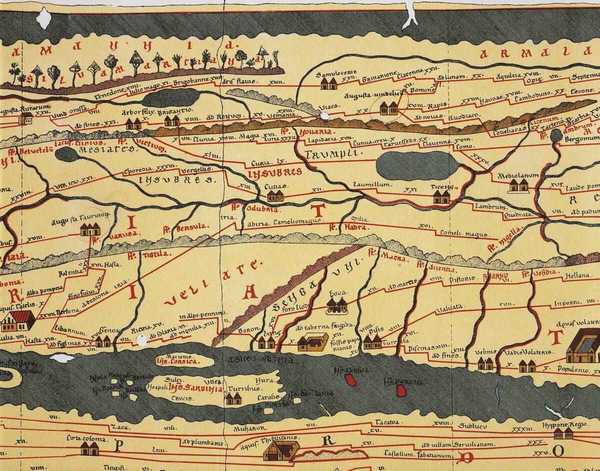
The Peutinger Map is a fascinating scroll from the Roman era, stretching over 22 feet long. It meticulously details the Roman road network, providing insights into the transportation and trade routes of the empire.
Unlike modern maps, it prioritizes connectivity over scale, emphasizing the importance of travel routes. This map was a vital tool for Roman administrators and traders, highlighting the empire’s vastness and the efficiency of its infrastructure.
Exploring the Tabula Rogeriana: A Medieval Marvel
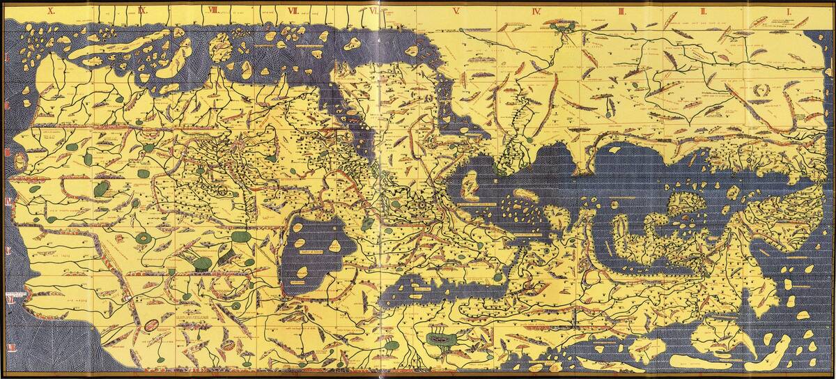
Created by the Arab geographer Muhammad al-Idrisi in 1154, the Tabula Rogeriana was a comprehensive map of the known world. Commissioned by King Roger II of Sicily, it was notable for its accurate depiction of Europe, North Africa, and Asia.
The map was oriented with the south at the top, a common practice in Islamic cartography. Al-Idrisi’s work was a remarkable synthesis of knowledge from various cultures, reflecting the interconnectedness of the medieval world.
The Portolan Charts: Navigational Wonders of the Seas
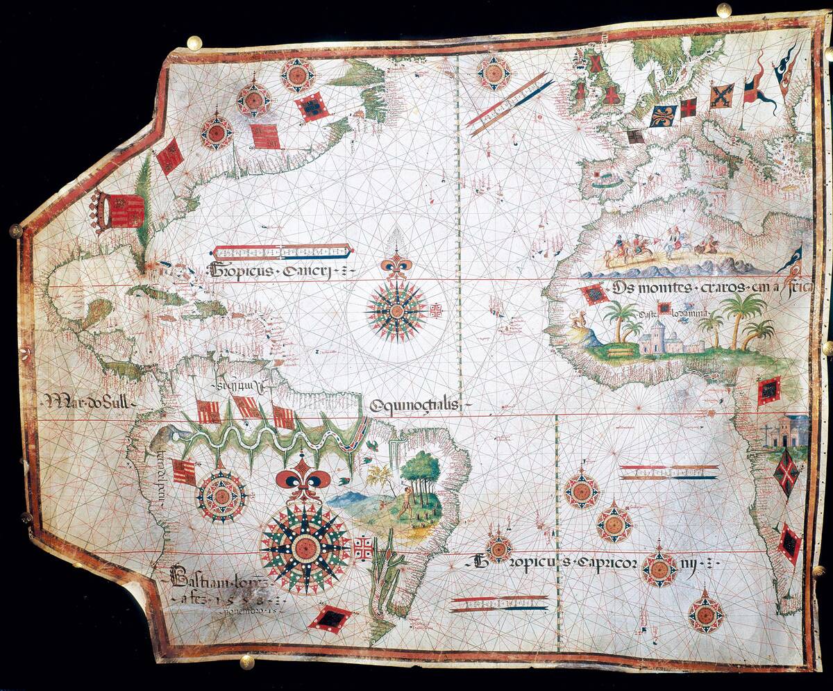
Portolan charts, emerging in the 13th century, were a leap forward in maritime navigation. These maps featured detailed coastlines and compass directions, aiding sailors in their voyages across the Mediterranean and beyond.
Notably, they lacked the medieval tendency to exaggerate landmasses, focusing instead on practical navigation. The charts were prized for their precision and utility, becoming essential tools for explorers during the Age of Discovery.
Ancient Chinese Maps: Ahead in Accuracy and Detail
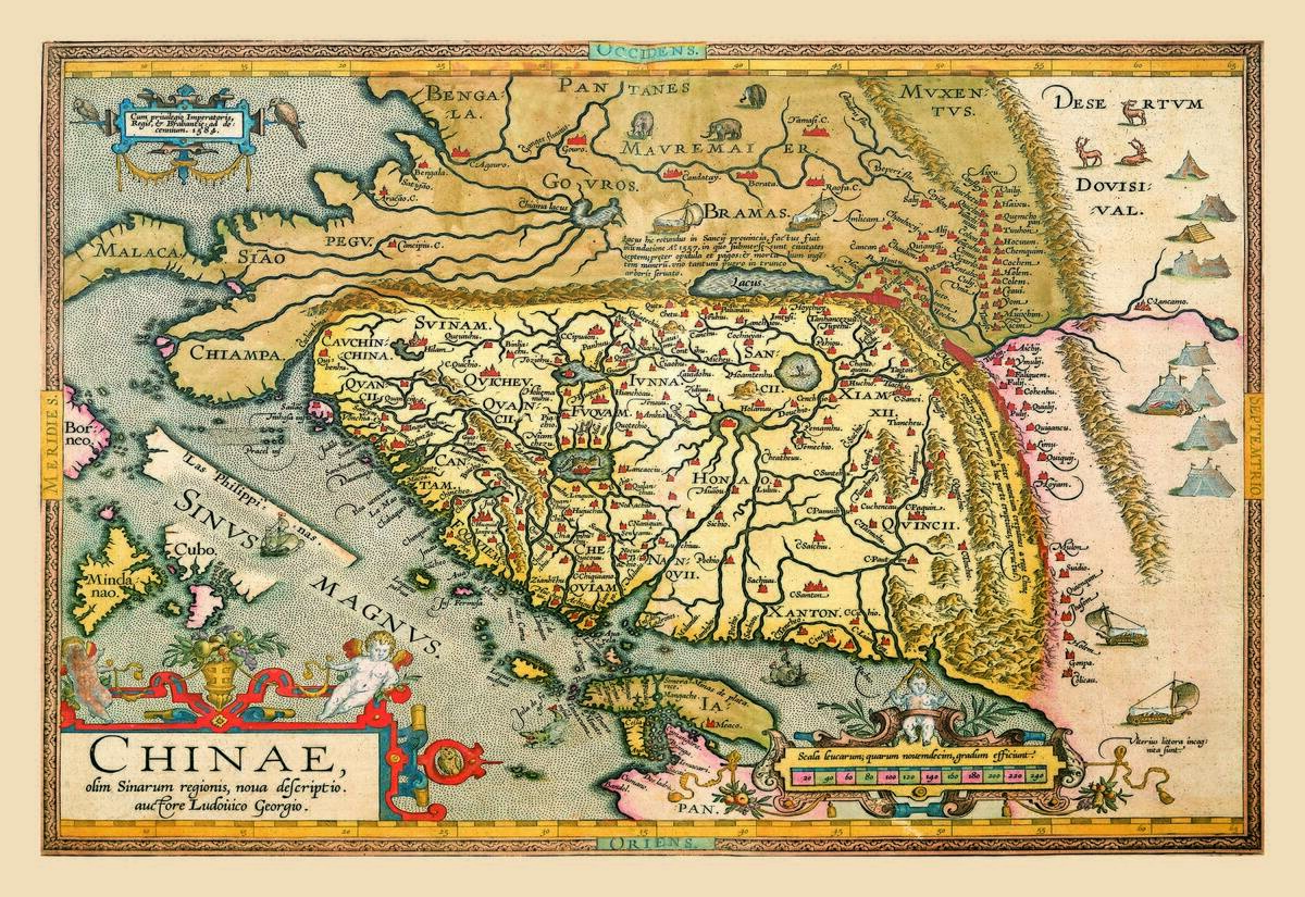
Ancient Chinese maps, dating back to the Han Dynasty, showcased remarkable precision and detail. These maps often employed a grid system, a technique not seen in the West until much later.
The ‘Map of the Tracks of Yu’ from the 12 century CE is one of the earliest examples, illustrating the meticulous nature of Chinese cartography. Their attention to topographical features and accurate scale set a high standard for map-making worldwide.
The Mappa Mundi: A Medieval Worldview
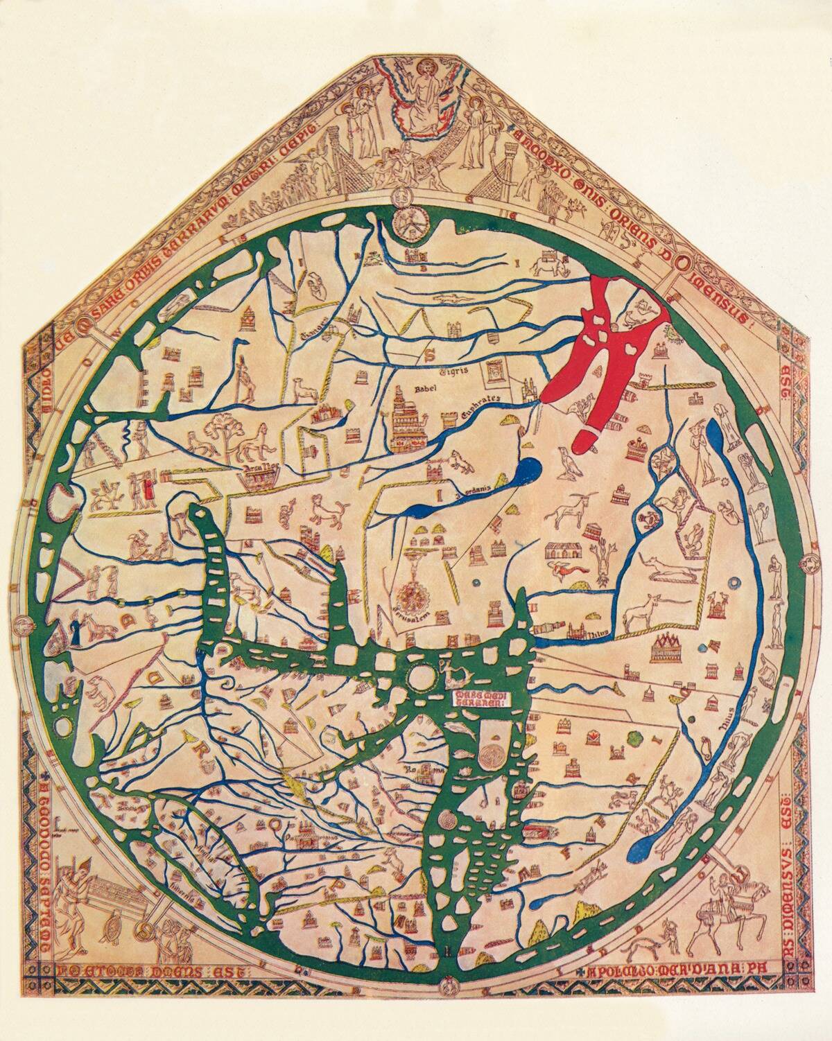
The Hereford Mappa Mundi, created around 1300, offers a glimpse into the medieval European worldview. Centered on Jerusalem, this map blends geography with religious symbolism, illustrating biblical events alongside real places.
It is a visual representation of the medieval mindset, where spiritual significance often outweighed geographical accuracy. Despite its inaccuracies, the Mappa Mundi remains a valuable artifact, reflecting the cultural and religious priorities of its time.
The Imago Mundi: Babylon’s Contribution to Cartography
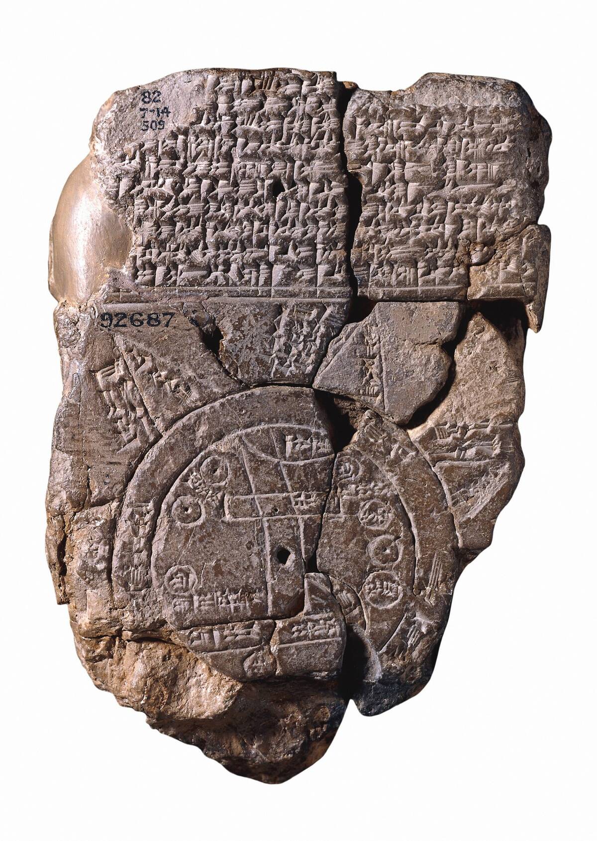
The Babylonian ‘Imago Mundi,’ dating back to the 6th century BCE, is considered one of the earliest world maps. It portrays Babylon as the center of the world, surrounded by a circular landmass and an encircling ocean.
This clay tablet map offers insights into Babylonian cosmology and geography, emphasizing their view of the world as a divinely ordered place. The Imago Mundi is a testament to the ingenuity and cultural perspectives of ancient Mesopotamian society.
The Kangnido Map: Korea’s Global Perspective
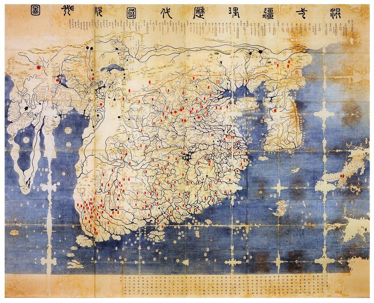
The Kangnido Map, created in 1402, is an extraordinary example of Korean cartography. It depicts a detailed view of the known world, including China, Japan, and parts of Africa and Europe.
The map reflects Korea’s openness to foreign knowledge and its desire to integrate global information. It stands as a testament to the cultural exchanges and scholarly pursuits of the Joseon Dynasty, highlighting the importance of maps in international relations.
The Erdapfel: The World’s First Terrestrial Globe
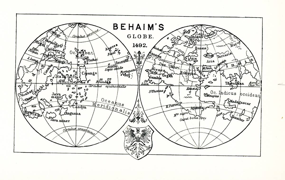
Martin Behaim’s ‘Erdapfel,’ crafted in 1492, holds the distinction of being the earliest surviving terrestrial globe. Unlike flat maps, the Erdapfel offered a three-dimensional view of the Earth, albeit with inaccuracies like the absence of the Americas.
Despite its limitations, it demonstrated the growing acceptance of a spherical Earth and marked a pivotal moment in cartographic history. This globe paved the way for future innovations in map-making and global exploration.
The Catalan Atlas: A Blend of Science and Art
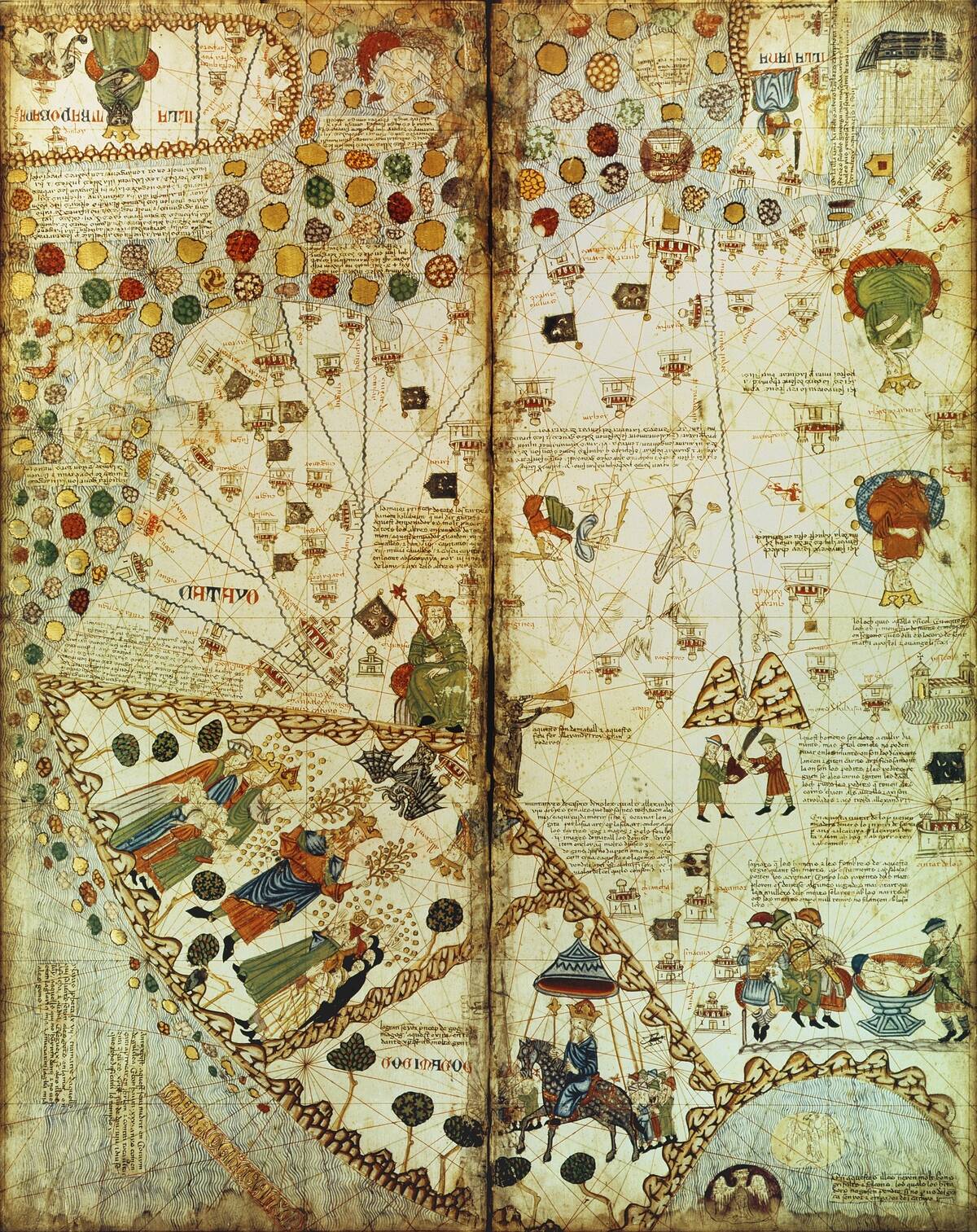
The Catalan Atlas, crafted in 1375, is a masterpiece of medieval cartography, renowned for its artistic flair and scientific accuracy. Created by the Majorcan cartographer Abraham Cresques, it features detailed geographical information alongside lavish illustrations.
The atlas includes astronomical tables and descriptions of various cultures, reflecting the diverse knowledge of the time. As both a navigational aid and a work of art, it exemplifies the rich tapestry of medieval scholarship.
The Gough Map: Mapping Medieval England
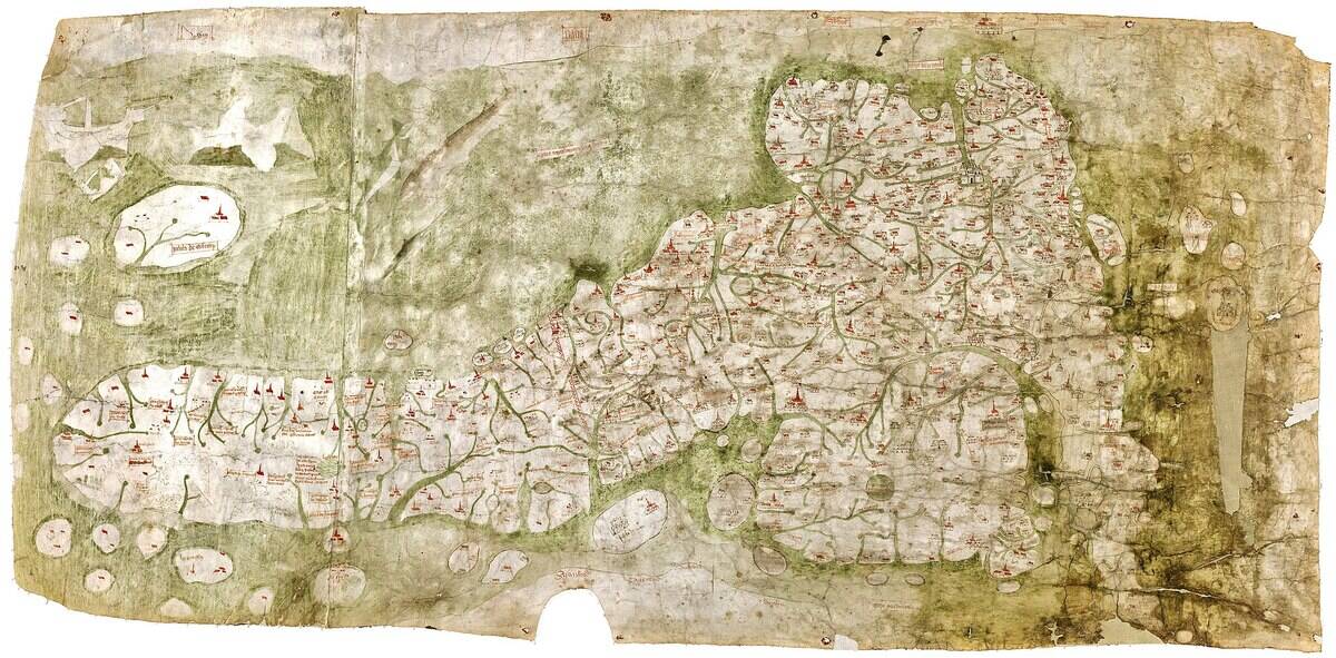
The Gough Map, dating to the 14th century, is the oldest surviving route map of Great Britain. Its detailed depiction of roads, towns, and rivers offers a rare glimpse into medieval England.
The map is notable for its accuracy in representing distances and locations, a rarity for its time. It served as a vital resource for travelers and administrators, reflecting the growing importance of maps in governance and travel during the medieval period.
The Ebstorf Map: A Detailed Medieval European Map
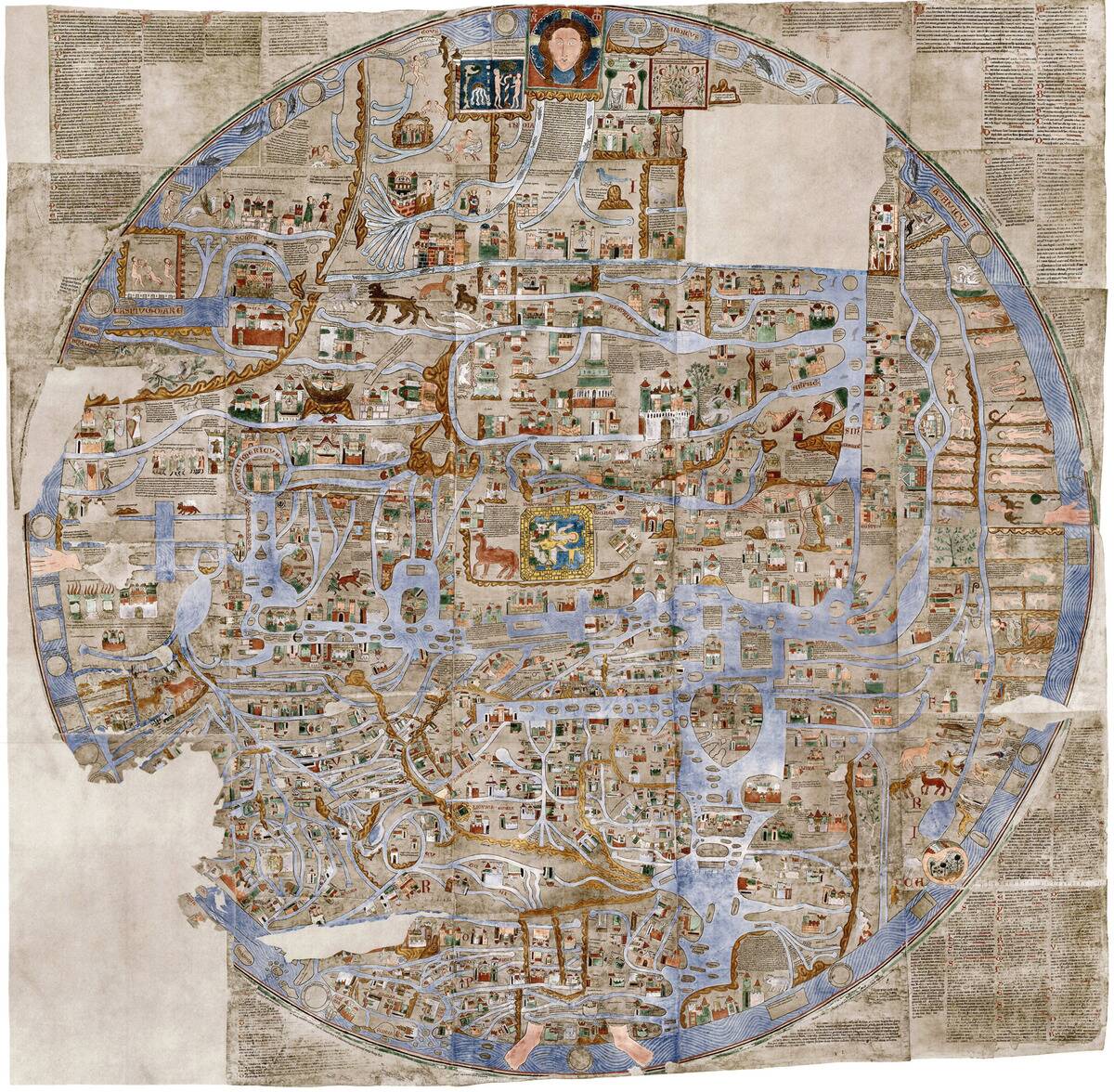
The Ebstorf Map, created in the 13th century, is a circular map of the world centered on Jerusalem. It is famous for its immense size and intricate details, depicting biblical scenes, mythical creatures, and real places.
Unfortunately, the original was destroyed during World War II, but reproductions preserve its legacy. The map is a remarkable illustration of medieval thought, combining religious beliefs with geographical knowledge into a single, unified vision.
The Fra Mauro Map: A 15th-Century Venetian Masterpiece
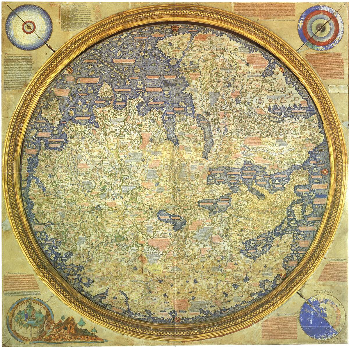
The Fra Mauro Map, completed around 1459, is a stunning representation of the known world from a Venetian perspective. Created by the monk Fra Mauro, it features detailed coastlines, cities, and trade routes, reflecting the commercial interests of Venice.
The map is notable for its use of descriptive text, providing insights into the cultural and economic landscape of the time. It is a testament to the skill and knowledge of Venetian cartographers, blending art with geography.


