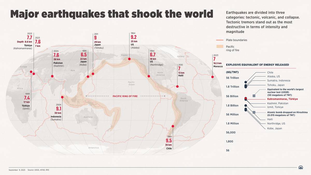
16 earthquakes that created landmasses in hours
Earthquakes are nature’s dramatic reminder of the dynamic planet we inhabit. They occur when stress along geological faults is released, causing the ground to shake. This immense power can reshape landscapes in mere seconds.
While often feared for their destructive potential, earthquakes also play a crucial role in creating new landforms. These seismic events can uplift mountains, form valleys, and even give birth to new islands, showcasing Earth’s incredible ability to regenerate.
The Science Behind Earthquake-Induced Land Formation
The process of land formation through earthquakes involves tectonic plate movements. When these plates collide or slide past each other, they can cause the Earth’s surface to lift or sink, forming new landmasses. For example, uplift can occur when two crustal plates converge, pushing land upward.
Additionally, earthquake-induced landslides can result in the accumulation of debris, creating new topographical features. This dynamic process has been shaping our planet for millions of years, often in astonishing ways.
Famous Earthquakes that Reshaped Earth’s Surface
Throughout history, numerous earthquakes have significantly altered Earth’s landscape. The 1556 Shaanxi earthquake in China, for example, is considered the deadliest in recorded history, drastically changing the topography and impacting millions of lives.
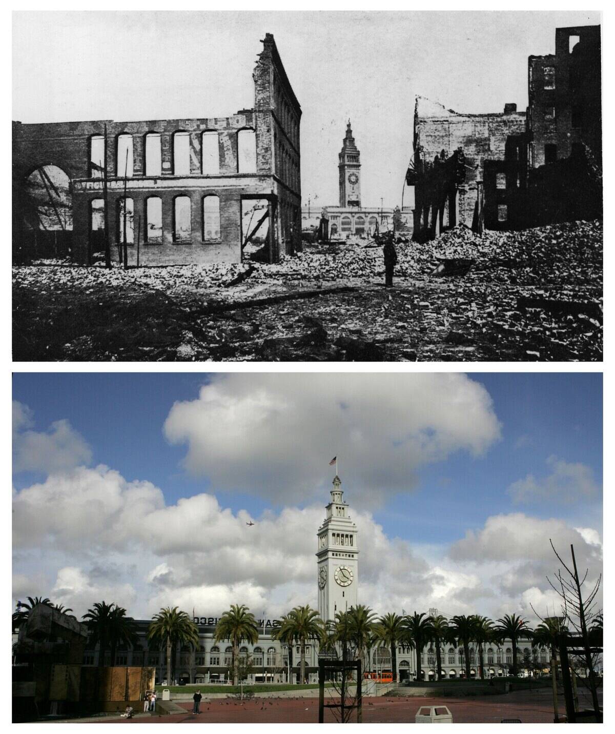
Similarly, the 1906 San Francisco earthquake not only devastated the city but also transformed the surrounding landscape. These events highlight the dual nature of earthquakes: their capacity for destruction and their role in Earth’s continual evolution.
The 1964 Alaska Earthquake: Birth of New Islands

The 1964 Alaska earthquake, also known as the Great Alaskan Earthquake, was a monumental event, registering a magnitude of 9.2. This quake not only caused widespread devastation but also resulted in the creation of several new islands.
The land around Prince William Sound was dramatically uplifted, giving birth to new landmasses. This earthquake is a prime example of how seismic activity can lead to the formation of new geographical features, altering the map of the region.
Chile’s 1960 Great Earthquake and Its Geological Impact
The 1960 Valdivia earthquake in Chile is the most powerful earthquake ever recorded, with a magnitude of 9.5. Its impact on the Earth’s surface was profound, causing massive tsunamis and reshaping the coastline. Entire sections of land were uplifted, creating new geographical features.
This seismic event not only altered the landscape but also provided valuable insights into the behavior of tectonic plates, highlighting the interconnectedness of geological processes across the globe.
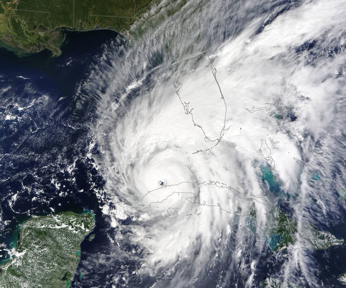
The 2004 Indian Ocean Earthquake and Tsunami: Land Changes
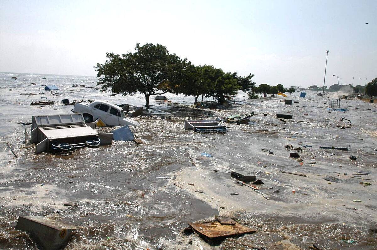
The 2004 Indian Ocean earthquake, with a magnitude of 9.1-9.3, triggered a devastating tsunami that affected several countries. The earthquake caused significant vertical displacement along the fault line, resulting in changes to the seafloor’s topography.
Some regions experienced uplift, while others subsided, altering the coastal landscapes. This event was a grim reminder of the power of earthquakes, but it also demonstrated how seismic activity can lead to long-term geological changes.
Creation of the Nafanua Volcano: Samoa’s New Land
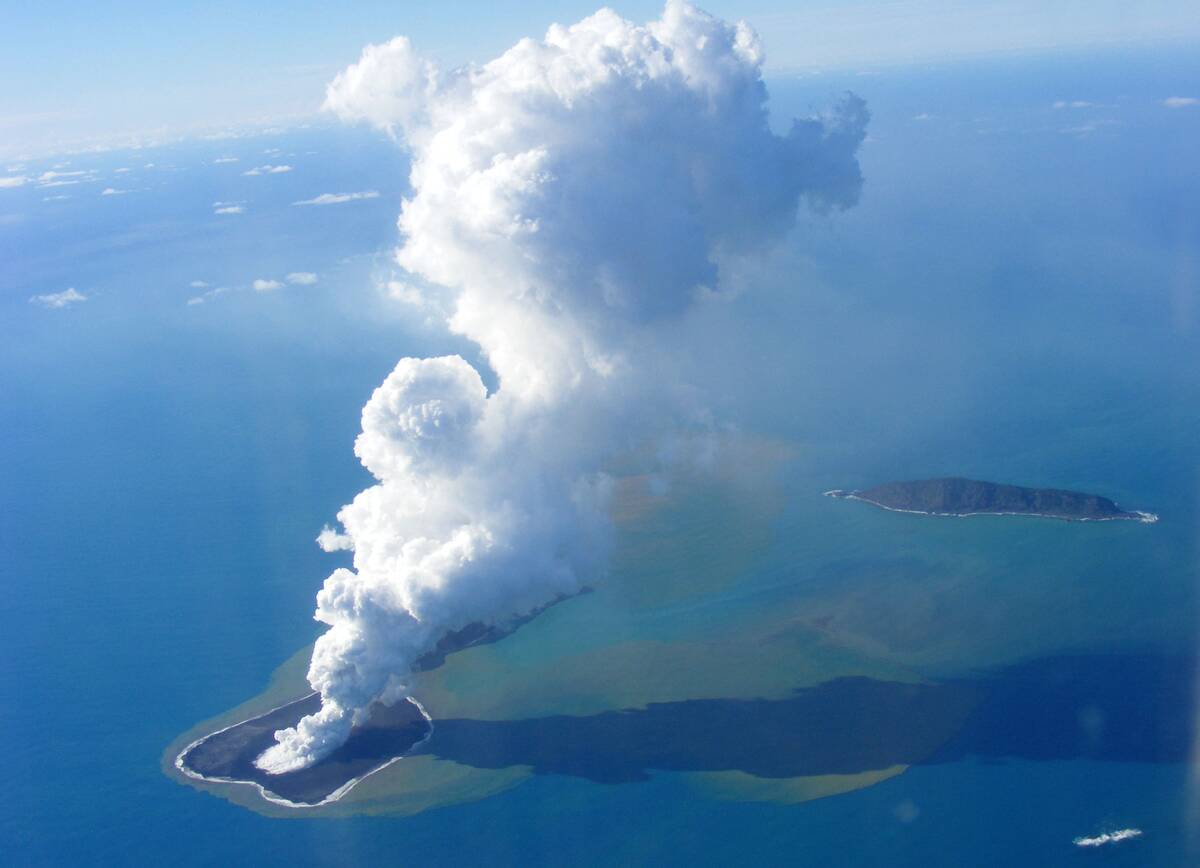
In 1995, an underwater volcanic eruption off the coast of Samoa led to the creation of the Nafanua Volcano. This geological marvel emerged as a result of tectonic and volcanic activity, illustrating how earthquakes and volcanic eruptions can contribute to island formation.
Over time, continued eruptions and seismic activity have added new layers to the volcanic island, expanding the landmass. The Nafanua Volcano is a testament to the ongoing dynamic processes shaping our planet.
Japan’s 2011 Tōhoku Earthquake: Shifting Landscapes
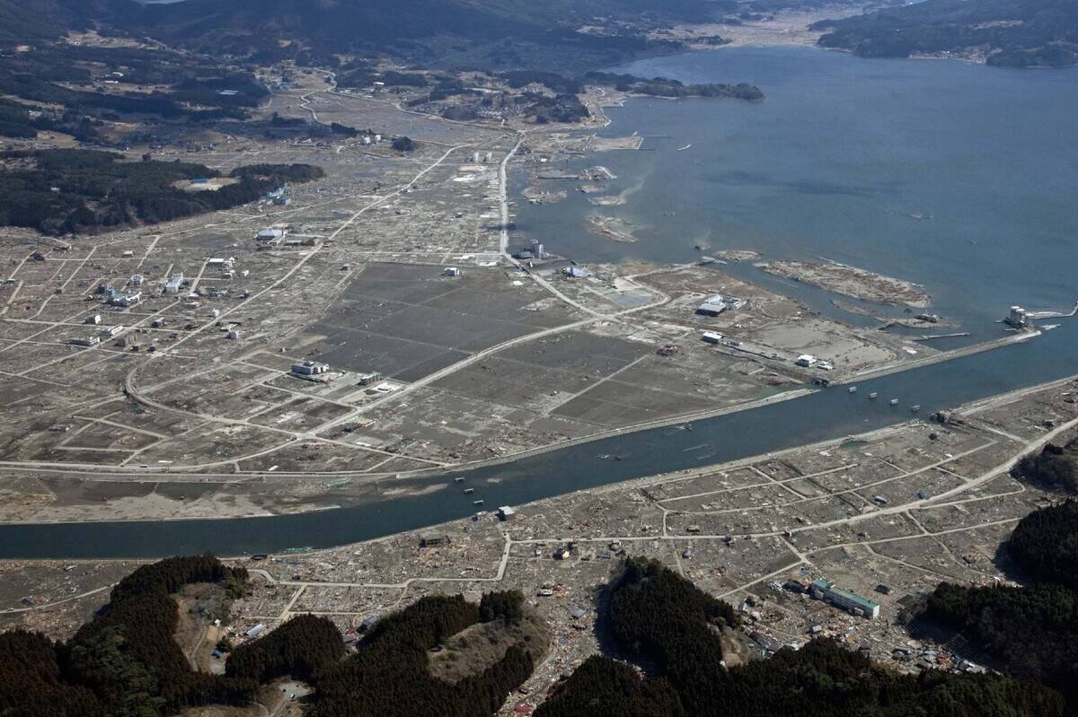
The 2011 Tōhoku earthquake in Japan, with a magnitude of 9.0, is known for triggering a destructive tsunami and causing significant land displacement. The quake shifted parts of Japan’s main island, Honshu, by several meters and even altered Earth’s axis slightly.
The resulting land changes and the tsunami’s aftermath reshaped the coastline, demonstrating the profound impact of seismic events on both human settlements and natural landscapes.
The Underwater Earthquake that Formed Surtsey Island
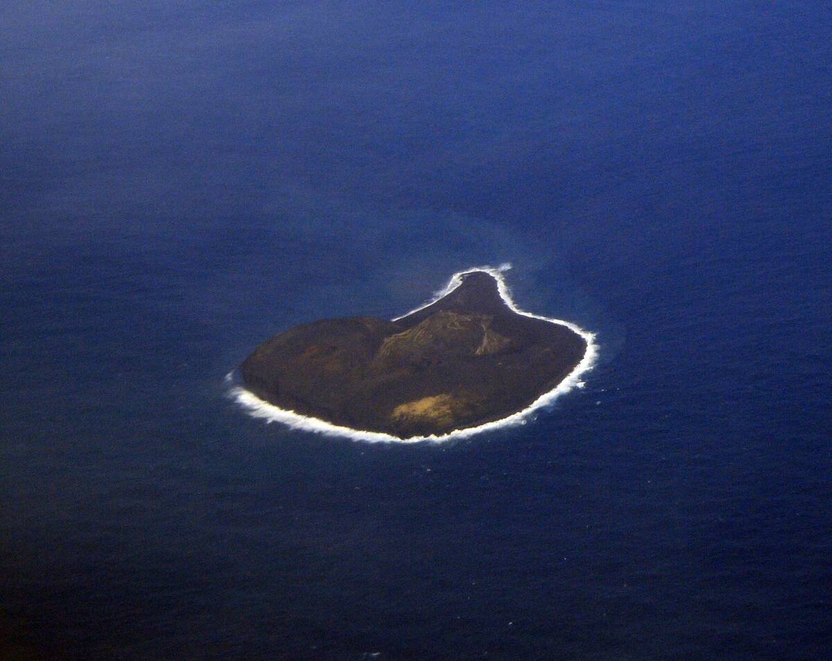
Surtsey Island, located off the southern coast of Iceland, was born from an underwater volcanic eruption in 1963. The eruption, which lasted until 1967, was the result of seismic activity along the Mid-Atlantic Ridge.
As lava cooled and solidified, a new island emerged from the sea. Today, Surtsey is a UNESCO World Heritage site, protected for scientific study, and serves as a natural laboratory for understanding ecological succession and the formation of new land.
The Role of Tectonic Plates in Creating New Land
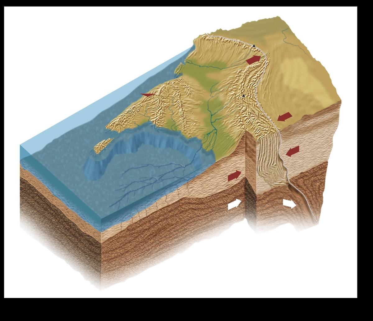
Tectonic plates are colossal slabs of Earth’s crust that interact at their boundaries, leading to various geological phenomena. These interactions can result in the formation of new land through processes like subduction, where one plate is forced beneath another, and rifting, where plates move apart.
Such movements can cause volcanic activity and earthquakes, ultimately leading to the emergence of new islands and mountain ranges. Tectonic plate dynamics are fundamental to Earth’s ever-changing landscape.
How Earthquakes Contribute to Island Formation
Earthquakes can lead to the formation of islands through both tectonic and volcanic activity. When tectonic plates shift, they can create conditions for volcanic eruptions, which deposit lava that solidifies into new land.
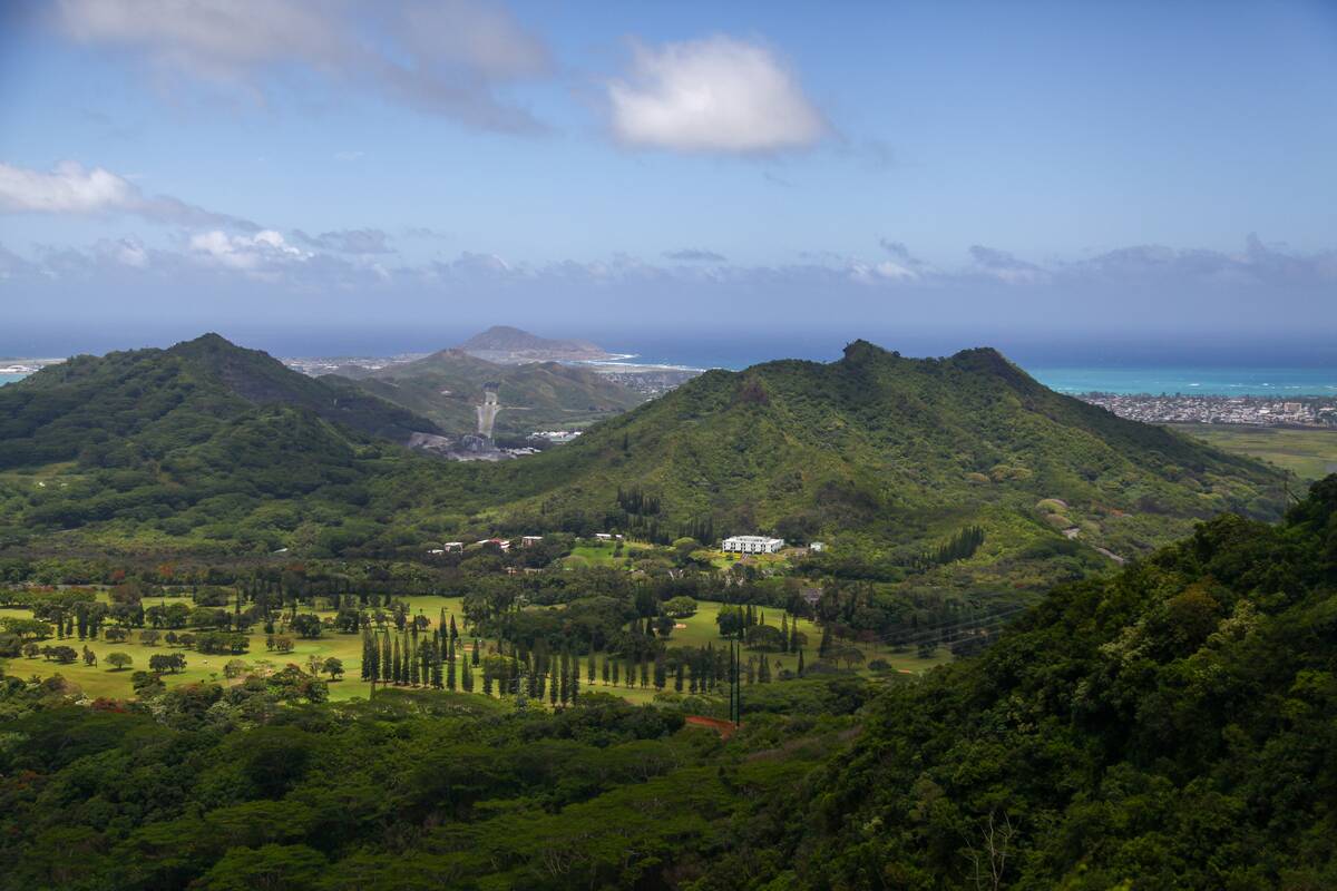
Over time, these processes can result in the emergence of islands above sea level. The Hawaiian Islands, for instance, are a product of volcanic activity associated with the Pacific Plate’s movement over a hotspot. Earthquakes play a crucial role in this ongoing geological process.
Modern Technology Revealing Hidden Landmasses
Advancements in technology have revolutionized our ability to study and understand Earth’s hidden landmasses. Techniques like satellite imaging and sonar mapping allow scientists to explore previously inaccessible regions, revealing submerged land features and underwater tectonic activity.
These tools have uncovered ancient land bridges and submerged islands, offering insights into Earth’s geological history. As technology continues to advance, our understanding of the planet’s dynamic landscape will only deepen.
The Fascinating World of Earthquake-Created Archipelagos
Earthquake-created archipelagos are clusters of islands formed through seismic and volcanic activity. These unique formations often emerge in tectonically active regions, such as the Pacific Ring of Fire.
The Galápagos Islands, for example, are a result of volcanic activity driven by tectonic movements. These archipelagos not only offer breathtaking landscapes but also serve as biodiversity hotspots, providing unique habitats for a variety of species. Their formation and evolution continue to captivate scientists and nature enthusiasts alike.
The Impact of Earthquakes on Human Habitation and Wildlife
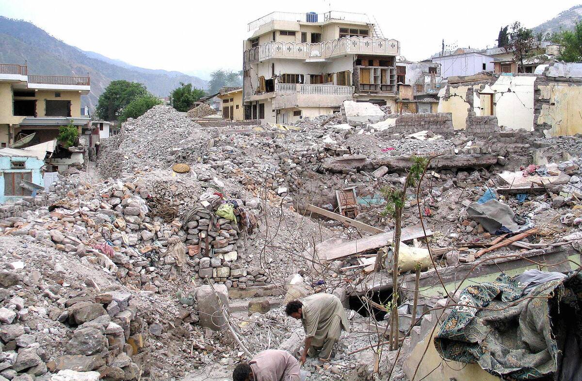
Earthquakes can have profound effects on human habitation and wildlife, often leading to displacement and habitat alteration. The 2005 Kashmir earthquake, for instance, resulted in significant human and wildlife displacement. Changes in landforms can disrupt ecosystems, forcing species to adapt or relocate.
However, new land created by earthquakes can also offer fresh habitats, fostering biodiversity. This dynamic interplay between destruction and creation underscores the complex relationship between seismic activity and life on Earth.
Earthquake-Induced Land Changes: A Brief Look at History

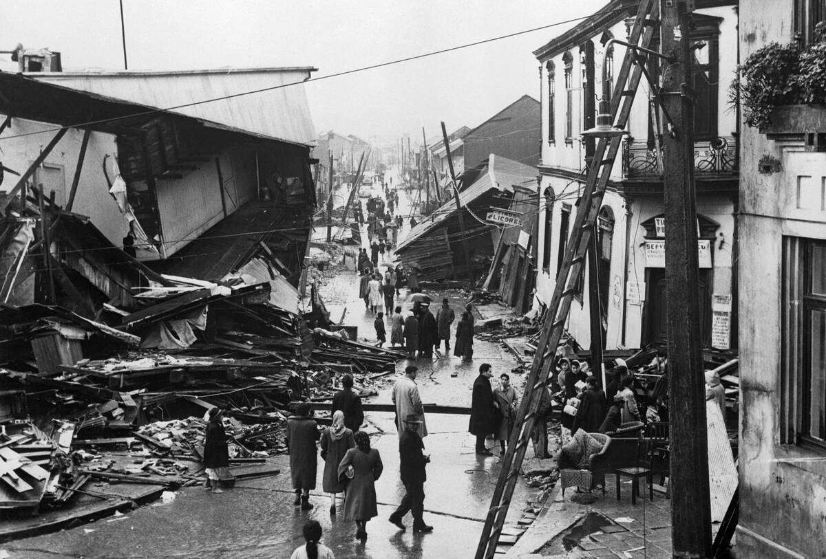
Throughout history, earthquakes have been pivotal in reshaping Earth’s landscape. The Lisbon earthquake of 1755, for instance, caused widespread destruction and led to significant changes in the city’s topography.
Such historical events demonstrate the transformative power of earthquakes. They remind us that while these natural phenomena can be devastating, they also play a vital role in the continuous evolution of our planet. Each seismic event adds a new chapter to Earth’s geological story.
The Role of Seismologists in Predicting Landmass Changes
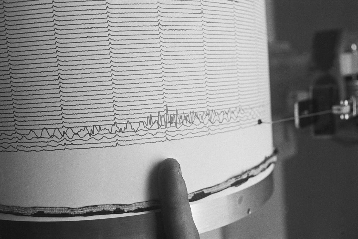
Seismologists play a crucial role in understanding and predicting changes in landmasses due to earthquakes. By analyzing seismic data, they can identify patterns and potential hotspots for future seismic activity. This information is vital for preparing for natural disasters and understanding geological processes. A
s technology advances, seismologists continue to refine their methods, enhancing our ability to anticipate and respond to earthquake-induced changes. Their work is essential in safeguarding communities and unraveling the mysteries of Earth’s dynamic landscape.
Fascinating Facts About Earthquake-Created Landmasses
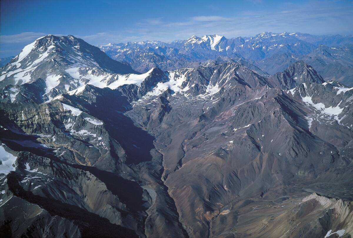
Did you know that the island of Java in Indonesia is the world’s most populous island, largely shaped by seismic and volcanic activity? Or that the Andes Mountains, the longest continental mountain range, owe their existence to tectonic activity along the South American Plate?
These facts highlight the incredible influence of earthquakes on our planet’s geography. From towering peaks to isolated islands, the landmasses created by seismic activity are both awe-inspiring and vital to Earth’s diverse ecosystems.


